New studies have increased local understanding of potential flood risk in three significant creek catchments across the City of Logan.
The work, by independent hydrologists and other industry experts, focused on Windaroo and Belivah creeks on the city's eastern border and Upper Oxley Creek in the city's west.
The results helped Logan City Council develop new flood-risk mapping for these areas.
The research is part of Logan City Council's rolling Flood Studies Review Program, endorsed in 2022, which ensures the latest information is used to make better-informed planning decisions and keep the community safe.
The new flood study reports are now available on Council's website at Flood - Logan City Council
The updated mapping, which is available in the online Logan Flood Portal, provides extra flood-risk information for existing residents and others.
Any development application in the three catchments where flood studies were not previously available, would have required the applicant to undertake their own localised flood study to determine potential risk.
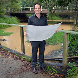
City of Logan Mayor Jon Raven said Council is committed to working with industry experts to obtain the most detailed mapping of potential flood risk across all waterways and catchments in Logan.
"This information is important when it comes to understanding the flood-risk in your area," Councillor Raven said.
"Until now, the range of potential flood scenarios in the catchments of Windaroo, Belivah and Upper Oxley creeks was shown as under investigation or 'unknown'.
"We hope this latest information will help residents plan more confidently to improve the flood resilience of their properties.
"I also urge the insurance industry to properly consider the risk identified in these maps and not sting people for unreasonable premiums during a cost-of-living crisis."
The latest updates follow on from risk-based flood mapping shared with the community in 2022 which centred on the Logan and Albert rivers along with Slacks and Scrubby creeks.
Late last year, Council added more creek catchment studies when it launched the online Logan Flood Portal. Work in that area is still ongoing.
The risk-based flood mapping method aligns with the Queensland Government's State Planning Policy (2017), which requires local governments to identify and map all possible flood risk and consider the impacts of climate change.
The publicly available data includes maps showing different flood characteristics:
- depth (how high above ground the water may get)
- velocity (how fast the water may flow)
- hazard (combination of depth and velocity)
- level (height above sea level)
These characteristics are shown in the mapping across a range of potential flood scenarios, from more likely but less severe through to the very rare but very severe flood (probable maximum flood event).
The release of the latest mapping comes after the Mayor last month addressed the Federal inquiry into insurers' responses to claims arising from the 2022 floods, which devastated parts of Logan.
Cr Raven told the public hearing in Beenleigh that the insurance industry needed to share the methodologies used to calculate premiums and show greater transparency on how risk is priced into policies.
He cited several examples of local residents whose insurance premiums had soared and described some of the increases as 'gouging'.
"The challenges posed by the 2022 major floods underscored the need for systemic change in how we approach insurance coverage in flood prone areas," Cr Raven said.
Flood risk information and mapping for other parts of the city has not changed at this time but may change in future as further studies are completed.


