Michala Garrison, using Landsat data from the U.S. Geological Survey
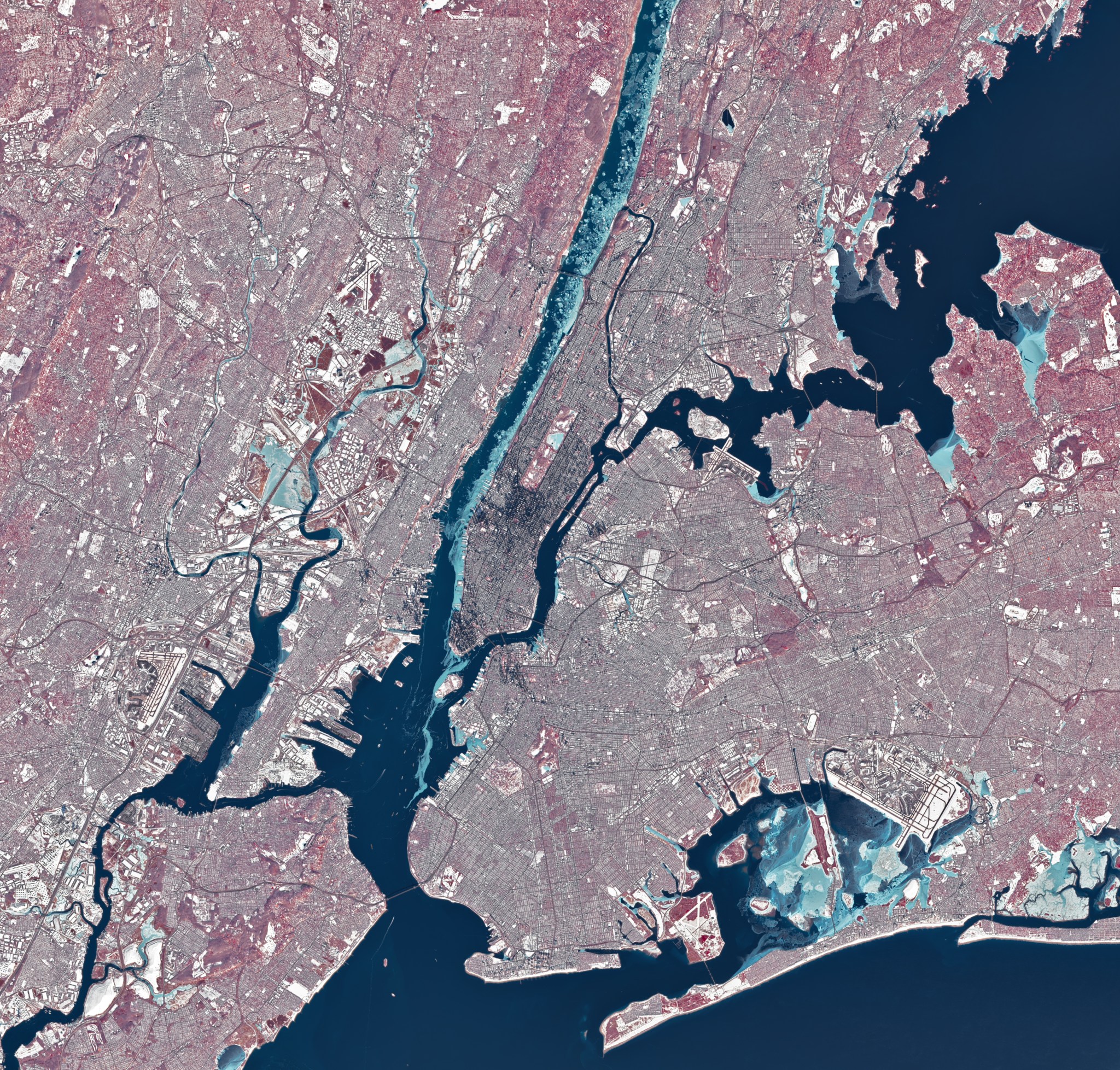
During a stretch of frigid weather in late January 2026, ice choked the Hudson River along Manhattan's western shore. The OLI (Operational Land Imager) on Landsat 8 captured this image of the wintry landscape around midday on Jan. 28. This image uses representational color to distinguish ice (light blue) from open water and snow. Vegetation appears red.
Much of the ice in the image likely floated there from farther upriver, where tidal currents are weaker and salinity is lower. These conditions allow water to freeze sooner and at higher temperatures than the faster-flowing, brackish water near the river's mouth, shown here.
/Public Release. This material from the originating organization/author(s) might be of the point-in-time nature, and edited for clarity, style and length. Mirage.News does not take institutional positions or sides, and all views, positions, and conclusions expressed herein are solely those of the author(s).View in full here.


