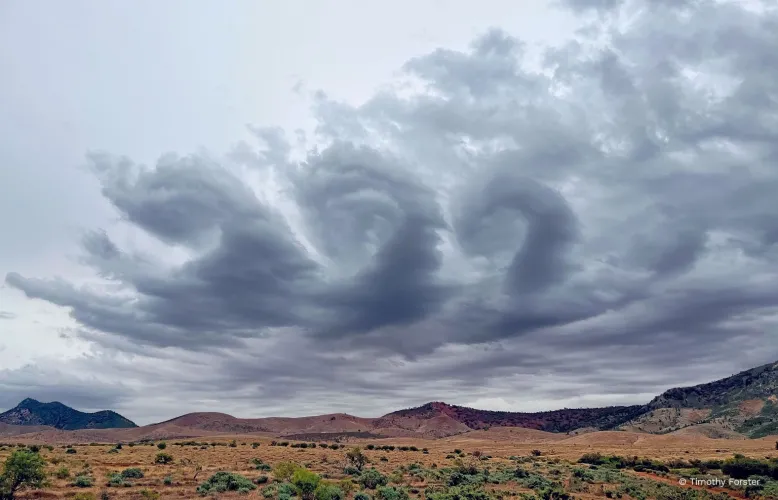
Whirl cloud, Quorn, South Australia. Credit: Timothy Forster.
As afternoon skies darken over the Flinders Ranges, the delicate swirls of Kelvin-Helmholtz clouds reflect atmospheric disturbance.
While such altocumulus clouds can form in a range of locations, they are frequently the result of unique wind patterns resulting from complex terrain.
Lee waves, in which stable air rises over a mountain, can also contribute to the formation of Kelvin-Helmholtz waves.
On this day, a cold front moved across South Australia, leading to gusty conditions in the afternoon and evening.
Abrupt changes in wind speed and direction, rainfall and dropping temperature are common features of cold fronts.
These happen when a relatively cold air mass moves into a region of warmer air, with the colder dense air staying low and forcing the warm air upwards to form clouds.
In Australia, warm northerly winds often occur ahead of a cold front, while colder southerly winds typically follow behind.
Cold fronts are generally stronger in southern Australia during springtime.
Keep an eye on the forecast to make sure you're well-prepared.
If a front is expected to bring dangerous weather, the Bureau will issue a severe weather warning - check our website or the BOM Weather app to stay up to date.
The Bureau's 2027 Australian Weather Calendar national photo competition is currently open for submissions until March 31.
For the full terms and conditions of entry, and to submit a photo, visit: http://www.bom.gov.au/calendar/contest/


