4 min read
NASA is now publicly distributing science-quality data from its newest Earth-observing satellite, providing first-of-their-kind measurements of ocean health, air quality, and the effects of a changing climate.
The Plankton, Aerosol, Cloud, ocean Ecosystem (PACE) satellite was launched on Feb. 8, and has been put through several weeks of in-orbit testing of the spacecraft and instruments to ensure proper functioning and data quality. The mission is gathering data that the public now can access at https://pace.oceansciences.org/access_pace_data.htm.
PACE data will allow researchers to study microscopic life in the ocean and particles in the air, advancing the understanding of issues including fisheries health, harmful algal blooms, air pollution, and wildfire smoke. With PACE, scientists also can investigate how the ocean and atmosphere interact with each other and are affected by a changing climate.
"These stunning images are furthering NASA's commitment to protect our home planet," said NASA Administrator Bill Nelson. "PACE's observations will give us a better understanding of how our oceans and waterways, and the tiny organisms that call them home, impact Earth. From coastal communities to fisheries, NASA is gathering critical climate data for all people."
"First light from the PACE mission is a major milestone in our ongoing efforts to better understand our changing planet. Earth is a water planet, and yet we know more about the surface of the moon than we do our own oceans. PACE is one of several key missions - including SWOT and our upcoming NISAR mission - that are opening a new age of Earth science," said Karen St. Germain, NASA Earth Science Division director.
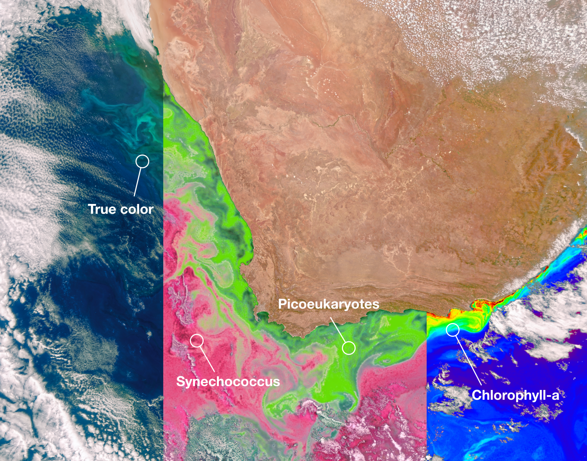
The satellite's Ocean Color Instrument, which was built and managed by NASA's Goddard Space Flight Center in Greenbelt, Maryland, observes the ocean, land, and atmosphere across a spectrum of ultraviolet, visible, and near infrared light. While previous ocean color satellites could only detect a handful of wavelengths, PACE is detecting more than 200 wavelengths. With this extensive spectral range, scientists can identify specific communities of phytoplankton. Different species play different roles in the ecosystem and carbon cycle - most are benign, but some are harmful to human health - so distinguishing phytoplankton communities is a key mission of the satellite.
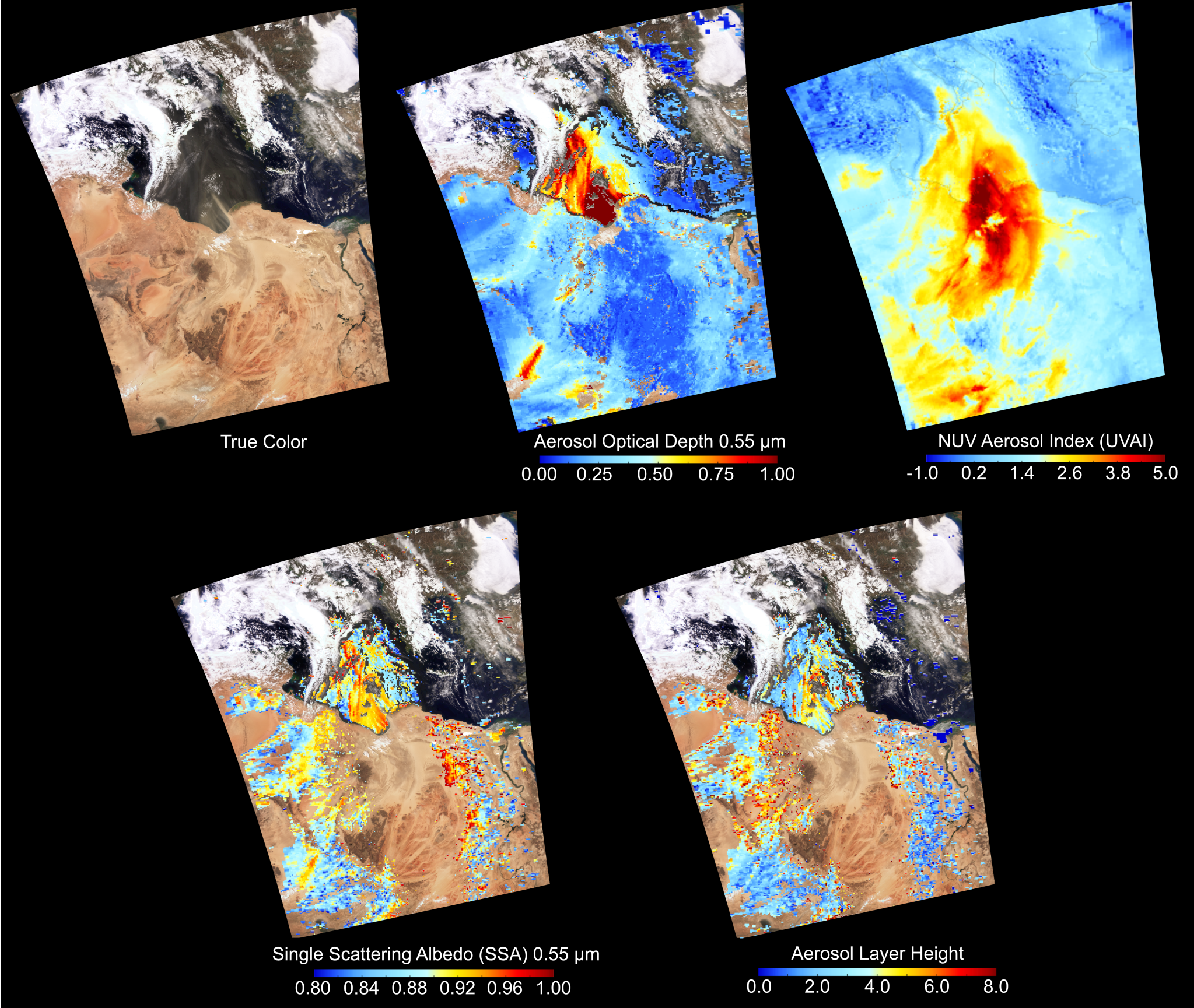
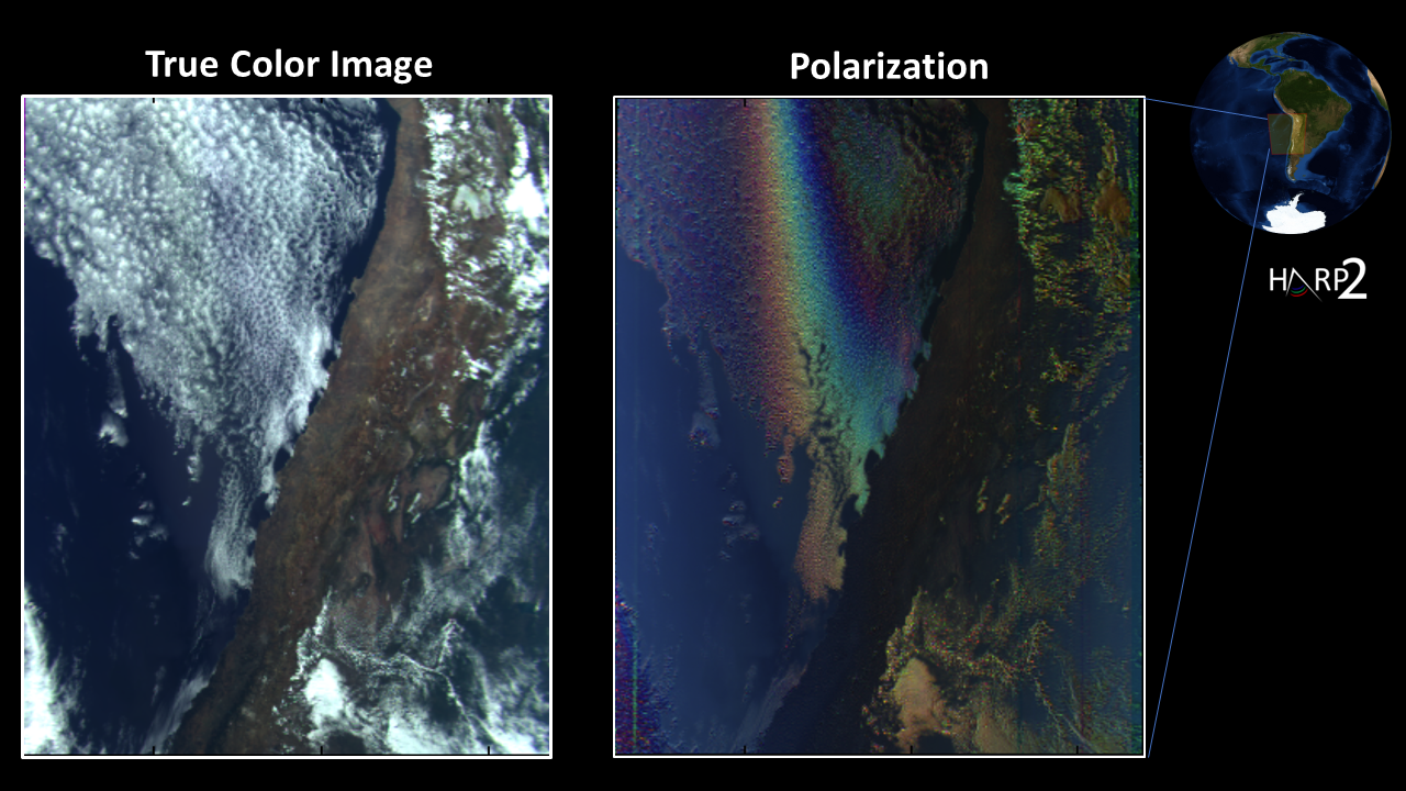
PACE's two multi-angle polarimeters, HARP2 and SPEXone, measure polarized light that has reflected off clouds and tiny particles in the atmosphere. These particles, known as aerosols, can range from dust to smoke to sea spray and more. The two polarimeters are complementary in their capabilities. SPEXone, built at the Netherlands Institute for Space Research (SRON) and Airbus Netherlands B.V., will view Earth in hyperspectral resolution - detecting all the colors of the rainbow - at five different viewing angles. HARP2, built at the University of Maryland, Baltimore County (UMBC), will observe four wavelengths of light, with 60 different viewing angles.
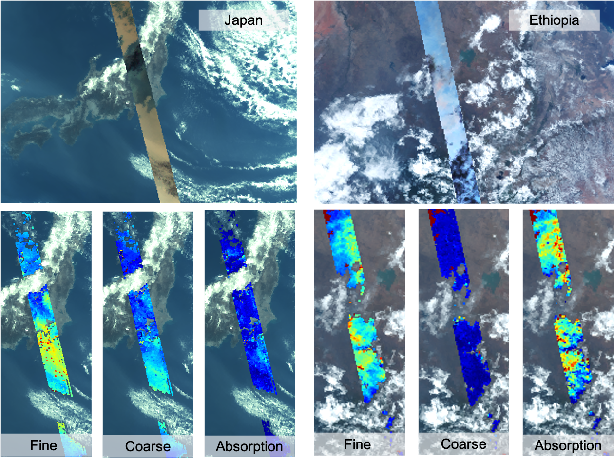
With these data, scientists will be able to measure cloud properties - which are important for understanding climate - and monitor, analyze, and identify atmospheric aerosols to better inform the public about air quality. Scientists will also be able to learn how aerosols interact with clouds and influence cloud formation, which is essential to creating accurate climate models.
"We've been dreaming of PACE-like imagery for over two decades. It's surreal to finally see the real thing," said Jeremy Werdell, PACE project scientist at NASA Goddard. "The data from all three instruments are of such high quality that we can start distributing it publicly two months from launch, and I'm proud of our team for making that happen. These data will not only positively impact our everyday lives by informing on air quality and the health of aquatic ecosystems, but also change how we view our home planet over time."
The PACE mission is managed by NASA Goddard, which also built and tested the spacecraft and the ocean color instrument. The Hyper-Angular Rainbow Polarimeter #2 (HARP2) was designed and built by the University of Maryland, Baltimore County, and the Spectro-polarimeter for Planetary Exploration (SPEXone) was developed and built by a Dutch consortium led by Netherlands Institute for Space Research, Airbus Defence, and Space Netherlands.


