
- Landsat Home
- Missions
- News
- Data
- Benefits
- Outreach
- Multimedia
- About
- Search
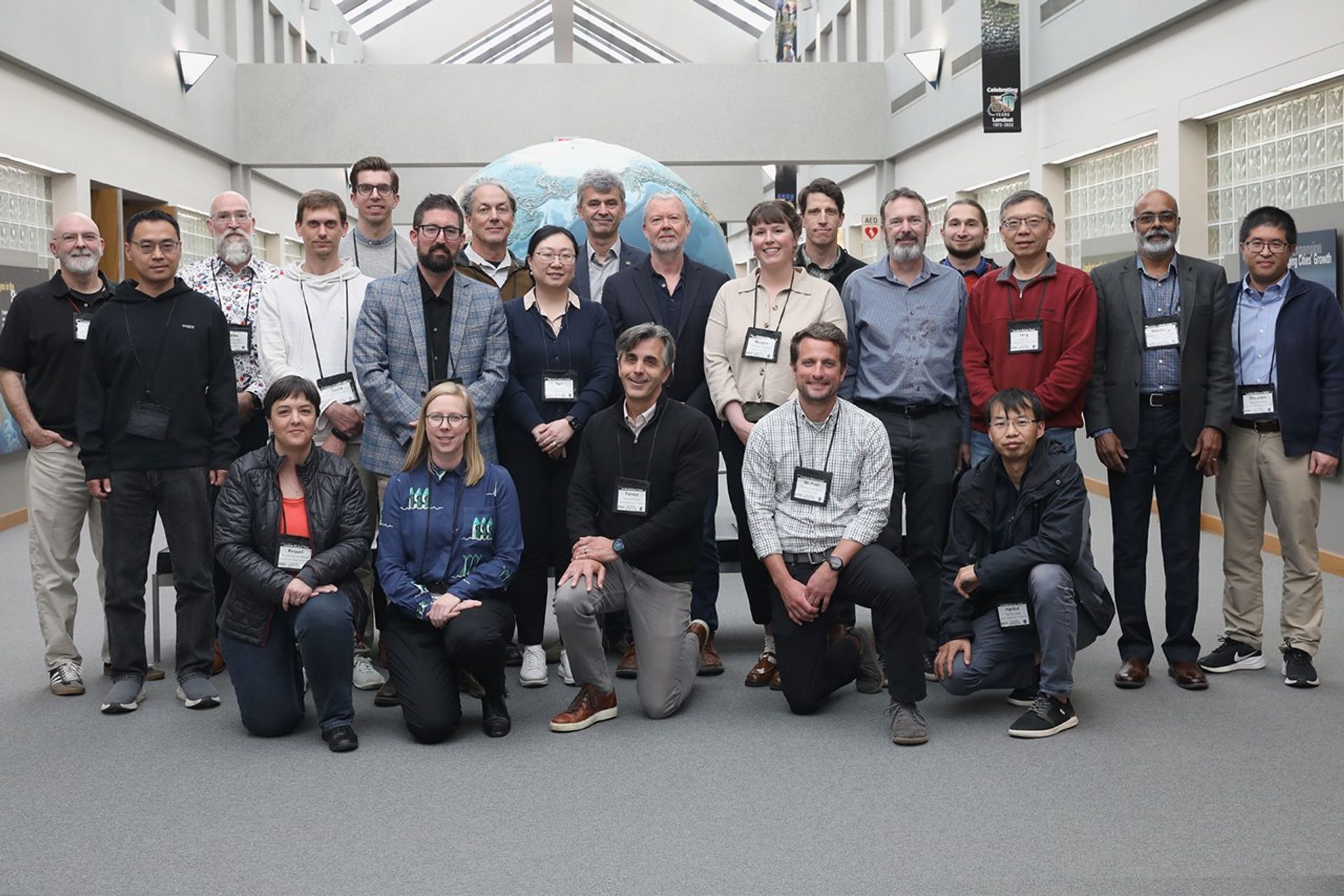
Front Row: Raquel De Los Reyes, Courtney Bright, Forrest Melton, Michael Campbell , Hankui Zhang
Standing: Greg Vaughan, Lin Yan, Mike Wulder, David Frantz, Kyle Knipper, Nimrod Carmon, Dean Hively, Yun Yang, Peter Strobl, David Roy, Morgan Crowley, Ned Bair, Phillip Dennison, Ryan O'Shea, Feng Gao, Medhavy Thankappan, Zhuosen Wang. Not pictured: Martha Anderson, Kimberlee Baldry, Eric Vermote.
From May 5 to 7, the 2026-2030 Landsat Science Team met for their first in-person meeting at the Earth Resources Observation and Science (EROS) Center in Sioux Falls, SD. The three-day event, co-moderated by Landsat 8, 9, and 10 Project Scientist Chris Neigh, allowed leaders from USGS and NASA to begin work on a vision for the upcoming five-year period.
Attendees shared their current work and a vision for the future of the Landsat program. Participants received comprehensive status updates on the upcoming Landsat 10 project, the ongoing interagency and international collaboration on the Harmonized Landsat and Sentinel-2 (HLS) data products, and detailed plans for Collection 3 (C3).
Throughout the event, team members representing funded, international, and federal programs showcased the far-reaching impact of Landsat data across various Earth science disciplines, spanning snow cover mapping, atmospheric correction, water quality monitoring, evapotranspiration, agricultural applications, volcanic monitoring, and more.
The meeting culminated in focused breakout sessions, where experts drafted vital recommendations across four key technical areas to guide future mission data processing:
Surface Reflectance
The surface reflectance working group identified several priorities, including topography and adjacency corrections, Bidirectional Reflectance Distribution Function (BRDF) correction, and enhanced cloud masking with consistent approaches for HLS data products. Key recommendations included incorporating CMIX2 cloud masking results into future collections and mapping out C3 toolkit dependencies for user-applied corrections.
Temperature and Emissivity
Discussions on land surface temperature and emissivity centered heavily on maintaining archive consistency. The team recommended either maintaining native resolution or standardizing to 60 meters, with additional testing specifically for volcano studies. They endorsed using ASTER GED/CAMEL emissivity datasets and preparing for Landsat 10's five thermal bands through ECOSTRESS comparison. They also called for better quantification of how atmospheric inputs impact harmonization efforts through collaboration between NASA's Jet Propulsion Laboratory (JPL), RIT, and EROS.
Aquatic Reflectance
Aquatic reflectance experts raised critical concerns regarding Landsat 10's planned 18-day repeat cycle, noting that it severely limits the monitoring of highly dynamic processes such as harmful algal blooms. The group called for increased investment in validation infrastructure for inland waters coordinated with international CEOS efforts. They also strongly advised against pixelwise algorithm switching to prevent data discontinuities and emphasized the need for strict compliance with CEOS Aquatic Reflectance V2.0 standards.
Projections, Tiling, and the Pixel
Finally, the group reviewing projection and tiling endorsed the USGS pixel grid nesting plan (which spans 10, 15, 20, 30, 60, and 120 meters). However, they recommended further trade analysis to optimize pixel replication errors, manage storage costs, and ensure proper coordination with Sentinel-2 Next Generation. The working group strongly recommended that if these complex grid issues remain unresolved, the program should maintain the Collection 2 approach (UTM and polar stereographic) while continuing to refine Analysis Ready Data (ARD) products for CONUS, Hawaii, and Alaska.
The recommendations generated during these breakout sessions created a roadmap for the new Landsat Science Team, ensuring that the global scientific community continues to receive high-quality, actionable Earth observation data through the end of the decade.
Explore More
From May 5 to 7, the Landsat Science Team meeting convened at the Earth Resources Observation and Science (EROS) Center…

Wild disturbances are on the rise, while land disturbed by human activity has been decreasing.
The Landsat 10 Spacecraft Draft Request for Proposal (DRFP) is available for review via SAM.gov.


