
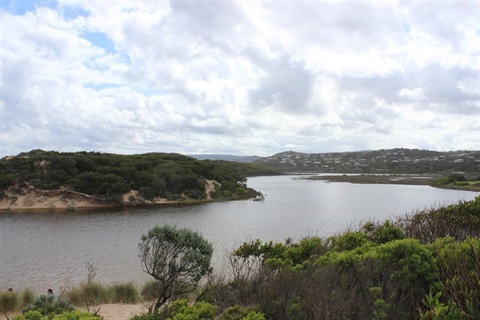
A Painkalac Creek flood study has provided a greater understanding and awareness of the
long-term flood risk in Aireys Inlet.
The study consisted of flood modelling in phase one, followed by potential mitigation and adaptation options in stage two.
Council considered the completed Painkalac Flood Mitigation and Adaptation Study at its September meeting in Aireys Inlet. It adopted the phase one findings, which will be provided to Corangamite Catchment Management Authority (CCMA). It also noted phase two findings.
Mayor Libby Stapleton said the study was a collaborative effort between Council and government partners to better understand potential opportunities to reduce flood risk into the future.
The study found that the changing climate – with more unpredictable storms and rainfall – will increase flooding risk to residential properties, businesses and critical infrastructure near the Painkalac Creek.
It was historically understood that around 50 private properties near the creek are at risk of inundation from flooding without intervention. Long-term hazard modelling showed that a larger area could be subject to future flooding, potentially impacting an additional 54 properties by the year 2100.
The study also found that artificially opening the creek to reduce flood risk is a tool that works currently to prevent flooding, however it will become a progressively less effective tool in the years ahead. The study did not assess environmental impacts of openings and a decision would need to be made and funding sourced for this to occur.
"The updated flood modelling, hazard mapping and supporting technical information will be recognised as Council's endorsed evidence base for understanding flood risk in Aireys Inlet," Mayor Stapleton said.
"We acknowledge the new information describes future impacts for the Aireys community, particularly identified property owners, who we've kept informed and involved along the way.
"Ultimately, the study will help us understand how we can work with other agencies and the community to support stronger planning and action in the changing environment."
The phase one findings will be provided to CCMA to consider in any future local flood-related planning controls, which may require an amendment to the Surf Coast Planning Scheme. Property owners are encouraged to use the flood modelling information from the study when undertaking any new developments or building works.
A planning scheme amendment led by the CCMA would include formal public exhibition, allowing affected landowners and the community to make submissions on the proposed planning controls.
Phase two explored 10 potential long-term mitigation and adaptation options, ranging from retrofitting properties so that they're more flood resilient, to structural measures and planting vegetation in the floodplain.
While the options were assessed for effectiveness, the study did not commit Council to fund or implement any as they require further investigation, detailed planning, funding and coordinated decision-making with relevant agencies and the community.
The flood study aligns with Council's goal that communities are prepared ahead of emergencies, supported during them and resilient in their aftermath.
Council delivered the Painkalac Flood Mitigation and Adaptation Study with support from CCMA, Department of Energy, Environment and Climate Action, and Great Ocean Road Coast and Parks Authority.


