Tropical cyclones are powerful, spiralling storms that cause damage and destruction from strong wind, flooding and storm surge.
We issue tropical cyclone forecasts and alerts to help Australians prepare and stay safe.
Understanding tropical cyclones and how we warn you about them could save your life.
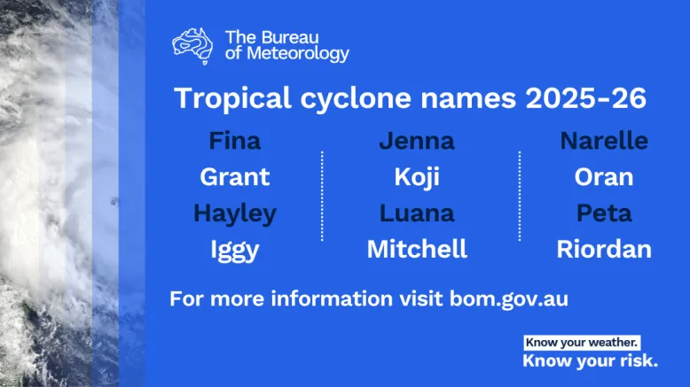
1. Cyclones are named so you take notice
Cyclone names raise public awareness about these dangerous storms. Naming them also means there's no confusion if there is more than one cyclone active at a time. The names come from our approved alphabetical list and we alternate between male and female names.
If a cyclone forms in an adjoining region to Australia, it's named there. The name stays the same if it moves into our region. For example, Tropical Cyclone Yasi in 2011 was named in Fiji.

2. Cyclones are also called typhoons and hurricanes
That's right - same storm, different name. In the Northwest Pacific Ocean, the term typhoon is used. In the northern Atlantic Ocean, central north Pacific Ocean and the eastern north Pacific, they're known as hurricanes. In the South Pacific and Indian oceans, we use tropical cyclone.
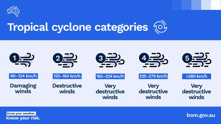
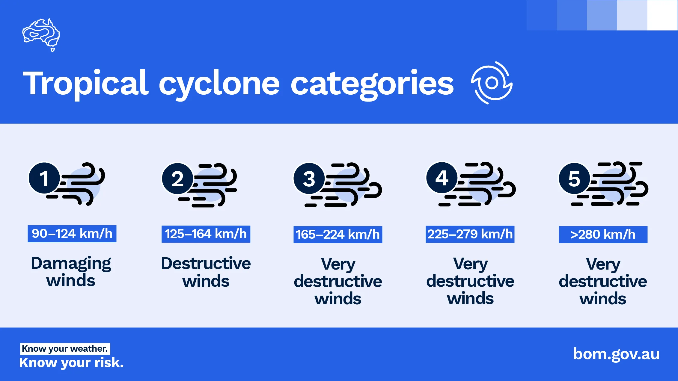
3. Cyclones are categorised by wind speed
Categories range from one to 5, with 5 being the strongest.
A Category 1 cyclone has a mean wind speed of 63-88 km/h and typical strongest gusts of up to 124 km/h. A Category 5 cyclone has a mean wind speed greater than 200 km/h and gusts greater than 279 km/h.
While helpful at highlighting the risk caused by wind, the category doesn't reflect the full range of hazards. A Category 1 cyclone can bring prolonged heavy rain or storm surge that leads to devastating flooding.
4. Warning about cyclones is a global effort
The Bureau is part of a global network monitoring and warning about cyclones. The network is coordinated by the World Meteorological Organization. We're responsible for warnings, advice and information about cyclones in the Australian region.
Australia's tropical cyclone area

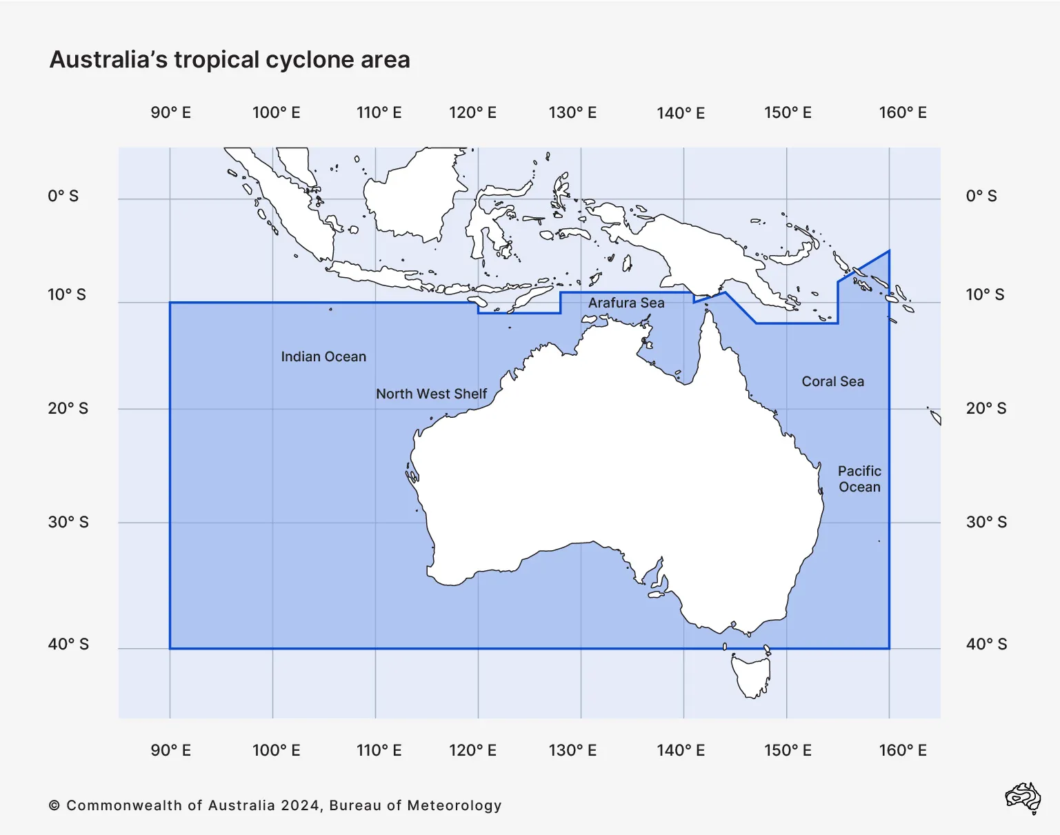
Australia's area of responsibility for cyclone tracking and warnings
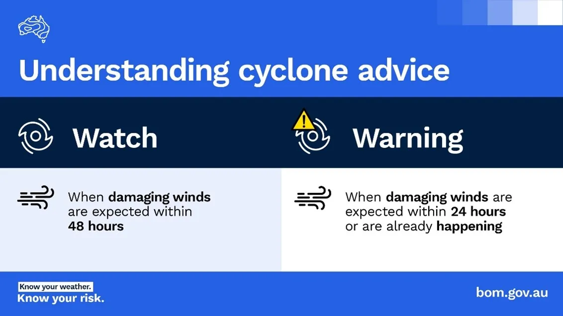
5. Watches and warnings tell you when a cyclone is coming
For each coastal community covered by the forecast we issue:
- a tropical cyclone watch when gales are expected in the next 24 to 48 hours
- a tropical cyclone warning, updated every 3 hours, when gales are expected in the next 24 hours or are already occurring.
We also issue track maps for cyclones in our region or likely to affect Australian communities. They show the cyclone's forecast movement, intensity and watch or warning zones.
You can see any active tropical cyclone watches or warnings on our Warnings and alerts page or through the BOM Weather app.