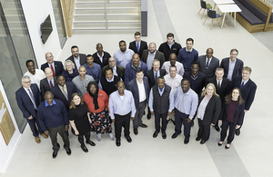
Delegates from the Overseas Territories visiting the UK Hydrographic Office
The UK Hydrographic Office (UKHO) have today launched a five-day capacity building seminar to help UK Overseas Territories support safe maritime trade.
The seminar, delivered as part of the government's Overseas Territories Seabed Mapping Programme, will focus on international regulations, with sessions on maritime safety information training, best practice governance and maritime law. This guidance, given by experts at both the UKHO and MCA, will help each of the 10 participating territories to comply with international obligations and share their own maritime safety information with ships operating in their waters.
For these ships, this information, including up-to-date bathymetry (seabed mapping data), navigational warnings and observations, is essential to safe navigation. And with global (which is primarily maritime) trade expected to double from $1.5 trillion in 2010 to $3 trillion in 2030, it's vital that these Overseas Territories develop their capability to not only support maritime safety, but create opportunities to increase seaborne trade and tourism. This is particularly important for the many Overseas Territories where these sources of income make up a significant part of their GDP.
Advice and support given through the seminar will also complement additional work carried out by the UKHO in collecting marine geospatial data – including bathymetry, tidal and a range of seabed features– in each territory's ocean environment. The data, which has been collected through 11 surveys in 6 territories, will not only support navigation through the creation of charts but give authorities the information they need to support disaster planning and resilience, coastal infrastructure and environmental protection.
This activity, including both the seminar and surveying, has been carried out under the UK the Conflict, Stability and Security Fund Programme funded by the UK Government.
Commenting on the seminar, Kerrie Howard, Hydrographic Programme Manager, UKHO, said:
This hydrographic seminar provides a unique opportunity to assemble an array of delegates from across the world, with a shared vision for using marine geospatial data to unlock safety, prosperity and sustainability.
Work that has been undertaken as part of the Overseas Territories Seabed Mapping Programme to date has shown the benefits of marine geospatial data. The next step, in terms of implementation, will see tangible returns on hydrographic investment. In the short and medium term, we expect new charts to be created with a higher level of detail than ever before, ensuring safety for mariners and providing businesses within OTs to begin planning for increased import/exports and even infrastructure development and coastal protection.
In the long term, however, what this work will foster – spurred by this week's session – is a shared culture of hydrographic excellence across the Overseas Territories, unlocking a marine geospatial-led future that maximises the potential of these territories' blue economies.
Those in attendance at the seminar will include representatives from Anguilla, Bermuda, British Virgin Islands, Cayman Islands, Falkland Islands, Gibraltar, Montserrat, South Georgia and South Sandwich Islands, St Helena and Turks and Caicos Islands.


