
Caribbean countries are testing storm warnings and emergency procedures. A simulated tropical storm in Saint Vincent and the Grenadines revealed what emergency warnings must explain: when danger will arrive, who is at risk and where people can seek shelter.
During an emergency exercise in Saint Vincent and the Grenadines, participants faced a simulated tropical storm bringing heavy rain, flooding, landslides, blocked roads and misinformation. As the scenario developed, they had to consider evacuations and emergency communication.
The exercise raised a practical question: would a weather warning give people enough information to understand the danger and know what to do?
This is one of the challenges being addressed through the Climate Risk and Early Warning Systems (CREWS) Caribbean 2.0 project. Across the region, countries are improving weather observations, forecasting services and cooperation between meteorological agencies and disaster management authorities. The work supports the Early Warnings for All initiative, with the aim of making national warning systems more reliable, connected and capable of supporting timely action.
The information behind an alert
Reliable forecasts depend on observations and the ability to exchange information quickly. Across the Caribbean, the number of countries meeting Global Basic Observing Network requirements has increased from five to nine, expanding the observations available to national, regional and global forecasting systems.
The implementation of the WMO Information System 2.0 is enabling faster data exchange between countries, while the Severe Weather Forecasting Programme has expanded throughout the Caribbean basin. These developments support forecasters as they anticipate tropical cyclones, heavy rainfall, flash floods and other high-impact hazards.
In Belize, CREWS support helped restore critical forecasting infrastructure when a weather radar failed during hurricane season. Local technicians diagnosed the fault, repaired the equipment and recalibrated the system, restoring an important source of information for monitoring severe weather. The intervention also gave them practical experience in maintaining the radar and responding to future technical failures.
Countries are also addressing the institutional foundations of their services. National strategic planning has advanced in Antigua and Barbuda, Belize, Saint Lucia, Saint Kitts and Nevis, and Trinidad and Tobago, helping meteorological and hydrological services define priorities, clarify responsibilities and plan longer-term investments.
These technical and institutional developments provide the foundation for effective early warnings. The next challenge is ensuring that the information produced by forecasting systems reaches the people who need it, in a form they can use.
Warnings people can act on
Impact-based forecasting is an important part of this effort. Rather than describing only the expected weather, it considers what the conditions could mean for people, infrastructure and essential services, and which protective actions may be needed.
In Jamaica, the Common Alerting Protocol (CAP) warning pipeline uses SmartMet and SmartAlert to display real-time, map-based small-craft warnings, tropical storm alerts and flash-flood watches through the Meteorological Service website and the Jamaica Weather application.
CAP is an international standard that allows authorities to issue consistent warnings across different communication channels. Its use is also expanding elsewhere in the Caribbean, alongside efforts to improve coordination between meteorological services, disaster management authorities and other agencies.
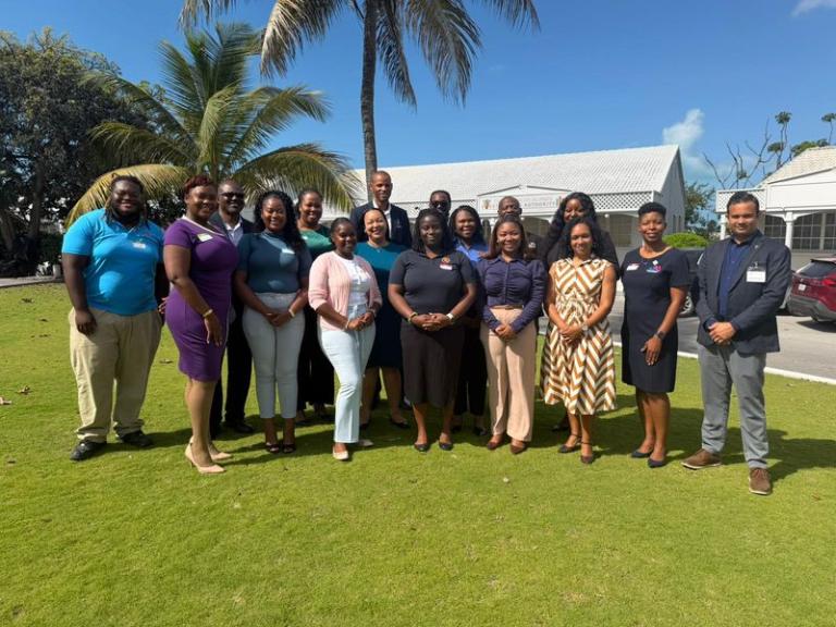
In August 2026, CREWS Caribbean 2.0 supported national workshops on CAP and impact-based forecasting in Antigua and Barbuda, Jamaica, Saint Kitts and Nevis, and Saint Vincent and the Grenadines. Participants used the WMO CAP Composer to develop alerts describing expected impacts, people and places at risk, and recommended protective actions.
They also examined who should create, authorize, distribute, update and cancel warnings, identifying priorities such as approved message templates, clearer operating procedures and regular multi-agency exercises.
In Saint Vincent and the Grenadines, the simulated tropical storm scenario highlighted the need for warnings to include timing, expected impacts, emergency contacts, shelter information and evacuation instructions. Agreed follow-up priorities include establishing a national CAP community of practice and an operational workflow linking the Meteorological Service, the National Emergency Management Organisation and other key sectors.
In Jamaica, the national workshop focused on widening participation in the warning process to include disaster management, public works, electricity and agriculture partners.
A separate CREWS-supported exercise in the Turks and Caicos Islands examined how warnings travel from technical agencies to the public. Weather and disaster management authorities worked with government communicators and media representatives to identify communication bottlenecks and clarify responsibilities. They also agreed to develop pre-approved emergency messages to reduce delays during a crisis.
The exercise highlighted the role of broadcasters and journalists in helping official information reach vulnerable communities through sources they use and trust. Their involvement can also help agencies identify unclear language.
Across the Caribbean, CREWS Caribbean 2.0 is addressing different parts of the same challenge: providing forecasters with reliable information, helping national services issue more useful warnings and establishing clearer procedures for coordinated action. Putting the agreed improvements into regular operational practice will help countries prepare for the next severe weather emergency.


