A close-knit group of friends -- who also happen to be GIS experts -- share their knowledge to enhance conservation efforts in Africa
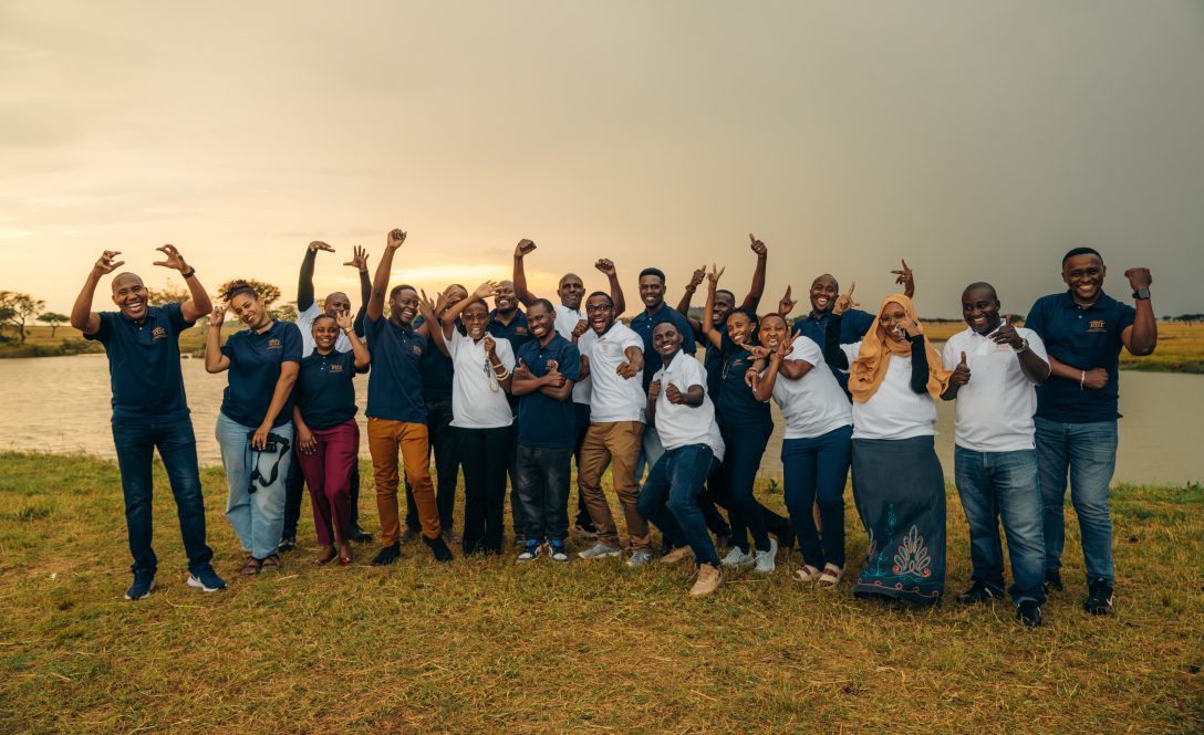
The summer 2025 cohort of in-person participants in the advanced GIS course at the Grumeti Fund Trust RISE facility. This year the course was expanded to include nearly 50 participants and an additional day of training. (Contributed photo)
UConn Department of Geography, Sustainability, Community, and Urban Studies assistant professor-in-residence Dan Wanyama and a group of his closest friends and colleagues have collaborated to share their expertise with sustainability and conservation scholars and specialists in Africa. They developed a free advanced Geographic Information System (GIS) training program that is attracting interest from around the globe.
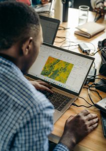
GIS technology is software that helps users collect, store, integrate, analyze, and map many different types of location-based data. GIS is used by students, researchers, government agencies, and industries across the globe to understand patterns and relationships to inform decision-making, and in this case, improve our understanding of climate change in Africa, enhance sustainable farming, and improve natural resource conservation efforts.

The collaboration started in 2019, when Wanyama's wife Susan Kotikot was attending Penn State pursuing her Ph.D. in geography. This is where they met Grace Malley, who was also pursuing her Ph.D. in geography and her husband, George Lohay, who had just graduated with his Ph.D. in biology from Penn State. They all became good friends, and as the country went into lockdown due to the COVID-19 pandemic, they grew into a support system. The group is now extending this support further.
Wanyama explains George now has a job in Tanzania at the Grumeti Fund, a non-governmental organization committed to rehabilitating and preserving the Serengeti ecosystem. As Head Scientist of Grumeti Fund's Research and Innovation for the Serengeti Ecosystem (RISE) program, George was looking for research and educational activities and he reached out to the rest of the group, who happen to also be GIS experts, about starting an advanced GIS training program.
The team now also includes Wanyama's best friend, Donald Akanga from Montana State University, Billings, and they all met and decided to give it a shot. This past summer they wrapped up their second annual training session which included another on-site lecturer, Richard Giliba, from the Nelson Mandela African Institution of Science and Technology
The collaboration hosted their first advanced GIS training in the summer of 2024. Wanyama says they aimed to admit around 20 participants, with 12 to 15 present at Grumeti and a handful of remote participants.
"We got over 150 applications and then we wondered how we could get that down 20 people. We ended up expanding the number to about 40. The group represented 11 countries and initially wanted to only get people from East Africa (Kenya, Uganda, Tanzania), but then we got applications from India, the United States, Nigeria, Malawi, and other places. We ended up having to expand the geographic coverage also," says Wanyama.
The training consists of hands-on activities where the participants compile the output of each exercise into a story map to document their progress. Students are also given licenses for ArcGIS software for one year, with support from the Grumeti Fund, so they can continue practicing and applying their skills.
Wanyama says that since the training wrapped up, they have had participants reconnect to tell them how they have employed their new skills; for instance, one student applied new techniques they learned to their master's thesis. Others have paid it forward by sharing their knowledge with colleagues.
"We've had people who submitted great applications to graduate school, and they're now going to graduate school. We have impact. People who are working in conservation in these regions are doing well with data analysis and data handling," says Wanyama.
Wanyama's work demonstrates how these skills can be applied to research and problem-solving. An important aspect that Wanyama recognized that would be helpful to include in the training is the abundance of open-source data that not many people know about. Wanyama explains there are many types of datasets derived from remote sensing, including data on land use, land cover, and agriculture; the trouble is tracking them down and letting people know they are freely available.
"One thing I found working in eastern Africa in the area of GIS and remote sensing was that many people have no idea we have all this open-source remote sensing data. Land use, land cover data, data on forests, data on agriculture, all this open-source data exists, and not many people use them."

Wanyama is inspired to share his knowledge. He grew up in a rural, agricultural community in Kenya, and he has seen dramatic changes over the years.
"The agriculture that we do now is not anything close to what we used to do back in the day," says Wanyama. "You just needed to plant on time, use high-quality seeds, weed on time, and you'd get good yields. Now, plant on time or not, that does not guarantee anything."
Wanyama explains that agricultural yields are decreasing due to climatic changes, which are shifting suitable conditions for specific crops such as maize, wheat, and rice. GIS can help researchers like Wanyama and participants in the GIS training understand these shifts to help farmers adapt and be better prepared.
"The suitability for these crops has changed a lot. People are getting low yields from maize, because rainfall quantity and distribution is changing. Within the season, we can have droughts and then high intensity rainfall episodes which cause flooding and water logging issues. We need the consistent distribution of rain for those crops."

With more people trained in how to access and analyze these data, the team hopes to continue to support sustainability and conservation efforts. This year the team expanded the program to include more participants and they added an additional day, resulting in six days of advanced GIS training. Interest is also growing, as Wanyama says they had over 350 applicants and nearly 50 participants from 21 countries.
"At this point, we will be doing it every year, maybe twice a year. I have always seen the need for using technology to understand these processes and try to find a solution for the people. Make it better for the people," says Wanyama. "I feel like we are making progress, reaching out to more people. And now they reach out to us and saying thank you for teaching us this."
The group is grateful for the financial support provided by the Grumeti Fund, who generously covered travel, meals, accommodation, and game drive expenses for on-site participants, and ArcGIS licensing fees. They also appreciate Montana State University Billings (MSUB) for providing access to the Canvas learning platform, which facilitated seamless collaboration and engagement throughout the training.


