
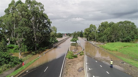
Logan City Council has endorsed improvements to its Logan Flood Portal and Property Flood Reports to provide clearer, easier-to-use information for residents.
It follows last week's endorsement of major changes to Logan's flood mapping and policy, which when implemented, will more than halve the overall number of properties in the city's flood mapping overlay.
Mayor Jon Raven said the improvements to the Logan Flood Portal reflected community feedback while still providing more detail for emergency planning purposes and customers who require more information.
"We've listened to the community and worked hard to get the balance right. These changes will make sure the Portal is a simple and easy tool to use, with the most relevant information for residents up front," Mayor Raven said.
"In another step forward, we've also submitted the major changes to flood mapping and policy endorsed by Council last week to the State Government for approval.
"When these come into effect, it will result in 56.8 per cent of properties being removed from the city's flood mapping overlay."
Improvements to the Logan Flood Portal and Property Flood Reports endorsed in today's Council meeting include:
- the Portal's landing page (Key Maps tab) and standard Property Flood Report will focus on flood information up to the 1 in 100 annual chance (1% AEP) flood event.
- flood information relating to more rare and extreme floods, up to the 1 in 2000 annual chance (0.05% AEP) flood event will continue to be available in the Portal and detailed Property Flood Report to support flood awareness, resilience and emergency planning.
- the Probable Maximum Flood (PMF) will be removed from the maps in the Logan Flood Portal, the Property Flood Reports as well as the planning scheme.
- ·new interactive mapping functionality for small screens will make it easier for people to access the Logan Flood Portal on their mobile devices.
- Property Flood Reports will be simplified, with a new standard report becoming the default option. A detailed option will remain available for flood risk awareness and emergency planning.
The changes to flood mapping and policy will be implemented through a Temporary Local Planning Instrument (TLPI) which was endorsed at last week's Special Council meeting.
The TLPI has been submitted to the Minister for State Development, Infrastructure and Planning for approval. If approved by the Minister, the TLPI will return to a future Council meeting for adoption. Subject to these approvals, Council expects the changes to take effect in early 2027.
The Logan Flood Portal improvements will be introduced when changes to the flood mapping and policy come into effect.
Council will continue to review submissions received on the Logan Plan and progress further work on creek mapping, with the review expected to be completed in 2027.
A dedicated webpage provides updates, timelines, FAQs and background information at: logan.qld.gov.au/Floodmaps. Residents can subscribe for email updates as new information is added.


