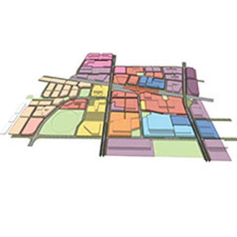
A new, planned town centre, set to be among the largest in metropolitan Melbourne, will be developed in Cobblebank over the next 30 to 40 years with Melton City Council this week adopting two major framework documents.
Together, the Urban Design Frameworks (UDFs) strategically map out locations for a range of uses in the area.
The Cobblebank Metropolitan Activity Centre is a 100-hectare regional town centre for retail use, a health precinct, education space, offices, a justice precinct, and recreation. The area surrounds the intersection of Ferris Road and the Melbourne-Ballarat railway line (already home to Western BACE and Cobblebank Railway Station).
The Cobblebank Employment and Mixed Use area is a 490-hectare site which will house big box retail, light industry, warehousing and office uses to facilitate local job creation. It is bounded by the Western Freeway, Mt Cottrell Road, the Melbourne-Ballarat railway line and Toolern Creek.
Mayor Cr Lara Carli said the UDFs will help guide cohesive development in the areas.
"A very well-planned future is in sight for Cobblebank and it's exciting that we can now really visualise how it will look, feel and function in the future," Cr Carli said.
"This will be a major new regional hub for shopping, services, food and entertainment, and importantly it's going to create a lot of jobs for our residents.
"These frameworks provide certainty that Cobblebank will be developed in an integrated way and provide the infrastructure and services for a thriving, growing community."
The UDFs were developed in consultation with landowners, stakeholders and the community over the past two years.


