National Parks and Wildlife Service in conjunction with Fire and Rescue NSW and NSW Rural Fire Service is planning two hazard reduction burns in Lane Cove National Park over the weekend, starting tomorrow Friday 8 October.

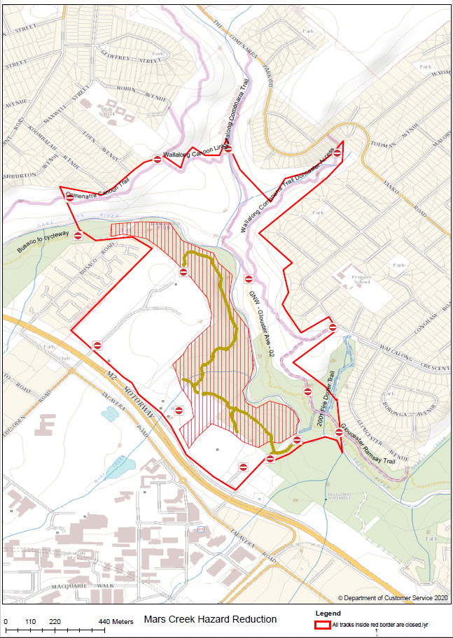
The Blaxland hazard reduction burn bounded by Lady Game Drive, Terrace Road, Albert Drive, Great North Walk and Lane Cove and a second burn in the Mars Creek area, in the bushland surrounding the Macquarie University sporting fields near Christie Park, will take place from Friday 8 to Sunday 10.
Riverside Walk track between Porters Creek and Deburghs Visitor Entry Station and the Great North Walk between Fiddens Wharf and Deburghs Bridge (Ryde Road (A3)) will be closed during the operations. The purpose of the burns is to reduce bush fire fuel levels and provide protection to local community assets.
Smoke from the burn program may be evident in local communities depending on wind direction.
People with asthma or those who are susceptible to respiratory problems are advised to keep clear of the area or stay indoors.
The NPWS hazard reduction program is focused on essential burns to protect park neighbours, assets, or significant habitat to ensure ongoing recovery of the wildlife impacted by the summer bushfires.
All burns across New South Wales will continue to be coordinated with the NSW Rural Fire Service (RFS) and Fire and Rescue NSW (FRNSW) to ensure the impact on the community, including from smoke, are assessed at a regional level.
Details on specific burns will be made available in advance on the Rural Fire Service website 'Fires Near Me' app, and on the NPWS Alerts website.
For health information relating to smoke from bush fires and hazard reduction burning, visit NSW Health or the Asthma Foundation.
For up to date information on these, and other, planned hazard reduction activities, visit the Rural Fire Service.