The UKHO recognises the impact seabed mapping has on enabling ocean action on World Hydrography Day and at the United Nations Ocean Conference in Nice in June.
Seabed mapping is the foundational data set for almost all marine activity, it informs safer navigation, sustainable development and management, and smarter decisions about how we use our oceans.
In recent weeks, the science of hydrography and seabed mapping has been at the forefront of the marine community with the month of June hosting both World Hydrography Day and the United Nations Ocean Conference held in Nice.
Critical to the safe passage of vessels by providing data used to produce navigational charts, seabed mapping is also key for sectors such as offshore energy, fishing and aquaculture, defence, environmental protection and telecommunications.
Seabed mapping: enabling ocean action
Recognising the importance of hydrography in our understanding of the ocean, the International Hydrographic Organization (IHO) established World Hydrography Day which takes place on 21 June each year.
This year, the IHO selected 'Seabed Mapping: Enabling Ocean Action' as the theme, identifying how critical seabed data is to the future of our ocean.
To celebrate this year's World Hydrography Day, the UKHO unveiled a new video highlighting the importance of seabed mapping and how it enables marine science, defence, planning, environmental sustainability and the Blue Economy. As a global player, the UKHO enables ocean action by sharing seabed data to make decisions with confidence.
Underlining how integral seabed data is for a vast range of marine activities, the video demonstrates the importance of supporting the sustainable use of our ocean for future generations.
Learn more about the value of seabed mapping and how it enables ocean action by watching the video:
UN Ocean Conference - 'Our ocean, our future: united for urgent action'
The importance of seabed mapping in enabling ocean action was also identified at the United Nations Ocean Conference (UNOC3) in Nice and attended by the UKHO. The conference, held between 9 and 13 June 2025, set out to accelerate action and mobilise stakeholders to find a way to use and conserve the ocean sustainably, in line with the United Nations Sustainable Development Goal 14 ('Life below water') .
The UN Ocean Conference resulted in a new political declaration, 'Our ocean, our future: united for urgent action.' The declaration outlines the need for a variety of collaborative actions, including the key part seabed mapping plays in enabling the conservation and sustainable use of our oceans.
In paragraph 28, the UNOC declaration summarises:
We emphasize the critical need for national ocean accounting and mapping of coastal and marine ecosystems, and of the ocean floor, as appropriate, to inform policy decisions, development planning, integrated coastal zone management, and conservation planning.
Contributing as part of the UK delegation, the UKHO participated in an official IHO side-event in collaboration with many other organisations, such as UNESCO Ocean, Gouvernement Monaco, the French Naval Hydrographic and Oceanographic Service (SHOM), the National Hydrographic Agency (Nigeria), Norwegian Mapping Authority, and Schmidt Ocean Institute.
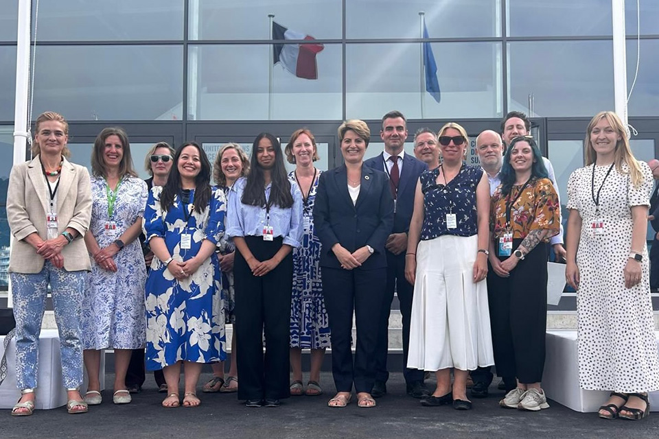
UK delegation at the UN Ocean Conference in Nice, June 2025
David Parker, Head of Hydrographic Programmes, and Koen Vanstaen, International Hydrographic Portfolio Manager, attended the event on behalf of the UKHO where they discussed the benefits of improved coordination through the UK Centre for Seabed Mapping (UK CSM) and held meetings with our partners from across the globe attending the event.
Developing a collaborative seabed mapping community
Led by the UKHO, the UK Centre for Seabed Mapping was set up to establish and support a collaborative seabed mapping community. The UK CSM coordinates the collection, management and access of publicly funded data, resulting in a network of stakeholders and an infrastructure that enables proactive action in support of the UN Ocean Decade .
The UK CSM brings together over 30 public sector organisations in the UK with an interest in marine geospatial information and data. The community seeks to optimise the investment being made into publicly funded data programmes. It ensures this data is then available to better understand the marine environment, supporting activities such as national security and infrastructure, safe and efficient maritime trade, and sustainable environmental and resource management.


