Powerful technology that efficiently detects and accurately predicts eucalyptus tree species favoured by koalas could help ecologists find the best habitats for conservation.
Researchers, in a study coined 'Project Airbear', used hyperspectral airborne imagery technology taking high resolution images of the environment.
Spectral images record how light reflects from objects at different wavelengths, including invisible light beyond what the human eye can see. Hyperspectral images go further by capturing this information in many very narrow wavelength bands for every pixel in the image, allowing subtle differences in materials or vegetation to be detected.
From a great distance, the project's aerial technology records visible and infra-red lightwaves reflecting off surfaces making it possible to detect the spectral signatures produced by leaf pigments, water content and chemical composition, including nitrogen content vital for koala nutrition.
Using these hyperspectral airborne images, the researchers trained complex machine learning models to leverage information in individual tree canopy pixels and identify tree species containing the nitrogen preferred by koalas.
By combining tree species identification with nutritional data, the method can highlight areas where koalas are most likely to thrive.
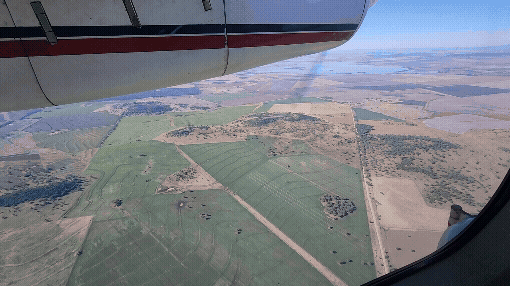
HyVista taking hyperspectral airborne imagery of remanent vegetation (potential koala habitat) in agricultural land. Credit: Glen Huber
Koala populations are declining significantly due to habitat loss, making large scale identification of quality koala habitats essential for conservation.
However, koalas are famously picky eaters, choosing to eat only Eucalyptus leaves with certain nutritional levels from certain tree species. They also prefer to live in very specific Eucalyptus trees.
"It's a real 'Goldilocks' situation when looking for the best locations for koala habitats. It's not just finding the right tree species, it also needs to have the right nutritional quality that can help a population to thrive long term. That can even differ within the same tree species," said research lead Professor Mathew Crowther from the School of Life and Environmental Sciences, University of Sydney.
"To our knowledge, no koala focused study has attempted to classify individual Eucalyptus species using this method and include tree species as a candidate to improve nitrogen content predictions."
"We can sample trees directly and measure the chemical contents, but it is labour intensive, and can only cover small areas, and show the actual nutritional content.
"That's why this technology is so important.It promises to speed up identification and protection of invaluable habitats."
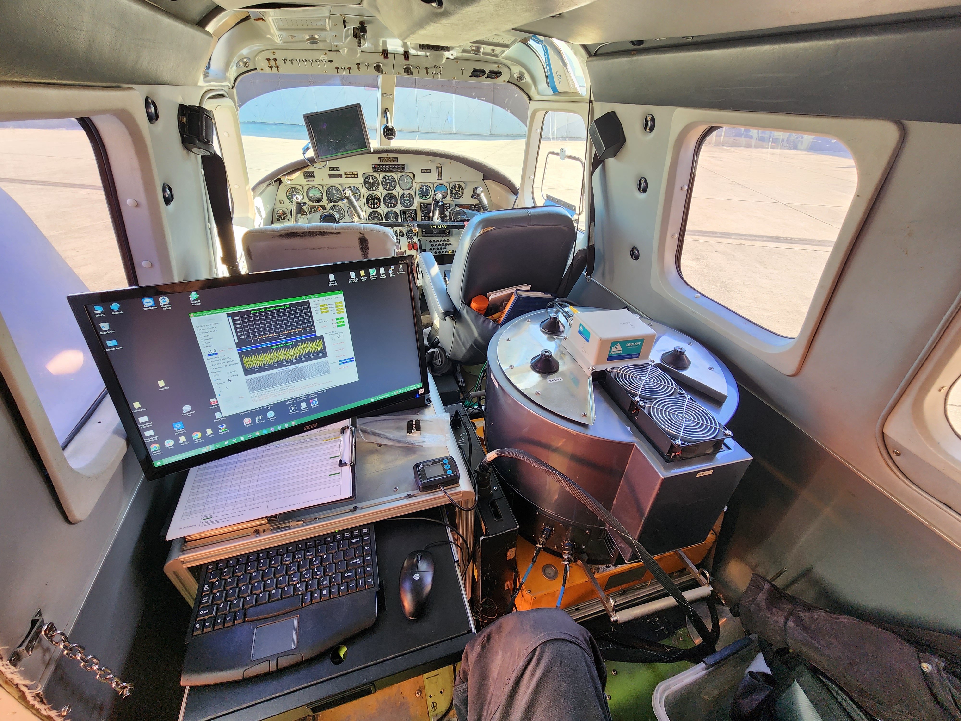
Hyperspectral airborne imagery technology being operated. Source: Glen Huber
The study used airborne imagery collected over Gunnedah, in the Liverpool Plains region of north-western New South Wales, Australia, an area with a declining koala population. Gunnedah's agricultural landscape is a patchwork of Eucalyptus woodland containing species such as river red gum.
The initial stages of the study saw the researchers on the ground, painstakingly identifying the tree species and its geolocations and collecting leaf samples for laboratory nitrogen analysis. These samples were then used to train and test machine learning models based on hyperspectral airborne imagery.
The study's lead author, Dr Cristian Gabriel Orlando from the University of Sydney said:
"By exploiting the variability contained at the pixel-level of each canopy, we can train accurate models to predict suitable koala habitat at scale with limited on-ground data. This will support conservationists and land managers in habitat restoration and planning possible future koala translocations, which rely on knowledge of the trees within the landscape. This research will improve future management actions."

HyVista taking hyperspectral airborne imagery of remanent vegetation (potential koala habitat) in agricultural land. Credit: Glen Huber
The study was published in Science of the Total Environment , as part of a collaboration between University of Sydney, the Sydney Institute of Agriculture, the University of New England and HyVista Corporation.
The researchers hope to expand the study to other areas of NSW and, eventually, across Eastern Australia.
Professor Bradley Evans from the University of New England said:
"Robust remote sensing techniques that identify the species composition down to individual plants across landscapes are a big step forward for Australian Ecology and Earth Observation.
"With the spectral and spatial power of the HyVista HyMap sensor, we can cover an order of magnitude more ground per day flying faster than with our drones.
"Moving forward, we can expect to see detailed assessments of our biodiversity and koala habitat condition, powered by more routine flights covering our most critical and threatened landscapes."
Professor Evans said the next phase of the research would involve NASA JPL bringing out their latest Hyperspectral Imager out in 2027.
"We will be working with various environmental and agricultural agencies to have NASA and HyVista fly our most critical sites. The University of New England, partnering with University of Sydney and others, are also planning a new 'National Collaborative Facility' for this technology so we can put the technology to good use for Australia and future collaborations with NASA."

Cartoon depiction of 'Project Airbear', a research surveying potential Koala habitats. Credit: Ivy Shih @ivyhish
Declaration: The authors declare that they have no known competing financial interests or personal relationships that could appear to influence the work reported in this paper. The project was supported by the University of Sydney School of Life and Environmental Sciences Strategic Partnership Seeding grant 'Airbears: Predicting koala habitat by combining leaf chemistry with hyperspectral imagery' to MS Crowther, F F. van Ogtrop and T.F.A Bishop.


