The Australian Urban Observatory (AUO), in partnership with RMIT's Centre for Urban Research, has released new mapped data, painting a comprehensive picture of Australia's housing and liveability landscape.
Available at neighbourhood, suburb, and local government area levels, the publicly available housing indicators provide key insights into housing across Australia's 21 largest cities.
The 24 indicators look at housing precarity, housing and transport costs, rental and mortgage stress levels, access to homelessness services and key worker populations.
AUO Director and Associate Professor at RMIT, Melanie Davern, said the new indicators aim to address critical housing issues and inform public policy and decision-making on key liveability factors.
"These specialist housing indicators have been designed with policymakers, service providers, and community advocates to understand area-based differences and use evidence to shape effective policies and address critical housing issues that affect communities nationwide," Davern said.
"Understanding within-city disparities in liveability is so important, and this includes access to housing, transport, employment and nature which have a huge influence on our health, wellbeing and overall quality of life."
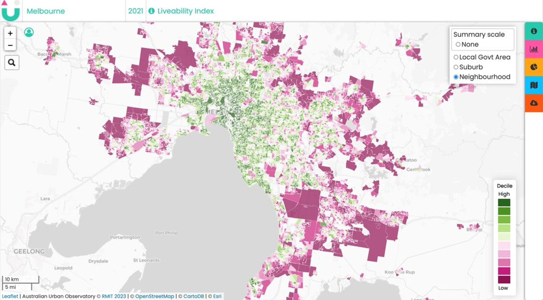 Available at neighbourhood, suburb, and local government area levels, the publicly available housing indicators provide key insights into housing across Australia's 21 largest cities. SOURCE: Australian Urban Observatory
Nithya Solomon, Director of RMIT's Innovation Catalyst, said that an important aspect of designing for inclusive cities and neighbourhoods is making access to data more inclusive and affordable.
"This is essential data for addressing key issues Australians face when it comes to how and where they live, and it is now accessible to everyone, free of cost," Nithya said.
"Eliminating barriers to accessing specialised, custom data is one of many ways that a social innovation precinct can harness resources and collaborations that make it easier to design for future social and economic wellbeing."
The AUO is a digital liveability planning tool developed for decision-makers and the community to measure, map and understand the liveability of local neighbourhoods in Australian cities and create more liveable places using evidence in planning and decision making.
There are now 48 indicators across 9 domains that cover liveability, walkability, social infrastructure, transport, food and alcohol.
The AUO's indicators are one of the many social innovation and urban renewal initiatives being led by RMIT University's Innovation Catalyst, supported by the Victorian Government as part of the Victorian Government's Higher Education State Investment Fund (VHESIF).
To explore the data visit the Australian Urban Observatory's website.
RMIT External Affairs and Media


