
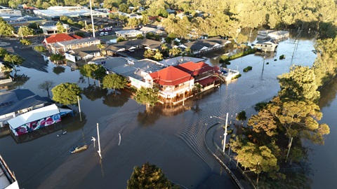
Residents across six Western Downs communities are being encouraged to explore updated flood mapping and share their local knowledge as part of Council's latest flood study consultation.
Western Downs Regional Council has released draft flood mapping for Chinchilla, Dalby, Jandowae, Miles, Tara, and Wandoan following detailed technical flood modelling and phase one of community consultation in 2025.
Western Downs Regional Council Spokesperson for Planning and Environment Cr Kylie Bourne said the updated studies use modern modelling techniques, additional rainfall and flood data, and more extensive survey information to provide a more accurate understanding of flood behaviour across the region.
"Local knowledge is incredibly valuable when it comes to understanding how water behaves during flood events, and we received some really valuable feedback about our catchments during our first consultation round late last year, which was incredibly useful for the hydrologists," Cr Bourne said.
"We're encouraging residents to jump online, explore the new draft mapping.
Whether you've lived in your town for five years or fifty years, your feedback can help ensure the studies are as accurate and reliable as possible.
"Residents can view the draft studies online, explore interactive flood maps for each of our six major towns, and provide feedback through Council's Have Your Say website."
The updated studies will help improve Council's understanding of flood risk, support future infrastructure planning, assist emergency management activities, and provide information to inform future planning and development decisions.
Cr Bourne said residents would have the opportunity to view the draft mapping, speak directly with Council planners and technical specialists, ask questions, and provide feedback at a series of community information sessions to be held in Dalby, Chinchilla, Jandowae, Miles and Tara.
"We know flood mapping can raise questions for residents and property owners," Cr Bourne said.
"That's why we're taking the studies out into the community. These sessions provide an opportunity to sit down with planners and flood specialists, understand what's changed, and discuss any concerns face-to-face.
"Community input will be considered alongside the technical analysis before the studies are finalised."
Cr Bourne said flood studies played an important role in helping communities prepare for future flood events.
"Flood studies are about more than maps," she said.
"They help us better understand flood behaviour, improve emergency planning, inform future infrastructure decisions, and strengthen community resilience.
"If you've witnessed flooding in the past, noticed how water moves through your neighbourhood, or simply want to better understand flood risk in your area, we encourage you to jump online, have a look at the maps, and share your feedback."
Community consultation session dates, times, and locations for each town will be available on the Have Your Say website at https://wdrc.au/floodstudy throughout the consultation period, which runs from 28 August 2026 to 20 September 2026.


