- Curiosity Home
- Science
- News and Features
- Multimedia
- Mars Missions
- Mars Home
2 min read
Earth planning date: Monday Aug. 11, 2025
Written by Lucy Lim, Planetary Scientist at NASA's Goddard Space Flight Center
On the Curiosity team, we're continuing our exploration of the boxwork-forming region in Gale Crater. A successful 25-meter drive (about 82 feet) brought the rover from the "peace sign" ridge intersection to a new ridge site. Several imaging investigations were pursued in today's plan, including Mastcam observations of a potential incipient hollow ("Laguna Miniques"), and of a number of troughs to examine how fractures transition from bedrock to regolith.
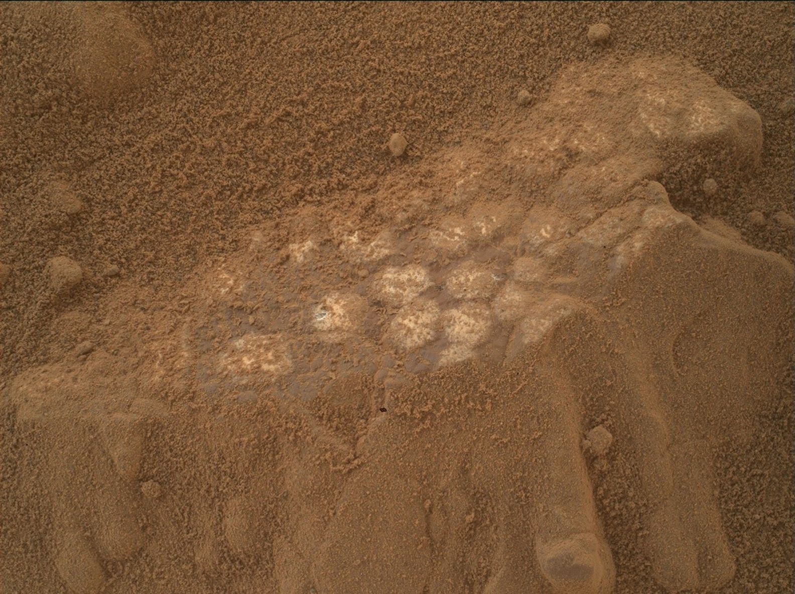
With six wheels on the ground, Curiosity was also ready to deploy the rover arm for some contact science. APXS and MAHLI measurements were planned to explore the local bedrock at two points with a brushed (DRT) measurement ("Santa Catalina") and a non-DRT measurement ("Puerto Teresa"). A third MAHLI observation will be co-targeted with one of the LIBS geochemical measurements on a light-toned block, "Palma Seca." Because we're in nominal sols for this plan, we were able to plan a second targeted LIBS activity to measure the composition of a high-relief feature on another block, "Yavari" before the drive.
The auto-targeted LIBS (AEGIS) that executed post-drive on sol 4626 had fallen on a bedrock target and will be documented in high resolution via Mastcam imaging.
Two long-distance imaging mosaics were planned for the ChemCam remote imager (RMI): one on a potential scarp and lens in sediments exposed on the "Mishe Mokwa" butte in the strata above the rover's current position, and the second on an east-facing boxwork ridge with apparently exposed cross-bedding that may be related to the previously explored "Volcán Peña Blanca" ridge.
As usual, the modern Martian environment will also be observed with camera measurements of the atmospheric opacity, a Navcam movie to watch for dust lifting, and the usual REMS and DAN passive monitoring of the temperature, humidity, and neutron flux at the rover's location.
The next drive is planned to bring us to a spot in a hollow where we hope to plan contact science on the erosionally recessive hollow bedrock in addition to imaging with a good view of the rock layers exposed in the wall of another prominent ridge.


