A collaboration between NASA and the small business Aloft Sensing produced a new compact radar system that will enable researchers to leverage High Altitude Long Endurance (HALE) platforms to observe dynamic Earth systems. This new radar is small, provides highly sensitive measurements, and doesn't require GPS for positioning; eventually, it could be used on vehicles in space.
Long before a volcano erupts or a mountainous snowpack disappears, millimeter-scale changes in Earth's surface indicate larger geologic processes are at work. But detecting those minute changes, which can serve as early warnings for impending disasters, is difficult.
With support from NASA's Earth Science Technology Office (ESTO ) a team of researchers from the small aerospace company Aloft Sensing is developing a compact radar instrument for observing Earth's surface deformation, topography, and vegetation with unprecedented precision.
Their project, "HALE InSAR," has demonstrated the feasibility of using high-altitude, long-endurance (HALE) vehicles equipped with Interferometric Synthetic Aperture Radar (InSAR) to observe changes in surface deformation mere millimeters in size and terrain information with centimetric vertical accuracy.
"It's a level of sensitivity that has eluded traditional radar sensors, without making them bulky and expensive," said Lauren Wye, CEO of Aloft Sensing and principal investigator for HALE InSAR.
HALE vehicles are lightweight aircraft designed to stay airborne for extended periods of time, from weeks to months and even years. These vehicles can revisit a scene multiple times an hour, making them ideal for locating subtle changes in an area's geologic environment.
InSAR, a remote sensing technique that compares multiple images of the same scene to detect changes in surface topography or determine structure, is also uniquely well-suited to locate these clues. But traditional InSAR instruments are typically too large to fly aboard HALE vehicles.
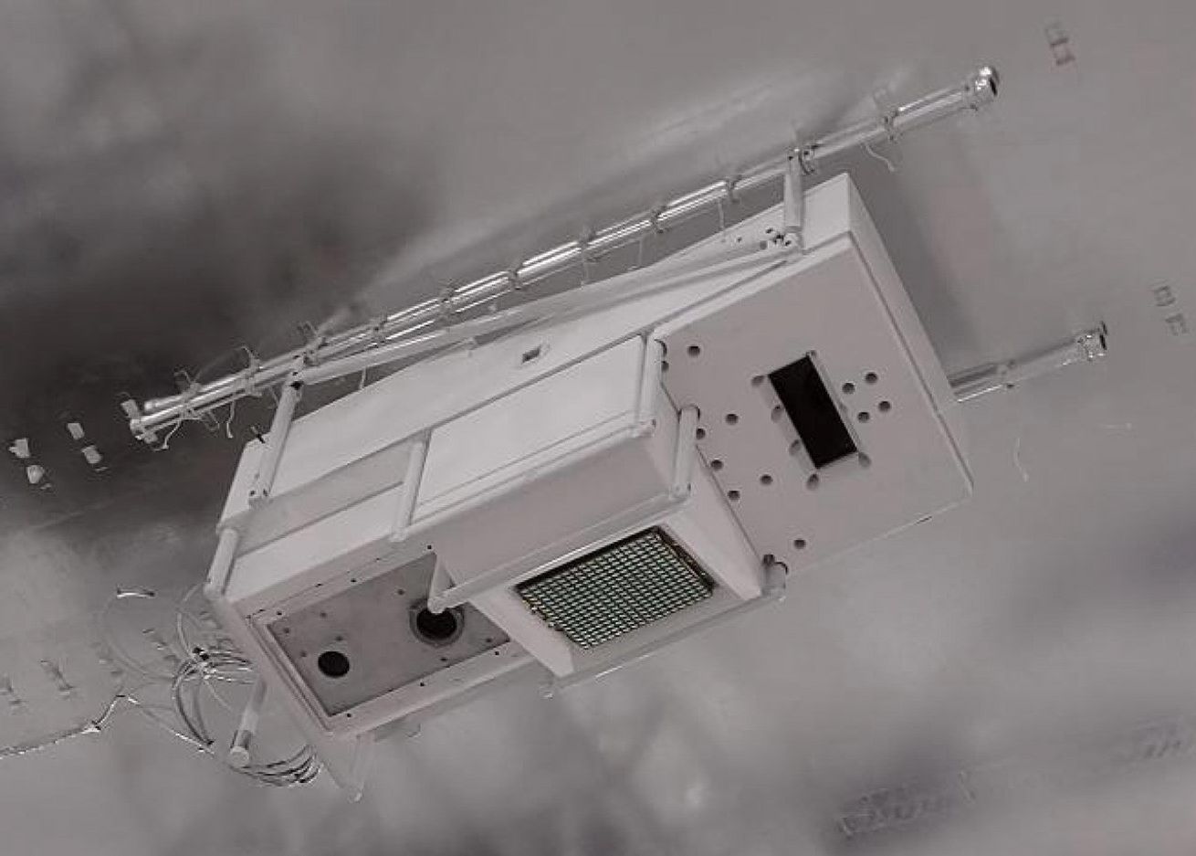
HALE InSAR is different. The instrument is compact enough for a variety of HALE vehicles, weighing less than 15 pounds (seven kilograms) and consuming fewer than 300 watts of power, about as much energy as it takes to power an electric bike.
HALE InSAR leverages previously-funded NASA technologies to make such detailed measurements from a small platform: a novel electronically steered antenna and advanced positioning algorithms embedded within an agile software-defined transceiver. These technologies were developed under ESTO's Instrument Incubation Program (IIP) and Decadal Survey Incubation (DSI) Program, respectively.
"All of the design features that we've built into the instrument are starting to showcase themselves and highlight why this payload in particular is distinct from what other small radars might be looking to achieve," said Wye.
One of those features is a flat phased array antenna, which gives users the ability to focus HALE InSAR's radar beam without physically moving the instrument. Using a panel about the size of a tablet computer, operators can steer the beam electronically, eliminating the need for gimbles and other heavy components, which helps enable the instrument's reduced size and weight.
"SAR needs to look to the side. Our instrument can be mounted straight down, but look left and right on every other pulse such that we're collecting a left-looking SAR image and a right-looking SAR image essentially simultaneously. It opens up opportunities for the most mass-constrained types of stratospheric vehicles," said Wye.
Using advanced positioning algorithms, HALE InSAR also has the unique ability to locate itself without GPS, relying instead on feedback from its own radar signals to determine its position even more accurately. Brian Pollard, Chief Engineer at Aloft Sensing and co-investigator for HALE InSAR, explained that precise positioning is essential for creating high-resolution data about surface deformation and topography.
"SAR is like a long exposure camera, except with radio waves. Your exposure time could be a minute or two long, so you can imagine how much smearing goes on if you don't know exactly where the radar is," said Pollard.
Navigating without GPS also makes HALE InSAR ideal for field missions in austere environments where reliable GPS signals may be unavailable, increasing the instrument's utility for national security applications and science missions in remote locations.
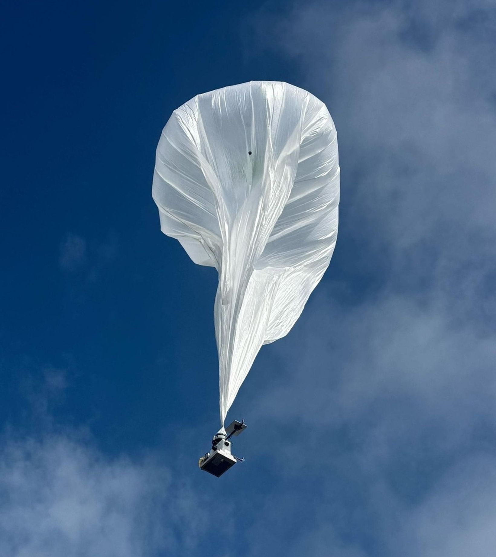
The Aloft Sensing team recently achieved several key milestones, validating their instrument aboard an airship at 65,000 feet as well as small stratospheric balloons. Next, they'll test HALE InSAR aboard a fixed wing HALE aircraft. A future version of their instrument could even find its way into low Earth orbit on a small satellite.
Wye credits NASA support for helping her company turn a prototype into a proven instrument.
"This technology has been critically enabled by ESTO, and the benefit to science and civil applications is huge," said Wye. "It also exemplifies the dual-use potential enabled by NASA-funded research. We are seeing significant military interest in this capability now that it is reaching maturity. As a small business, we need this hand-in-hand approach to be able to succeed."


