
The Tweed isn't just repairing what floods damaged. It's rethinking its relationship with the river, and working with the community to turn flood-prone land into long-term resilience.
The 2022 floods scoured and destabilised hundreds of kilometres of riverbank across the Tweed, the worst bank erosion on record for this region. In some places, entire sections of bank collapsed, leaving farms, roads and communities exposed before the water from the last flood had receded. Conventional engineering can address the damage, but it is not always financially feasible or environmentally sound. What Council's environment team has been doing is different: working with nature rather than against it, using timber piles, rock revetment and native vegetation to rebuild banks that are stable, alive and self-sustaining.
This is the second-last chapter in the Facing the River series. It is also the most forward-looking.
"Climate change is increasing the frequency and intensity of flood events across the Tweed. In 2019, Council declared a climate emergency and committed to taking urgent action at every level of our work. The environmental recovery program is part of that commitment. When we invest in healthy riverbanks and native vegetation, we're not just repairing flood damage. We're building the natural infrastructure this region needs to be more resilient for decades to come."
Naomi Searle, Director Sustainable Communities and Environment, Tweed Shire Council
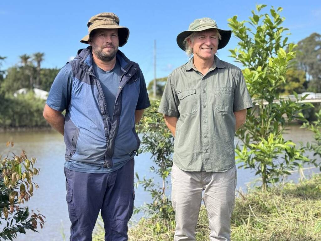
Tom Alletson, Team Leader Coast and Waterways, and Condong landowner Matthew Shoobridge inspect the restored riverbank on Matthew's sugarcane farm, where nature-based works are helping protect farmland and improve the health of the Tweed River.
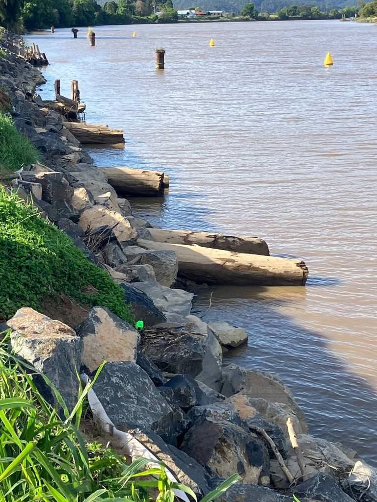
Tweed River, Condong: a farmer, a riverbank and a partnership
On the Tweed River estuary opposite the Condong sugar mill, a cane farm sat on a riverbank left exposed and vulnerable after years of ongoing erosion, made significantly worse by the 2022 floods. The damage threatened both the farm's operation and the health of the river. What followed is the kind of partnership that makes this chapter different from all the others in this series.
Landowner Matthew Shoobridge didn't wait to be told what would happen. He actively campaigned for Council action and helped raise community awareness of erosion along the river. The completed project involved bank battering, installing large boulders and timber combined with revegetation to stabilise the bank, protect farmland and provide fish habitat. Around 500 metres of riverbank was restored with funding from the NSW Government's Coastal and Estuary grants program and Tweed Shire Council. Matthew dedicated land along the river to create a buffer of native trees and shrubs that will provide long-term bank protection.
"Our farm has been severely impacted by boat wave erosion, and it was obvious that we needed to take action to stop losing productive farmland. Wake boats and other towing activities have been relentless, and the natural soft silt riverbank just kept being undermined and washed away. Council staff, particularly Tom, were great to engage with and explore options. I am really happy and proud of what's been delivered, which will protect precious farmland, help river health and promote fish habitat. The follow up maintenance works have also been very good. I would encourage all Tweed landowners to engage with Council around wasteway health, campaign for measures to stop the destructive boat damage that's occurring, to help prepare for future flood events, ways to promote native vegetation and weed control."
Matthew Shoobridge, landowner, Condong
It is a model for how flood recovery on private land can work: Council expertise, government funding, landowner commitment and a shared understanding that a healthy riverbank is good for the farm, the community and the estuary downstream.
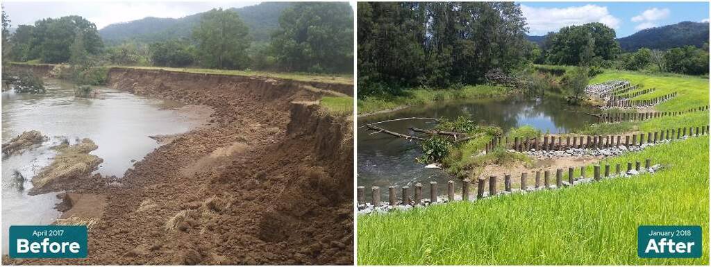
What was once a bare and vulnerable riverbank is now a thriving stretch of native vegetation along the Oxley River at Eungella, demonstrating the long-term benefits of investing in river health.
Uki: 700 metres of riverbank restored
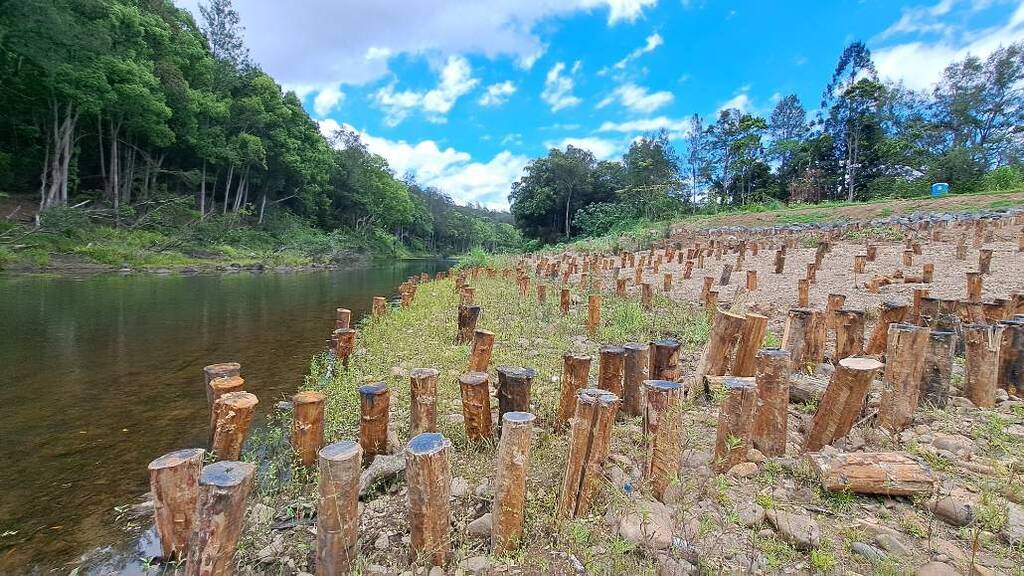
At Riverside Park in Uki, a $620,000 project completed in December 2023 restored 700 metres of Tweed River bank damaged by the 2022 floods. The project used a design approach that works with the river's natural processes to rebuild the bank that was lost. More than 1,700 hardwood timber pins were driven into the riverbed to slow the flow of water and allow sand and gravel to be captured, promoting the recovery of native riparian vegetation. Rocks were placed along the toe of the bank to prevent further scouring during floods, and native trees and shrubs were planted on the bank batter to provide long-term stability.
The Tweed River near Uki supports platypus populations and several threatened species. Works were designed to protect habitat for fish and other aquatic species and reduce sediment entering the Tweed River estuary. North Coast Local Land Services provided funding through the NSW Government's Marine Estate Management Strategy, with the aim of improving water quality for the benefit of marine habitats, wildlife and the community.
"The approach we've taken at Uki and Condong starts with understanding how the river has evolved in the landscape. Conventional bank protection can hold a bank in place, but rock-lined rivers can reduce habitat complexity and trigger erosion downstream. Good design includes nature-based strategies to restore river health over the long term. The community expects recovery works to be effective and resilient to future floods, without affecting the ecology of our waterways."
Tom Alletson, Team Leader, Coast and Waterways, Sustainability & Environment, Tweed Shire Council
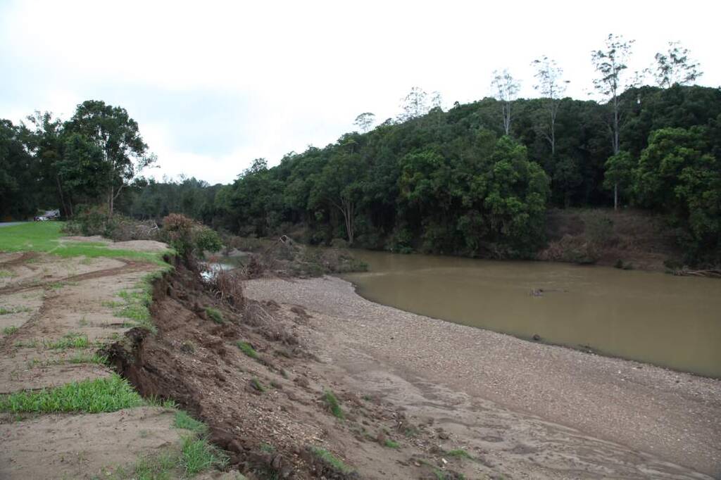
Severe riverbank erosion along Kyogle Road near Glenock following the 2022 floods, with large sections of riverbank washed away by floodwaters.
Working across boundaries: the Kyogle Road story
On Kyogle Road, Council's engineering and environment teams worked together to include timber piles in the river adjacent to road repair works, encouraging the riverbed to rebuild after severe flood erosion. Without these features, the river risked becoming wider and straighter, leaving it more vulnerable to future flood events. The timber piles replicate the role of trees and shrubs in a natural waterway. The decision to think beyond the road repair, and to consider what the works would do to the river system beside them, is a clear example of how this recovery program has been designed to consider both community resilience and the long-term health of the natural environment.
Supporting landowners across the Tweed
Council recognises the role private landholders play in protecting the Tweed's internationally significant environment. Since 2006, the River Health Grants program has supported rural landholders to undertake work on their properties to improve water quality and waterway health. Works include revegetation of bare banks, weed management, erosion control, and fencing off riparian areas from cattle. The program prioritises the drinking water catchment above Bray Park Weir but is open to landholders throughout the shire, in recognition of the public benefits of maintaining healthy waterways.
More than 200 landholders have been supported since the program began, improving over 132 kilometres of waterways. These works collectively repair cleared riverbanks and floodplains and provide natural flood protection by slowing the flow of water through the catchment and reducing the impact of flooding downstream.
In late 2024, Council was awarded around $160,000 through the North Coast Regional Landcare's Caring for Catchments program to revegetate around 1.2 kilometres of the Tweed River at the Byangum weir pool. More than 12,000 trees have been planted on the site, with community involvement through a tree planting on National Tree Day in 2025. These works will improve bank stability at the town water supply intake, before water is treated for Tweed Shire residents and businesses. Caring for Catchments is delivered by North Coast Regional Landcare Network with funding from the Australian Government under the Northern Rivers Recovery and Resilience Program, administered by the NSW Reconstruction Authority.
Separately, in 2024 Tweed Shire Council received $300,000 through the Northern Rivers Watershed Initiative to undertake natural flood management work on four properties. Around 12,000 trees have been planted along 1.6 kilometres of waterways including the Tweed and Oxley Rivers and Woodlands Creek, with a further 3,000 trees to be planted along Pipeclay Creek this year. The project is also controlling 700 metres of cat's claw creeper, one of the world's worst weeds of riparian areas. The Northern Rivers Watershed Initiative was developed by Rous County Council and funded through a $5 million commitment ahead of the 2023 NSW State Election.
Since the 2022 floods, 51,370 trees have been planted as part of the flood recovery effort.
Nature as infrastructure
The work on riverbanks and waterways is part of Tweed Shire Council's broader response to climate change. Since declaring a climate emergency in 2019, Council has planted over 65,000 trees in riparian projects, including around 25,000 in 2025 alone. Since the 2022 floods, 51,370 trees have been planted as part of the flood recovery effort. More than 132 kilometres of riverbank have been actively protected with on-ground works, and conservation support has been provided across more than 750 hectares of private land.
Healthy rivers reduce flood severity. Native vegetation holds banks in place. Riparian planting filters sediment and improves water quality. These are not environmental additions to the recovery program. They are the infrastructure of a resilient community, and they are being built one riverbank, one partnership and one planted tree at a time.
River Health Grants Program
River health grants aim to improve and protect water quality and waterway health in the Tweed's natural waterways.
Funding is available for projects targeting typical problems along our rivers and creeks including poor riparian vegetation and bank erosion.


