Can someone turn the tap off please?
The rainfall in some parts of our Shire, and in other parts of the Northern Rivers last night was extraordinary.
The Bureau of Meteorology (BoM) gauges recorded 319mm at Coopers Shoot in the 24 hours to 9am this morning, 282mm at Byron Bay and 236mm at Myocum. Alstonville had a tally of 431mm!
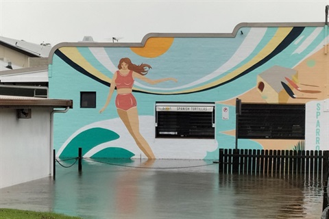
This morning we woke to flooding in Byron Bay and Suffolk Park, more damage to our roads, especially in the hinterland, and even more people and businesses impacted by this run of terrible weather. Our thoughts are with everyone affected and dealing with the aftermath today.
Many of our staff live in this community too and have been flood affected or could not get to work, making things just that little bit more difficult as we responded to emergencies.
Our Water, Sewer and Works teams have been doing the best they can and as things dry out it will once again be full steam ahead for us as we get services restored and roads and accesses reopened where possible.
Once again, we have put our regular Flood Recovery Update on hold as we push through this latest rain event and bring you a summary of relevant information from Council.
This afternoon, at the time of publication, the BoM put out a bulletin saying that minor flooding was possible at Mullumbimby and Billinudgel tonight.
The BoM said further rain was forecast tonight which may cause renewed river level rises and minor flooding.
For links to all the latest information from the SES, BoM and Council go to our Emergency Dashboard.
Our Facebook page has loads of information as well.
Roads
Where possible, our staff have been out assessing damage to our road network throughout the day.
However, several pockets of the Shire remained inaccessible late this afternoon.
We are working to ensure MyRoadInfo is updated with the most accurate information we have about damage and flood impacts on our roads.
The M1 remains closed southbound at Tyagarah.
The landslip at Broken Head Road was cleared by emergency services this afternoon and drivers are advised to take care when driving in this area.
The slip at Bangalow Road has also been cleared.
The landslip at Wilsons Creek Road will be inspected as soon as possible tomorrow.
There is also a landslip at St Helena which is barricaded for safety. We will be looking to get geotechnical advice at these areas as soon as possible.
The Byron Bay town centre remains inundated with stormwater.
Several roads remain barricaded and will not be opened until it is safe to do so. This includes Shirley Street, and the Sunrise Boulevard intersection at Ewingsdale Road. Traffic controls are in place.
The Byron Industrial Estate is now clear.
Some roads in Suffolk Park are still inundated by flood waters.
We have received reports of further damage to our causeways at Palmwoods and Main Arm and our crews will be out inspecting these as soon as it is safe to do so.
Significant damage has occurred at the Beatties Creek causeway on Goonengerry Road. Whian Road also remained impassable this afternoon.
Evacuation Centres
The Cavanbah Centre Byron Bay was opened as an Evacuation Centre this morning by the lead agencies (Department of Communities and Justice and Northern Rivers NSW SES).
We are aware getting to the Cav is a challenge because of road closures. Check MyRoadInfo to see what roads are open and closed.
The other two evacuation centres in the Byron Shire are:
- Ocean Shores Country Club, Orana Road, Ocean Shores.
- Mullumbimby Ex-Services Club, 58 Dalley St, Mullumbimby.


