Crossing 3 states
Severe Tropical Cyclone Narelle had a long and historic journey as it travelled across northern, and then western Australia during March 2026. The tropical cyclone was unusual in how long it lasted, and how much distance it covered.
Narelle first formed in the Coral Sea on 17 March. It initially moved onto the coast in Queensland, then the Northern Territory and then finally Western Australia.
Heavy rain fell on Cape York Peninsula in Queensland and the Top End in the Northern Territory. The rain renewed flooding in the Northern Territory, including along the Daly River.
Across Western Australia, Narelle brought heavy rainfall and gusty winds to the Kimberley region, where it crossed as a Tropical Low. For the North West Cape, once Narelle had re-intensified, the impacts were far greater with heavy rainfall, destructive wind gusts, large waves and abnormally high tides, as well as riverine and coastal flooding.
Video: Severe Tropical Cyclone Narelle summary
Tropical Cyclone Narelle formed as a category 1 system on Tuesday 17 March.
Narelle became a severe category 5 tropical cyclone on Thursday 19 March.
Narelle reached the north Queensland coast on Friday 20 March as a powerful category 4 system.
Narelle reformed in the Gulf of Carpentaria before reaching the Northern Territory as a category 3 early in the morning on Sunday 22 March.
After crossing northern Australia as a Tropical Low, Narelle strengthened back into a cyclone over the Indian Ocean on Wednesday 25 March.
Narelle then quickly intensified back to a category 4 system by Thursday 26 March.
Narelle made landfall in the north-west on Friday as a severe category 4 tropical cyclone.
Narelle left the country to the south late on Saturday, over 8 days after arriving in Queensland.
A historic system
Northern Western Australia, Far North Queensland, and the Top End in the Northern Territory are areas commonly affected by tropical cyclones. But it is rare for a single tropical cyclone to make landfall in all 3.
Narelle is the second system, after Severe Tropical Cyclone Ingrid in 2005, to make landfall as a severe tropical cyclone (category 3 or stronger) in Queensland, the Northern Territory, and Western Australia since reliable intensity records began in 1980-81. Tropical Cyclone Steve is the only other system to cross all 3 regions, but it did not reach severe strength.
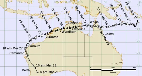
Narelle's track and intensity during March 2026 (times in AEST)
North West Manager Todd Smith said the hard work of local and national teams spanned the entire life of Narelle.
"Our teams were there 24 hours a day from when the system first formed off Queensland to when it left Western Australia as a tropical low," Mr Smith said.
"Specialists from all areas of the country, including our tropical cyclone warning centres, provided cyclone watches and warnings, track maps, associated severe weather warnings, flood watches and warnings, forecasts, briefings and advice to the community, emergency management, and industry."
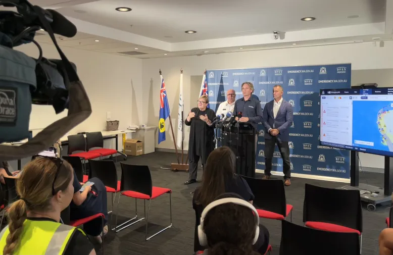
WA Manager James Ashley speaking at a press conference
Senior meteorologist Angus Hines knows it's times like this when sharing accurate information early can make a real difference for Australians preparing for a major weather event.
"Our whole team pulls together to keep the community informed as best we can online, and through press conferences and TV, and radio interviews," Mr. Hines said.
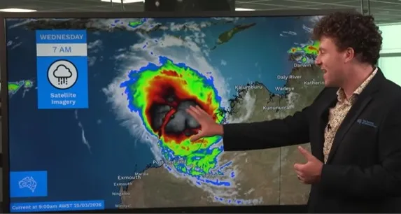
Senior meteorologist Angus Hines filming a Severe Weather Update video
The long journey
Narelle was a relatively long-lived system. It impacted the south-west Western Australia coast 7-and-a-half days after first making landfall at North Queensland.
Between first forming in the Coral Sea, and moving off the Western Australia coast, Narelle travelled approximately 6,500 km.
During Narelle's life, we issued 103 Tropical Cyclone Advice messages. This is far more than most tropical cyclones, and comparable to the long-lived Severe Tropical Cyclone Nathan in 2015.
For meteorologist Jessica Lingard it is important to make the changing forecasts and advice easy for the public to understand.
"Our focus is always on the impacts people can expect on the ground, not just a category number," Ms Lingard said.
"We explain when strong winds are likely to begin, how damaging they may be, when heavy rain will set in, and when conditions will ease. These details really matter when helping communities prepare for severe weather."
Ms Lingard said the Bureau provides extra radio crosses during tropical cyclones and other severe weather events.
"We provide hourly updates on ABC Radio's Emergency Broadcasts, which helps the community stay up to date with the latest information while they are going through a severe weather event.
"We also work closely with First Nations media organisations to help share our forecasts and warnings into remote communities."
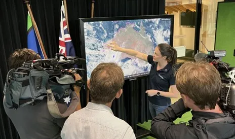
Meteorologist Jessica Lingard doing media interviews to keep communities informed
Staying prepared
It is important to stay informed during Australia's tropical cyclone season which runs from 1 November to 30 April.
Our forecasters are always working to make tropical cyclone forecasts more accurate. We analyse recent performance and look for ways to improve. To help keep communities safe, we:
- keep a 24-hour watch on developing cyclones in our region
- provide a tropical cyclone forecast for the 7 days ahead
- deliver seasonal guidance for Australia and the South Pacific to assist planning and preparation
- issue watches and warnings when a cyclone is expected to affect Australia's coast or territories.
Stay up to date via the tropical cyclone forecast or the BOM Weather app.