
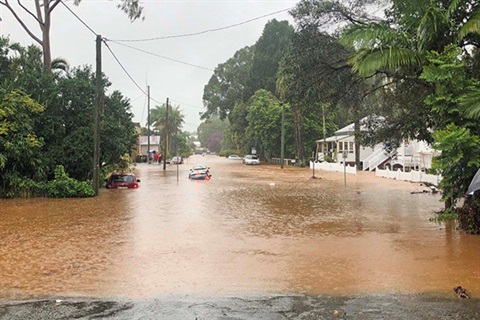
The Draft Bangalow Flood Study looks at flooding from Byron Creek, Paddys Creek and Maori Creek, as well overland flooding from rain overwhelming the drains and stormwater systems.
It is the first comprehensive, modern flood study for Bangalow using NSW and Australian flood modelling standards.
Consultants used best-practice technology to model flood behaviour in and around Bangalow, calibrating and validating the model against real flood extents caused by events in 2016, 2017 and 2022.
"The results produced by the modelling matched the records from the flooding that happened in the three major events assessed and the observations we received from the community," Nikki Bourke, Project Officer, said.
"In light of the flash flooding in March this year we are asking people to submit photos or provide information as part of their submission," Ms Bourke said.
The draft study confirmed that riverine flooding from Bangalow Creek and its tributaries were the dominant flood risk to Bangalow in particular:
- Deacon Street and Ashton Street
- Industrial estate and Lismore Road
- George Street and Market Street
- Raftons Road crossing of Paddys Creek.
Overland flooding hotspots caused by intense rainfall exceeding the capacity of the stormwater system were identified in five other areas.
Information from the study will be used to develop a Floodplain Risk Management Plan and Study. It will also be used to guide future planning and development decisions.


