Logan City Council is updating its flood mapping as part of the new planning scheme, Logan Plan 2025 (LP25), which will guide the city's booming growth through sustainable development.
New risk-based mapping will help residents and businesses be better prepared for flooding.
The new mapping method has been developed in line with the Queensland Government's State Planning Policy (2017), which requires local governments to identify and map all possible flood risk and consider the impacts of climate change.
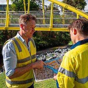
Council used the latest available data and worked with expert industry consultants to meet the new risk-based mapping obligations. The mapping covers the full extent of the floodplain in the City of Logan.
The first draft of LP25 was endorsed unanimously during last week's City Planning, Economic Development and Environment Committee meeting, and at this week's Ordinary Council meeting.
The draft scheme will now be sent to the Queensland Government for a mandatory state interest review.
Mayor Darren Power said the new risk-based mapping would help build flood resilience across the community.
"Flooding has occurred in the Logan area for generations and unfortunately, we know it will occur again," Cr Power said.
"As our weather becomes more extreme, it is even more important to understand where and how flood waters could impact our communities.
"The new flood mapping identifies the City of Logan's full floodplain for the first time, which will improve our understanding of flood risk and allow us to plan the development of our growing city in the most appropriate areas."
The new mapping identifies four areas of flood risk:
High (dark blue) - areas which may be frequently flooded, or subject to deep and fast-flowing waters during a flood.
Moderate (light blue) - areas which are less frequently flooded but could be subject to shallow or slow-moving water.
Low (yellow) - areas which have a small chance of shallow flooding.
Very low (grey) - these areas are very unlikely to be flooded but the grey shows the full extent of the floodplain.
The new planning scheme specifies what type of development may be permitted within each area of risk and in areas that could become isolated by floodwaters.
The new mapping will not require existing buildings or infrastructure to be removed and will not stop any property owner from buying or selling.
Logan City Council's flood study program was recognised as a best-practice approach in the Queensland Government's draft ShapingSEQ 2023 Update.
The new planning scheme is scheduled to commence in late 2025 to meet legislation that requires local governments to update their planning scheme every 10 years.
To help keep the community safer and make use of the new flood risk information sooner, Council will seek to introduce the new risk-based flood mapping and policy through a Temporary Local Planning Instrument (TLPI) to the existing Logan Planning Scheme 2015.
The proposed TLPI was also endorsed by Council this week.
Once the Queensland Government's initial review is completed, Logan Plan 2025 will be shared for community consultation, most likely not until next year.
Residents and businesses will be invited at that time to have their say on the scheme and the new risk-based flood mapping policy.


