NASA Earth Observatory/ Wanmei Liang
Lee esta historia en español aquí.
NASA satellite data and trainings helped Uruguay create a drought-response tool that its National Water Authority now uses to monitor reservoirs and guide emergency decisions. A similar approach could be applied in the United States and other countries around the world.
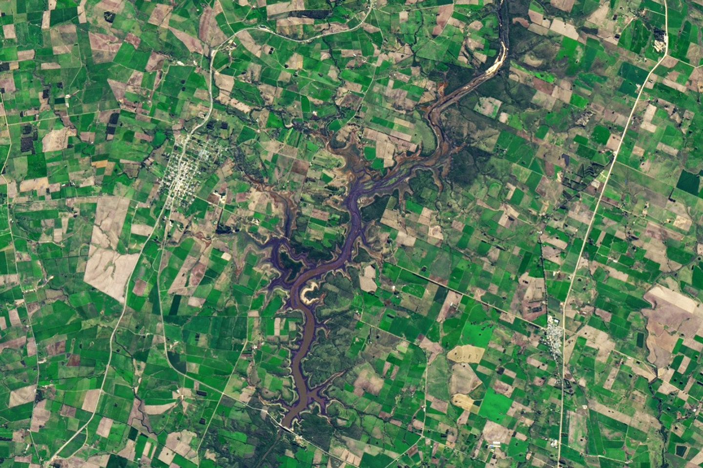
From 2018 to 2023, Uruguay experienced its worst drought in nearly a century. The capital city of Montevideo, home to nearly 2 million people, was especially hard hit. By mid-2023, Paso Severino, the largest reservoir and primary water source for Montevideo, had dropped to just 1.7% of its capacity. As water levels declined, government leaders declared an emergency. They began identifying backup supplies and asked: Was there water left in other upstream reservoirs - mainly used for livestock and irrigation - that could help?
That's when environmental engineer Tiago Pohren and his colleagues at the National Water Authority (DINAGUA - Ministry of Environment) turned to NASA data and trainings to build an online tool that could help answer that question and improve monitoring of the nation's reservoirs.
"Satellite data can inform everything from irrigation scheduling in the Great Plains to water quality management in the Chesapeake Bay," said Erin Urquhart, manager of the water resources program at NASA Headquarters in Washington. "NASA provides the reliable data needed to respond to water crises anywhere in the world."
Learning to Detect Water from Space
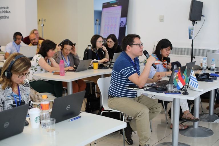
The DINAGUA team learned about NASA resources during a 2022 workshop in Buenos Aires, organized by the Interagency Science and Applications Team (ISAT). Led by NASA, the U.S. Army Corps of Engineers, and the U.S. Department of State, the workshop focused on developing tools to help manage water in the La Plata River Basin, which spans multiple South American countries including Uruguay.
At the workshop, researchers from NASA introduced participants to methods for measuring water resources from space. NASA's Applied Remote Sensing (ARSET) program also provided a primer on remote sensing principles.
"NASA doesn't just deliver data," said John Bolten, NASA's lead scientist for ISAT and chief of the Hydrological Sciences Laboratory at NASA's Goddard Space Flight Center in Greenbelt, Maryland. "We collaborate with our partners and local experts to translate the data into information that is useful, usable, and relevant. That kind of coordination is what makes NASA's water programs so effective on the ground, at home and around the world."
The DINAGUA team brought ideas and provided guidelines to Pohren for a tool that applies Landsat and Sentinel satellite imagery to detect changes in Uruguay's reservoirs. Landsat, a joint NASA-U.S. Geological Survey mission, provides decades of satellite imagery to track changes in land and water. The Sentinel missions, a part of the European Commission managed Copernicus Earth Observation program and operated by ESA (the European Space Agency), provide complementary visible, infrared, and microwave imagery for surface water assessments.
From a young age, Pohren was familiar with water-related challenges, as floods repeatedly inundated his relatives' homes in his hometown of Montenegro, Brazil. It was extra motivation for him as he scoured ARSET tutorials and taught himself to write computer code. The result was a monitoring tool capable of estimating the surface area of Uruguay's reservoirs over time.
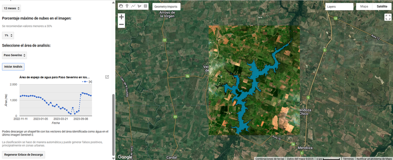
The tool draws on several techniques to differentiate the surface water extent of reservoirs. These techniques include three optical indicators derived from the Landsat 8 and Sentinel-2 satellites:
- Normalized Difference Water Index, which highlights water by comparing how much green and near-infrared light is reflected. Water absorbs infrared light, so it stands out clearly from land.
- Modified Normalized Difference Water Index, which swaps near-infrared with shortwave infrared to improve the contrast and reduce errors when differentiating between water and built-up or vegetated areas.
- Automated Water Extraction Index, which combines four types of reflected light - green, near-infrared, and two shortwave infrared bands - to help separate water from shadows and other dark features.
From Emergency Tool to Everyday Asset
In 2023, the DINAGUA team used Pohren's tool to examine reservoirs located upstream from Montevideo's drinking water intake. But the data told a tough story.
"There was water available in other reservoirs, but it was a very small amount compared to the water demand of the Montevideo metropolitan region," Pohren said. Simulations showed that even if all of the water were released, most of it would not reach the water intake for Montevideo or the Paso Severino reservoir.
Despite this news, the analysis prevented actions that might have wasted important resources for maintaining productive activities in the upper basin, Pohren said. Then, in August 2023, rain began to refill Uruguay's reservoirs, allowing the country to declare an end to the water crisis.
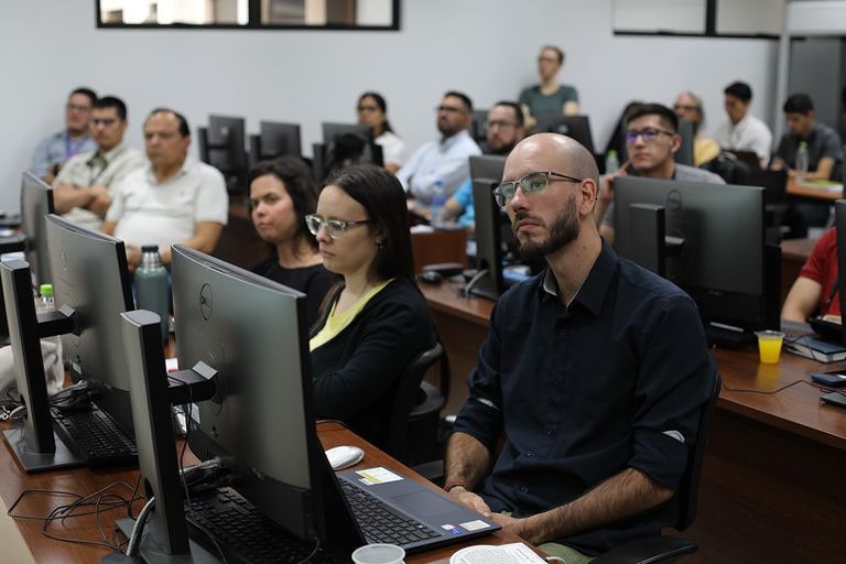
Though the immediate water crisis has passed, the tool Pohren created will be useful in the future in Uruguay and around the world. During an ISAT workshop in 2024, he shared his tool with international water resources managers with the hope it could aid their own drought response efforts. And DINAGUA officials still use it to identify and monitor dams, irrigation reservoirs, and other water bodies in Uruguay.
Pohren continues to use NASA training and data to advance reservoir management. He's currently exploring an ARSET training on how the Surface Water and Ocean Topography (SWOT) mission will further improve the system by allowing DINAGUA to directly measure the height of water in reservoirs. He is also following NASA's new joint mission with ISRO (the Indian Space Research Organization) called NISAR, which launched on July 30. The NISAR satellite will provide radar data that detects changes in water extent, regardless of cloud cover or time of day. "If a drought happens again," Pohren said, "with the tools that we have now, we will be much more prepared to understand what the conditions of the basin are and then make predictions."

By Melody Pederson, Rachel Jiang


