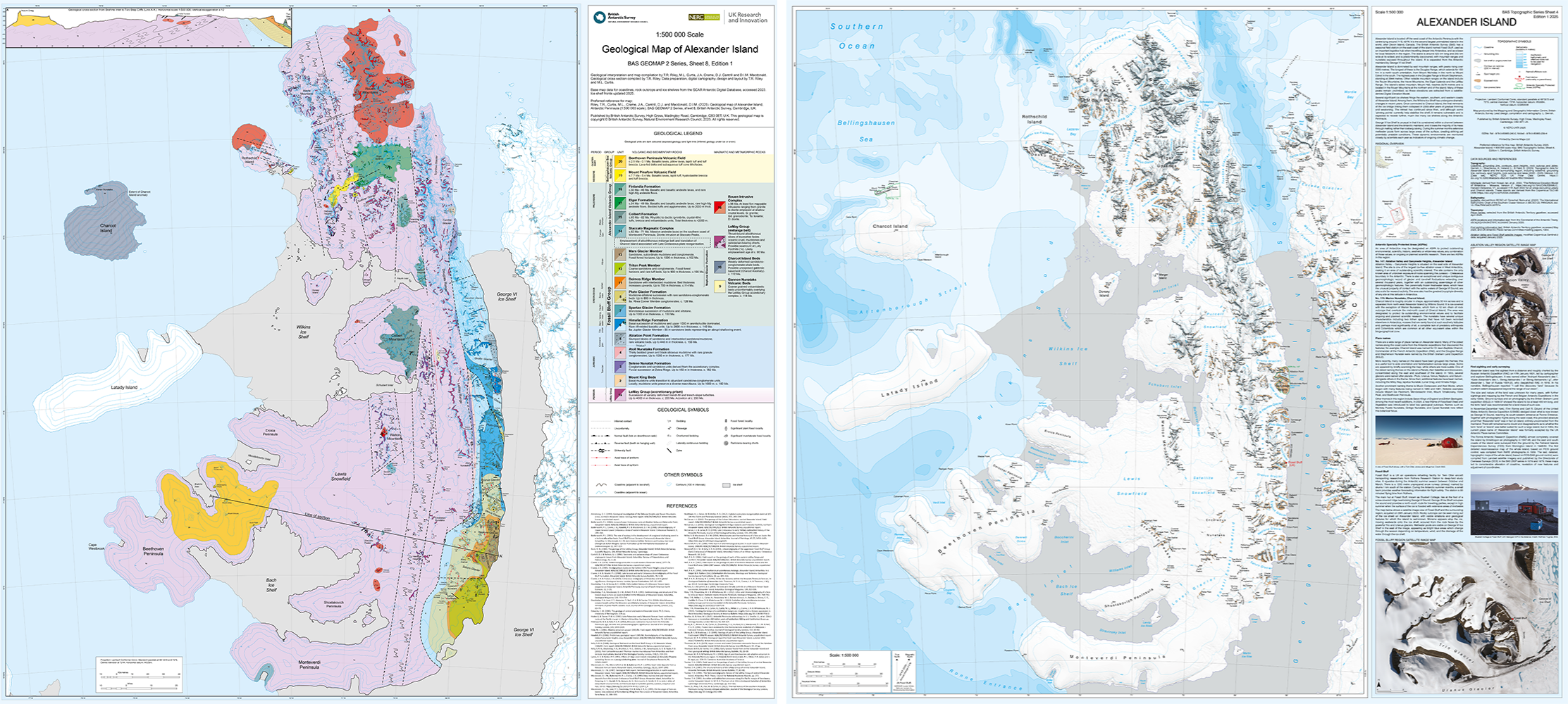
The Mapping and Geographic Information Centre (MAGIC) at the British Antarctic Survey have produced new maps of the topography (physical features) and geology of Alexander Island in Antarctica. These maps provide the first update of the region for 40 years, highlighting unseen features as well as how the glaciers are retreating due to climate change. New maps like this not only demonstrate the success of new technologies to map remote locations but are vital tools in aiding navigational and scientific endeavours in the region.
Alexander Island lies off the west coast of the Antarctic Peninsula and it is the largest island in Antarctica and the second largest uninhabited island in the world. The region surrounding Alexander Island is shown on the map, including the well-studied Wilkins and George VI ice shelves, and the smaller islands of Rothschild, Charcot and Latady.
The history of the region is a very interesting one. The island was first sighted and roughly charted in 1821, although it took until 1940 to confirm that the island was entirely disconnected from the mainland by the George VI Sound. The first detailed reconnaissance map of the region was compiled in 1959 by the Falkland Island Dependencies Survey (FIDS), the predecessor to BAS. Further maps were released in the 1980s, but none of these are comparable to modern standards of mapping. The island itself is constantly changing in this volatile polar environment, meaning new maps are needed to be made.
Island Topography
The topographic map contains information including the coastline and ice shelf extents, contours, mountain spot heights, rock outcrop extents, and place names. It displays the information in an easy-to-read manner.
Alexander Island has extensive mountain ranges reaching over 3000 metres in elevation. Due to the inhospitable conditions in these regions, exploration can be treacherous and very few of these mountains have been summited as a result. The team used satellite derived data to extract the heights of mountains. Mount Stephenson has long been thought the highest mountain on the island at 2944 m, but these new findings confirmed thinking in BAS that Mount Hall is the tallest at 3078 m!
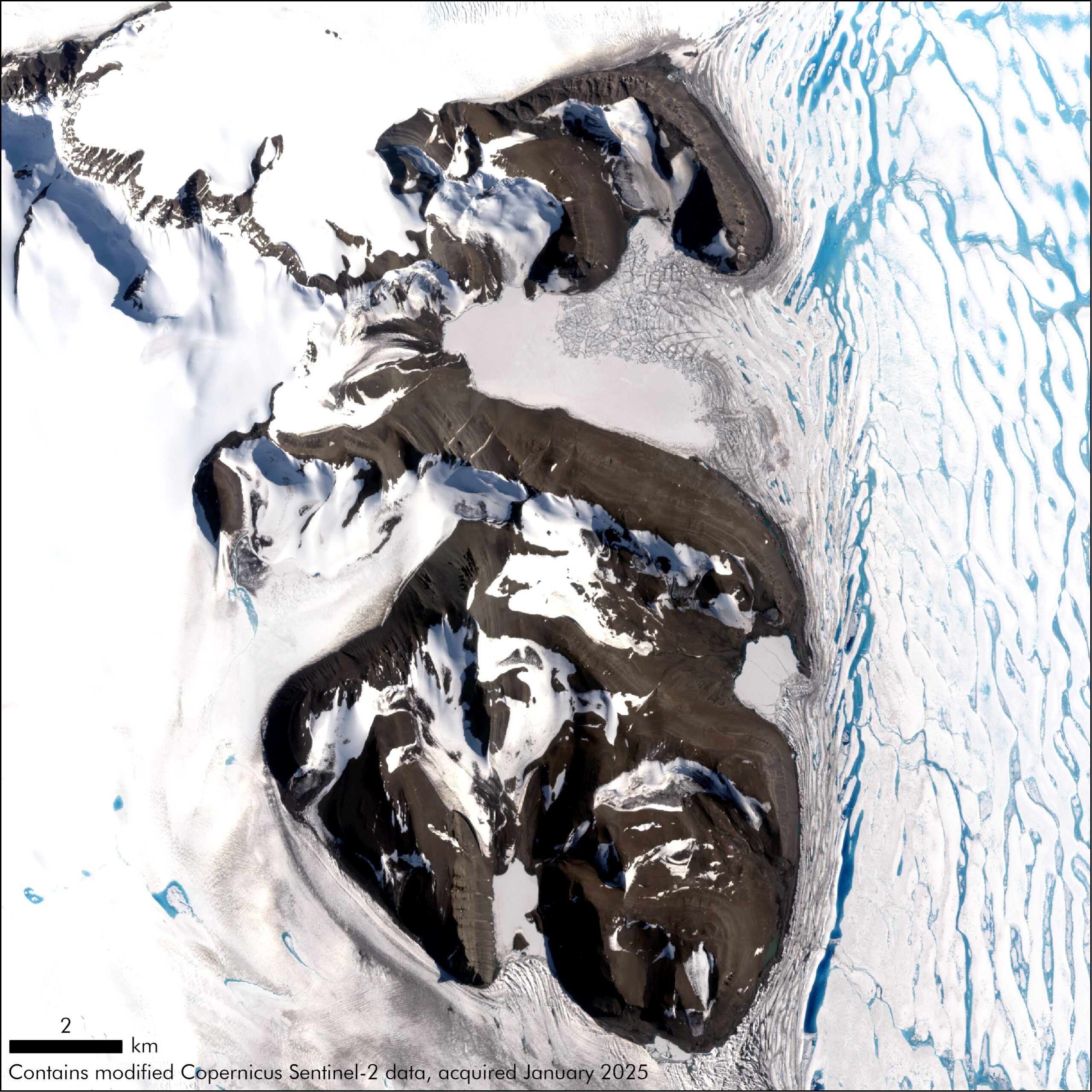
Ice shelves in the region are another important feature to show accurately. The Wilkins Ice Shelf has undergone dramatic changes in recent years. Once connected to Charcot Island via ice bridge, the final remnants linking them collapsed in 2009 after years of gradual thinning. The retreat has continued since then, meaning the ice shelf remains vulnerable and is expected to recede further, much like many ice shelves along the Antarctic Peninsula. The extents displayed on the map show its position as of late 2024 and early 2025, but in some areas it will have already changed. So is the nature of mapping Antarctica!
Island Geology
The geological map brings together decades of research and for the first time provides a complete geological history of Alexander Island that can be related to elsewhere in West Antarctica.
The first geological surveys of Alexander Island were carried out as part of the British Graham Land Expedition in 1936, with observations and fossil collections made from a transect along the length of King George VI Sound, observing for the first time the 'layer-cake' stratigraphy of the eastern part of the island.
The main phase of survey work on Alexander Island took place from the early 1960s until the mid-1990s when more than 50 geological field campaigns were completed. The work was a collaboration of more than 30 geologists of the FIDS and the British Antarctic Survey working across hazardous terrain.
Animation showing the difference between the old and new topographic maps made by MAGIC.
The Alexander Island maps are printed at 1:500 000 scale and are 90 x 100 cm in size, allowing us to see detail at a level not before shown. The maps are available to purchase as a double-sided product, either folded with a card cover, or as a flat wall map. It is available from the Scott Polar Research Institute and Stanfords Map Shop in London, as well as further distributors detailed here. The geological map is also available as a digital copy along with others in the series from here. Further topographic maps can be found here.