- Curiosity Home
- Science
- News and Features
- Multimedia
- Mars Missions
- Mars Home
5 min read
Written by Susanne Schwenzer, Planetary Geologist at The Open University
Earth planning date: Friday, May 16, 2025
As Curiosity progresses up Mount Sharp, it crosses different terrains, which the team has mapped from orbit. If you want to follow the path and see for yourself, you can have a look on the "Where is Curiosity?" map, an interactive tool that allows you to see all the stops the rover has made. If you look very closely, you can see that the stop on sol 4532 is on an area that has a very textured and red expression on this map, and the next stop on sol 4534 is in an area that appears more gray, while the stop after that (sol 4537) is on redder material again, but that looks much less textured. The next two stops, including today's parking position, are both very close to a north-south running linear feature. Just looking at the locations of those different stops, and what you can see on this interactive tool, gives you the full story of the latest planning days.
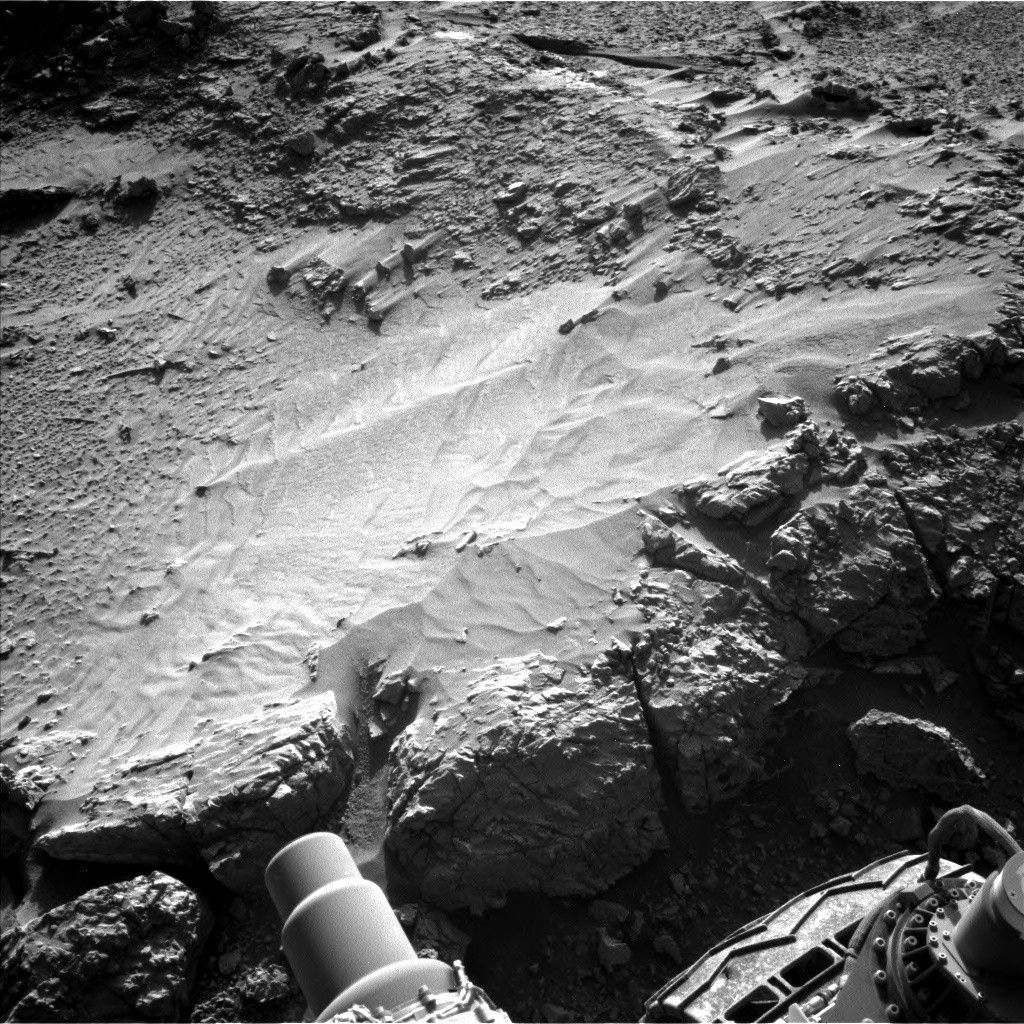
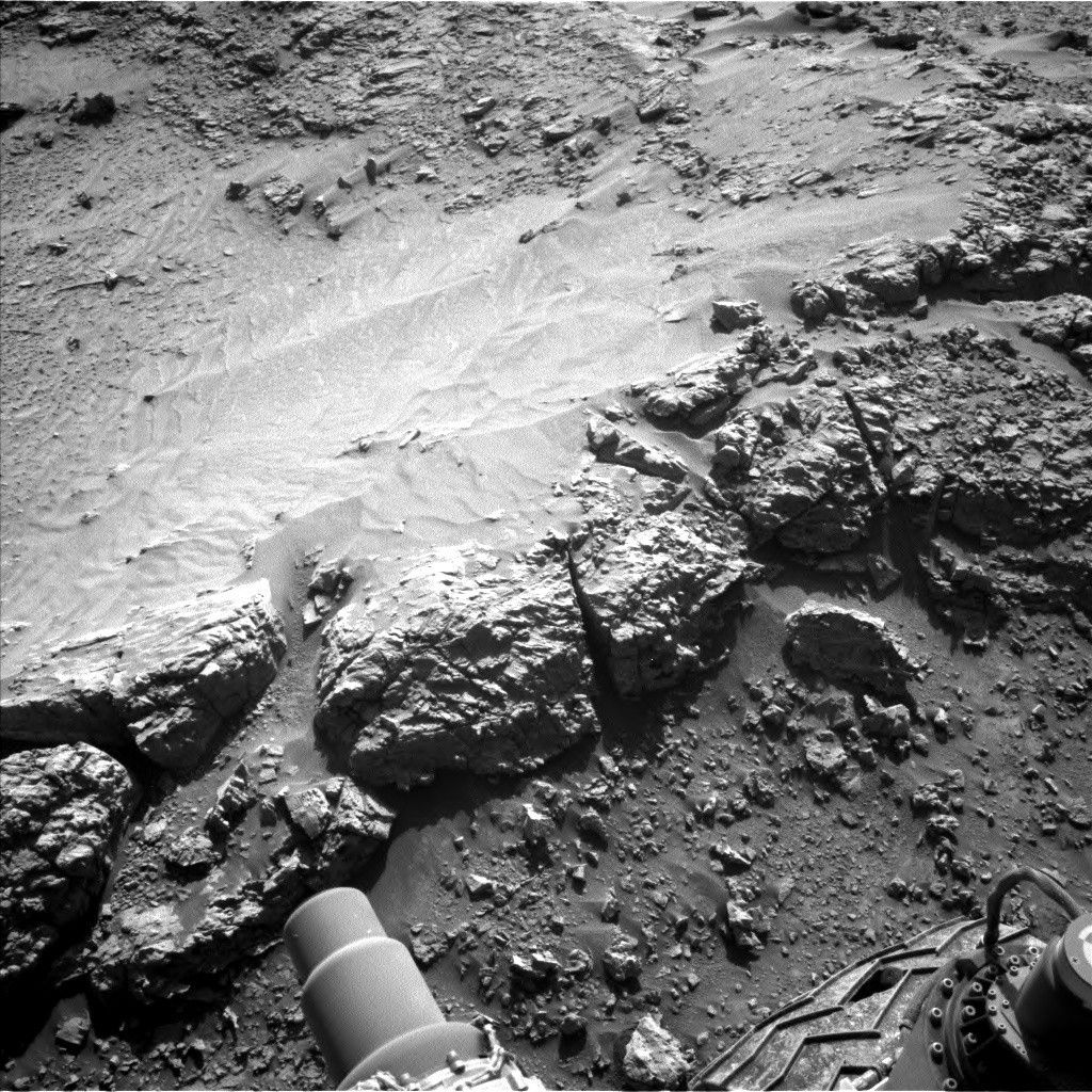
We were driving through the rough-looking terrain for quite a while now. So when that change came closer and closer the team started to make plans for how to investigate it. Of course we added the ground-based images to the picture as we edged closer with every drive. Last week, we could finally start to put the plans in place, when we stood at the edge of the changes in the landscape on sol 4532. As you can see from the interactive map, the drives got a bit shorter to make sure we stop at an example of every new feature. So we stopped in the grayish-looking area on sol 4534, then in the middle of the reddish-looking area on sol 4537, and then arrived at the linear feature.
Unfortunately, Mars didn't read the script and placed a pesky pebble under one of our wheels (see the blog post "Sols 4541-4542: Boxwork Structure, or Just 'Box-Like' Structure?"). Whenever the rover isn't on firm ground, we cannot take the arm out. So the engineers used the drive in the last plan to pull the rover back by less than a wheel's turn; we are now parked on solid ground at the linear feature, and we can do arm activities! That always makes the planning team cheer.
Being on stable ground gave us many opportunities for contact science. After careful discussions of what is in front of us, we decided on target "Arroyo Seco," where it is possible to apply the brush - DRT as we say - and do an APXS measurement on the brushed material. APXS will then measure the edge of that big feature, where the rocks are a little more resistant to weathering - at least that's what the fact that they are sticking out might suggest. That is the target "Mesa Grande." Near Mesa Grande is target "Paso Picacho," which is on the same part of the ridge as the second APXS target. In addition, ChemCam investigates the ridge feature at target "Pauma Valley."
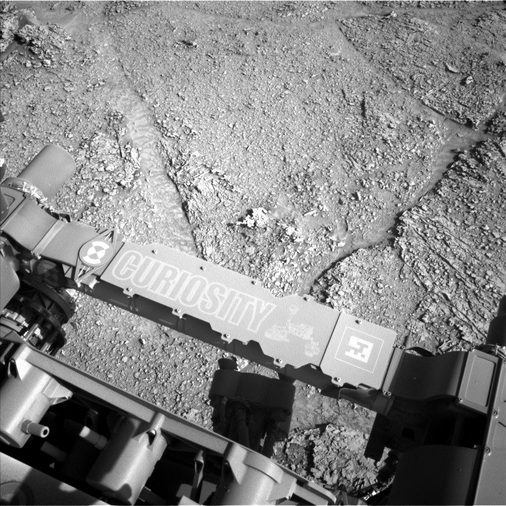
On a weekend there is always a little more time, and Curiosity will make the most of it! In addition to the two APXS and ChemCam LIBS targets, ChemCam will also get a passive spectral investigation on the target "San Ysidro" to investigate the texture we are seeing hints of in the Mastcam image. Talking about Mastcam… There are many interesting features in the vicinity that will add to our investigation of this new expression of the landscape. Thus, Mastcam has more than 50 frames in the plan to image the ridges, fractures, and textures around the rover. Most of the targets have descriptive names today, such as "Fractures," but there are two names (all from the area in California where JPL is, too!): "Dos Palmas Oasis" is looking at brighter stones in the midfield, and "Sespe Gorge" takes a look at the big, rubbly looking rock right in front of the rover. Of course Mastcam will document the LIBS investigations, too, which includes the AEGIS location from the last plan.
The atmospheres and environment investigations are looking at the occurrence of clouds, dust devils and opacity, and we are looking at the surface with the DAN instrument. While you might think, "as always," it's important to get a consistent record to understand the patterns, but also to understand when a deviation from them occurs. Thus, I don't want to forget them here just because we are all so excited about the new expression of the landscape.
With all those investigations in the (electronic) bags, it's time to get back on the road. The next drive is about 20 meters (about 66 feet) and navigates around the ridge in front of us, which at this point has turned from a science target into an obstacle to getting back on the road. After safely maneuvering around it, the next drive will take us closer to the next ridges, and there are many more to come in the distance. They might even get bigger and more beautiful; who knows?! It's exploration, after all - going places that no rover has gone before.