
The famous saying "All roads lead to Rome" is not as true as it seems. An international team co-directed by the Universitat Autònoma de Barcelona has published a study in Nature Communications that reveals the structure and lasting impact of the Roman Empire's road network, and demonstrates that it was not as centralised as previously thought.
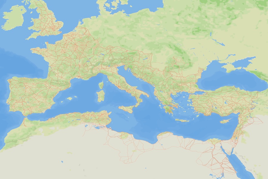
The Roman road system was the ancient world's first continental-scale transport network. It connected various regions of Europe, North Africa, and the Middle East, structuring the flow of trade, armies, and people. These routes played a crucial role, as they also facilitated the spread of technological innovations, religious beliefs, and even pandemics.
A new study co-directed by researchers from the Universitat Autònoma de Barcelona (UAB), creators of the Itiner-e project, the most detailed digital map of the Roman Empire's road network, presents a high-spatial-resolution quantitative exploratory analysis of the Roman Empire's road system, made possible by the creation of a detailed database covering the entire imperial territory.
The research addresses long-standing questions, such as the centrality of cities like Rome and the degree of straightness and longevity of the roads. The results demonstrate that the city of Rome occupied a more peripheral position within the Empire's mobility network than is traditionally attributed to it, whereas Byzantium—the capital during Late Antiquity—held a more central position. Furthermore, the analysis shows that provincial capitals consistently acted as key hubs that structured regional overland communications. The central position held by these capitals and the main roads suggests that the Romans were capable of making strategic decisions at a provincial—or even imperial—scale to develop the road network and key locations for organising, administering, and controlling newly conquered territories. This raises fascinating new questions regarding how they planned, mapped, and executed these decisions on a continental scale—a first in human history.
A lasting mark on the modern road network
The rigorous analysis carried out by researchers indicates that the Romans left a permanent imprint on the modern world and establishes a correlation between the presence of ancient Roman roads and that of the main modern highways, which persisted until the major historical changes driven by the Industrial Revolution. The continuity of Roman roads in modern times has been determined by local conditions that vary according to the region, whether in Europe, North Africa or the Near East. Conditions such as topography, the crossing of rivers and mountains, the presence and growth of cities, and historical and institutional development have varied the persistence of these routes.
Roads that were not as straight as current ones
The study also questions the assumption that Roman roads were uniformly straight. Although Roman engineers favoured straight roads when the terrain allowed, their routes were generally less straight than those of modern main roads and had to accommodate the local topography. The Romans nonetheless skilfully engineered roads in less favourable landscapes using bridges, rock cuttings, retaining walls and terracing systems. As a result, most Roman roads maintained a gradient of less than 16%, ensuring they remained suitable for animal-drawn carts. Interestingly, modern roads are slightly more sensitive to topography and show a stronger negative correlation with elevation than ancient roads.
Original article: Pažout, A., Brughmans, T., de Soto, P., et al. Network Science reveals the structure and lasting impact of the Roman road system. Nature Communications (2026).


