Key takeaways
- The air quality sensors set up by UCLA are providing real-time quality and safety readings, available to the public on a website.
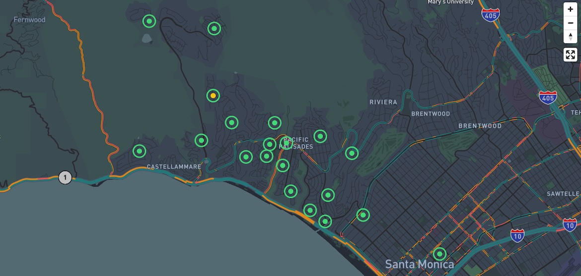
- The nonprofit-funded project, called CAP AIR, includes monitoring stations across Pacific Palisades, Malibu, Topanga State Park, Santa Monica and other Westside locations.
- Unlike many other air quality sensors, the UCLA stations monitor both fine airborne particles and coarser particles known as PM 10 particles that are more likely to be kicked up by construction and can contribute to a range of health problems.
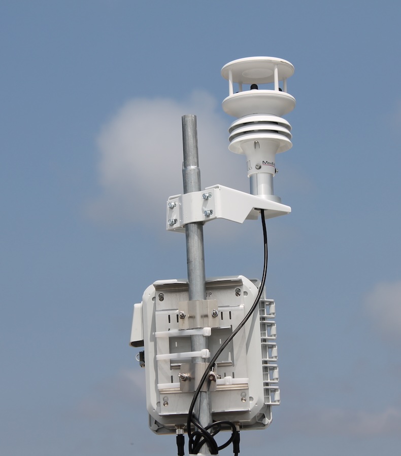
A team led by UCLA researchers this month completed the installation of 20 air quality monitoring stations in West Los Angeles, allowing residents across the region to get up-to-date information on air quality as reconstruction work moves forward after the devastating Palisades fire.

"The fires released a complex mix of particulate matter and volatile organic compounds from burned structures, vehicles and household products, and these emissions can persist for weeks to months as damaged materials gradually release pollutants back into the air," said Yifang Zhu, a UCLA Fielding School of Public Health air quality expert who leads the effort.
"Additionally," Zhu said, "cleanup activities — debris removal and demolition — and construction may further stir up dust and other contaminants, prolonging exposure risks for returning residents and construction workers. So, our goal here is to give residents access to real-time, local air quality data; help identify pollution hotspots; and inform public health responses."
The effort, known as the Community Action Project Los Angeles Air, or CAP AIR, consists of 20 sensor stations installed in secure locations from Topanga State Park east through Pacific Palisades toward Brentwood and south towards Santa Monica.
The January blazes in Los Angeles County, in both the Pacific Palisades–Malibu area, adjacent to the Santa Monica Mountains, and the Altadena–Pasadena communities in the foothills of the San Gabriel Mountains, claimed at least 29 lives and damaged or destroyed more than 18,000 structures, county officials said.
Funded by nonprofit foundations
The UCLA-led team is currently handling the western Los Angeles monitoring project, and a similar effort is underway in the Altadena–Pasadena area.
Read the Los Angeles Times article on the new monitoring network.
This effort in western Los Angeles has been jointly funded by the nonprofit R&S Kayne Foundation, with offices in California and New Zealand, and the Danhakl Family Foundation, based in Los Angeles.
"As both a mother and a physician living in the Palisades, I believe Dr. Zhu's air quality research is essential for all residents," said Dr. Victoria Danhakl, trustee of the Danhakl Family Foundation. "Air sensors are tools that give us real-time data to protect our kids, our patients, and our community. We are honored to support research that helps ensure that everyone can breathe clean, healthy air."
Tracking data other air quality maps do not
The air quality network provides easily understood updates from each station, superimposed over an online dashboard that maps the region every 5–10 minutes.
The data includes color-coded icons for air quality ranging from good (green) through hazardous (dark red) for a variety of potentially dangerous airborne particles — from 10 micrometers, or PM10 (about the width of a cotton fiber), to 2.5 micrometers, or PM 2.5, which us 30 times smaller than a human hair.
"While there are existing sensor networks that track PM 2.5, there's a real gap when it comes to monitoring PM 10," Zhu said. "Those coarse particles can contribute to a range of health problems, particularly affecting the respiratory and cardiovascular systems — especially after wildfires, when debris removal and reconstruction stir up dust. That's why it's important to measure both fine and coarse particles to gain a complete picture of air quality and community exposure."


