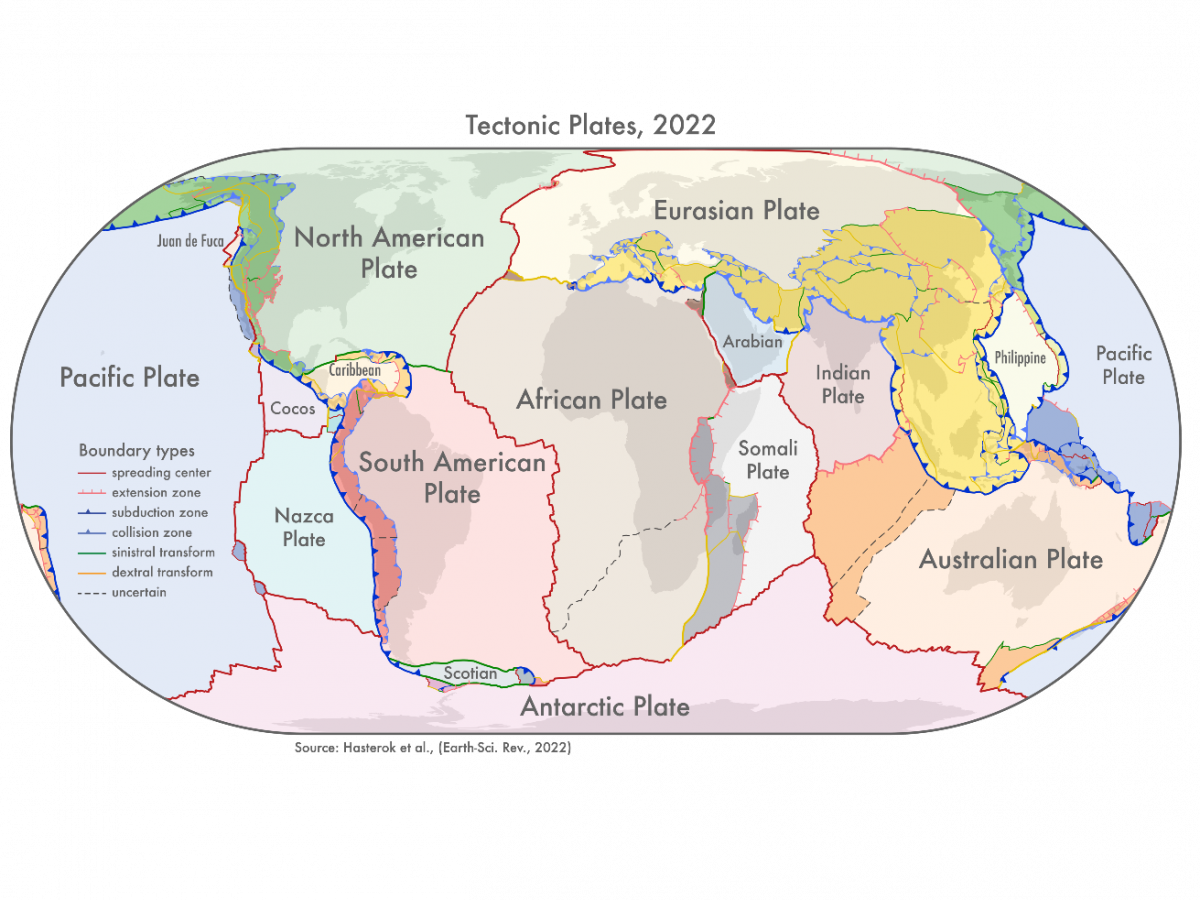
New tectonic plate model with boundary zones in darker shading. Image: Dr Derrick Hasterok, University of Adelaide.
New models that show how the continents were assembled are providing fresh insights into the history of the Earth and will help provide a better understanding of natural hazards like earthquakes and volcanoes.
"We looked at the current knowledge of the configuration of plate boundary zones and the past construction of the continental crust," said Dr Derrick Hasterok, Lecturer, Department of Earth Sciences, University of Adelaide who led the team that produced the new models.
"The continents were assembled a few pieces at a time, a bit like a jigsaw, but each time the puzzle was finished it was cut up and reorganised to produce a new picture. Our study helps illuminate the various components so geologists can piece together the previous images.
"We found that plate boundary zones account for nearly 16 per cent of the Earth's crust and an even higher proportion, 27 per cent, of continents."
"Our new model for tectonic plates better explains the spatial distribution of 90 per cent of earthquakes and 80 per cent of volcanoes from the past two million years whereas existing models only capture 65 per cent of earthquakes," Dr Derrick Hasterok, Lecturer, Department of Earth Sciences, University of Adelaide


