One of Brazil's worst environmental disasters - a dam collapse that also killed more than 200 people - could have been foreseen with the right monitoring technology, according to a new study by the University of Nottingham and Durham University.
The high-profile catastrophe took place on 25 January 2019 at a tailings dam near the Córrego do Feijão iron ore mine, close to the town of Brumadinho, in Minas Gerais state, south-east Brazil.
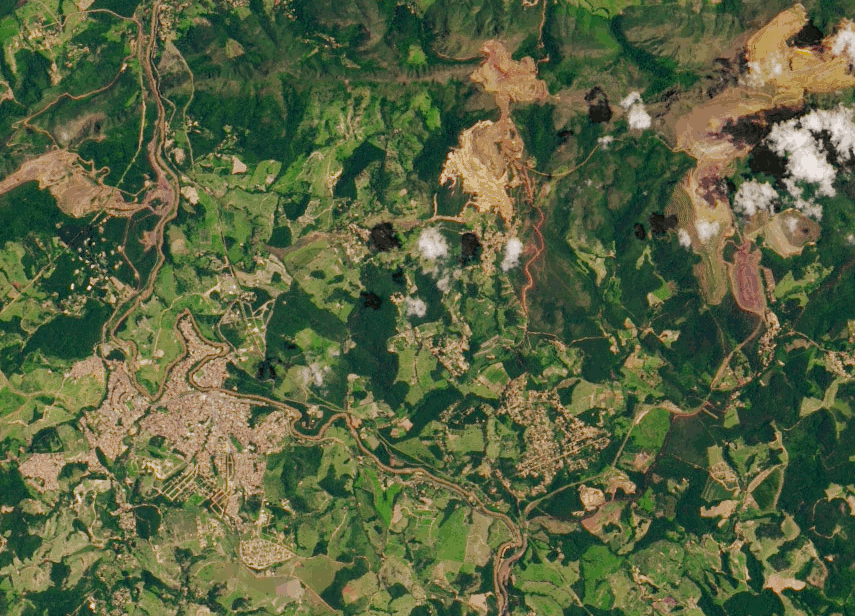
When the dam collapsed, it caused a torrent of sludge to cover surrounding land; taking lives, destroying homes and livelihoods and polluting rivers with toxic material.
Owned by Vale, Brazil's largest mining company, the tailings dam was used for more than 40 years to hold waste from the mine. While it is not uncommon for such dams to move as more material is added and it compacts and shifts, accelerated movement shouldn't happen; it's a precursor that failure will occur. Brumadinho was the second Vale-owned mining dam to collapse in recent years and one of many widely-reported failures worldwide.
There are growing concerns about the stability of this particular type of dam and a significant number need enhanced monitoring says lead author Assistant Professor Stephen Grebby from the Nottingham Geospatial Institute at the University.
"Most mining companies currently rely upon ground-based sensors to monitor the stability of dams. However, these typically offer an inadequate coverage of measurements over the whole of the dam, which can make it difficult to detect movement or other signs of distress."

Applying InSAR (satellite radar imaging) to check for small ground movements in and around dams is not current standard practice and this is something Dr Grebby would like to see change.
He collaborated with Durham University and University of Nottingham spin-out company Terra Motion Ltd on the study to identify whether failure at Brumadinho could have been foreseen.
They used an advanced InSAR technique called Intermittent Small Baseline Subset (ISBAS), developed by the University of Nottingham and Terra Motion, which can help overcome the limitations faced when using some of the more conventional InSAR techniques over vegetated terrain. Another benefit of this technology, over on-the-ground sensors, is it looks down from above and offers a more complete picture of ground movements with millimetre-level accuracy.
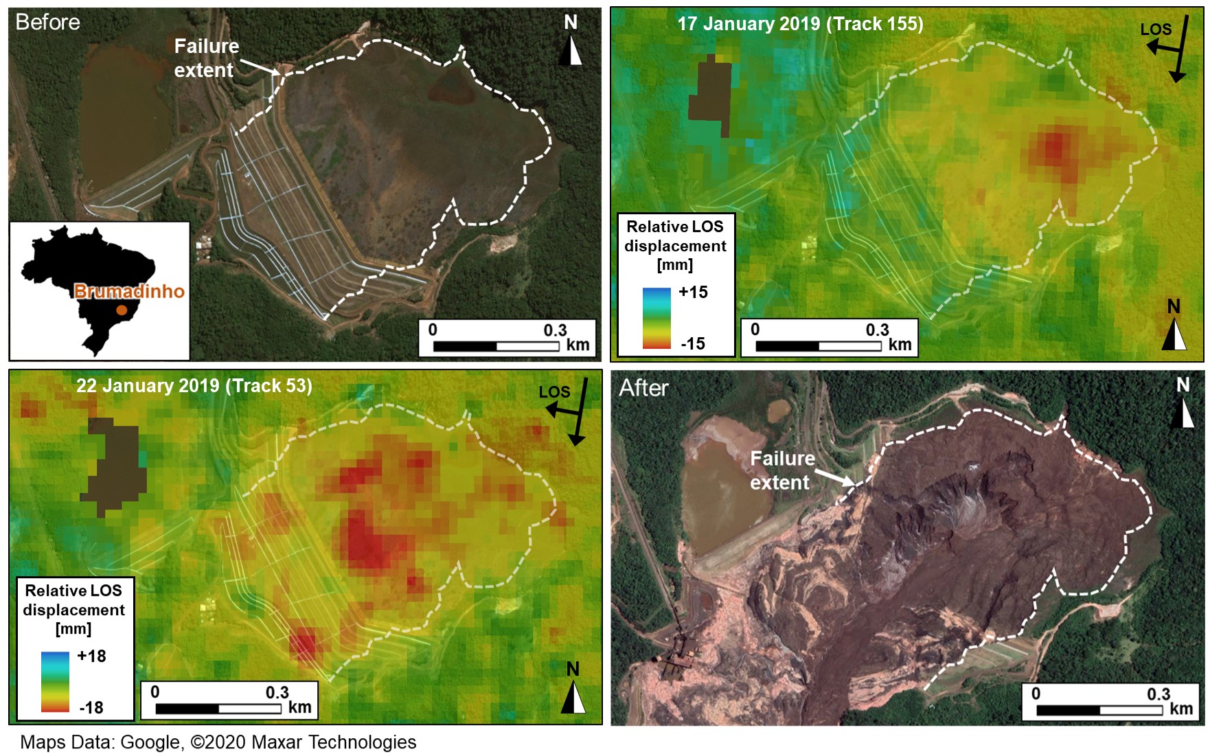
Dr Grebby adds: "Our ISBAS InSAR results revealed that different areas of the dam were moving at different rates and some of these were seen to accelerate suddenly during the two months preceding the collapse. Despite the dam being monitored by the mining company using standard techniques with no apparent warning raised, our analyses of the precursory movement indicate the timing of the collapse was foreseeable.
"If monitored routinely, using the ISBAS InSAR technique, the failure date could have been predicted to within a week of it happening. Crucially, this prediction would have been possible around 40 days prior to the collapse, allowing time for a warning to be raised that the dam was becoming unstable. This could have led to more in-depth monitoring or other mitigation measures to avert the loss of life and environmental disaster that tragically unfolded."
The full findings have just been published in the paper 'Advanced analysis of satellite data reveals ground deformation precursors to the Brumadinho Tailings Dam collapse' in the Nature journal Communications Earth & Environment.
Professor David Toll, Co-Director of the Institute for Hazard, Risk and Resilience at Durham University, said "Identifying an acceleration of ground movements during a period of wetting, just prior to the failure, helped to corroborate the anticipated failure mechanism. The collapse of the tailings dam can be explained by a reduction in suction in the tailings contributing to internal strains that could induce static liquefaction in the brittle materials."
"The novel use of InSAR satellite data to monitor the stability of dams is a real breakthrough as it means that you don't need to instrument the ground in and around the dam to monitor it. Monitoring is thus no longer solely in the hands of the operating company."

"This work would not have been possible without the availability of free satellite data from the Sentinel-1 mission which has global reach and is sustainable for the foreseeable future. Along with the innovative approach described in this paper and our unique InSAR products, this means that a low-cost operational remote tailings monitoring system is within reach at local, regional and even national scales anywhere in the world."
The researchers are now looking to develop the technology as a software that could be offered to the mining industry, which is looking out for a reliable, early warning system to predict the risk of imminent collapse at tailing dams. Combined with on-the-ground sensors, Dr Grebby sees advanced InSAR techniques as a valuable addition to the monitoring tool box to evacuate and protect life.