Vegetation phenology, the cycle sequence of the vital activities, is a highly sensitive indicator of the climate impacts on terrestrial ecosystems. Most recent studies focus on the structural changes in plants, such as using the growth process of leaves represented by the greenness indicators. However, these indices work well for capturing the variations in chlorophyll content or structural changes but are less sensitive to physiological changes in vegetation photosynthesis.
Researchers from the Wuhan Botanical Garden of the Chinese Academy of Sciences developed a method combining a smoothing filter and change-point detection to retrieve photosynthetic phenology from a recently developed satellite-based solar-induced chlorophyll fluorescence (SIF)-based gross primary productivity (GPP) product (GOSIF-GPP: 2001-2020) with a 0.05° spatial resolution.
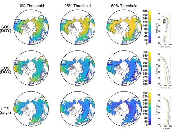
Several phenological metrics were considered, including the state-transition dates of photosynthesis (SOS), the end state-transition dates of photosynthesis (EOS), and the duration length of photosynthesis for terrestrial ecosystems above 30° N latitude (northern biomes, including forests, shrublands, savannas, grasslands, wetlands and croplands).
The dataset includes single-season and double-growing season phenology time, and the corresponding thresholds extracted at 10%, 25% and 50%. Each data is compared to other vegetation indices or GPP data and validated using the flux dataset.
This phenology product allows us to capture multiple photosynthetic activities of vegetation and helps to monitor the impact of climate change on terrestrial ecosystems.
This work was published in Scientific Data entitled "Vegetation photosynthetic phenology dataset in northern terrestrial ecosystems," and it was supported by the National Natural Science Foundation of China.