In February 2026, three global terrestrial networks - the Global Terrestrial Network for Glaciers (GTN-G), the Global Terrestrial Network for Permafrost (GTN-P), and the International Soil Moisture Network (ISMN) - were accredited as GCOS Affiliated Networks.
The global networks in the terrestrial domain play a fundamental role for GCOS by providing in-situ observations of Essential Climate Variables (ECVs) that are crucial to monitoring changes across the land, highlighting the connections between the hydrosphere and cryosphere, and improving our understanding of how climate change both affects and is influenced by the terrestrial systems.
Global Terrestrial Networks are fundamental for GCOS because they measure Essential Climate Variables (ECVs) to monitor critical changes in the terrestrial domain, showing how the hydrosphere and cryosphere are interlinked and how they are impacted by climate change, while also influencing the climate system.
Despite their importance, some of these networks are still suffering, at different levels, from gaps in global coverage and representativeness, and sometime also from uncertain support in the long-term.
As a recognition for their contribution to global climate observations and to improve their sustainability, these networks have the opportunity to apply for an accreditation from GCOS.
To get this accreditation a network shall meet some conditions, like: monitor one or more ECV at global level, ensure that data and metadata are openly and freely shared, and more in general comply with the GCOS Climate Monitoring Principles.
In February 2026, the following global terrestrial networks, closely collaborating with the GCOS Terrestrial Observation Panel for Climate (TOPC), have obtained the Accreditation as GCOS Affiliated Network, joining the Baseline Surface Radiation Network (BSRN, accredited in 2022) and the Global Terrestrial Network for Rivers (GTN-R, accredited in 2025):
- the Global Terrestrial Network for Glaciers ( GTN-G )
- the Global Terrestrial Network for Permafrost ( GTN-P )
- the International Soil Moisture Network ( ISMN )
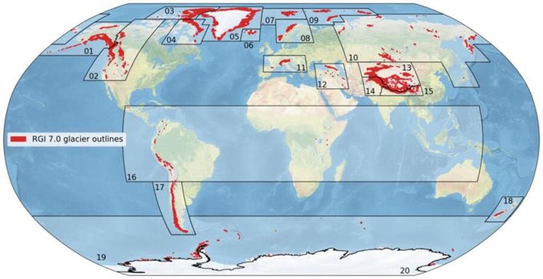
Glaciers - Worldwide coordination of glacier monitoring started in 1894, providing among the longest records of climate-driven change. GTN-G integrates in-situ observations, remote sensing and numerical modelling to provide the following ECVs: Glacier Area, Glacier Elevation Change, and Glacier Mass Change. GTN-G is a mature network with a well-established organizational structure, jointly run by the World Glacier Monitoring Service (WGMS), the US National Snow and Ice Data Center (NSIDC), and the Global Land Ice Measurements from Space (GLIMS) initiative. Today, glaciers remain the most powerful and visible symbol of climate change.
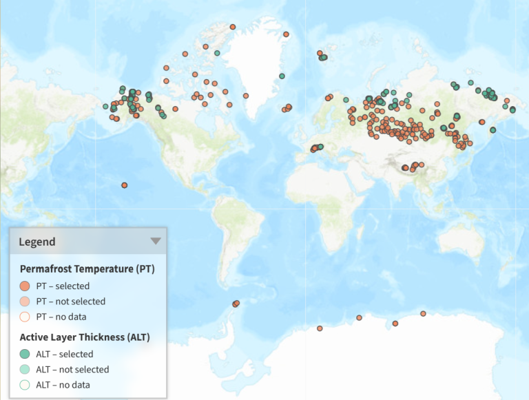
Permafrost - Developed in the 1990s by the International Permafrost Association (IPA), GTN-P is a global network monitoring permafrost across high latitudes and altitudes worldwide. It delivers the following in-situ components of the Permafrost ECV: Permafrost Temperature and Active Layer Thickness, while Rock Glacier Velocity is in the planning stage. Coordinated by the Alfred Wegener Institute (Germany), its Data Management System is powered by contributions from 40 National Correspondents across 26 countries. On 19 January 2026, GTN-P marked a major milestone with the launch of its new website and data platform.
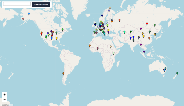
Soil Moisture - ISMN is the world's most comprehensive in-situ soil moisture database, launched in 2009 by TU Wien (Austria) and hosted since 2022 by the International Centre for Water Resources and Global Change (ICWRGC) and the Federal Institute of Hydrology (BfG) in Germany. With stable funding and a dedicated expert team, ISMN ensures long-term (up to 45 years' time series), open-access, high-quality observations of the ECV Soil Moisture from 3,200 stations worldwide, through its data portal. Most of the monitoring locations are in the Northern Hemisphere at the moment.