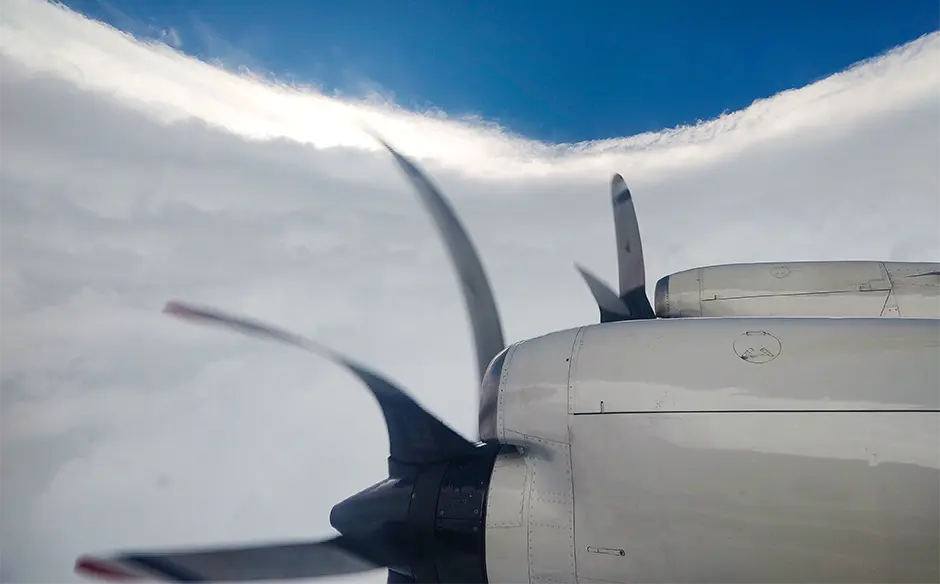
The turbulence tossed the P-3 Orion around like a toy.
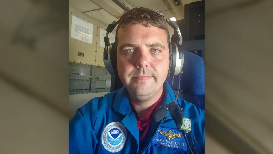
Harnessed in his seat aboard the four-engine turboprop, University of Miami tropical cyclone researcher Andy Hazelton struggled to process the meteorological data captured from one of the dropsondes that had been deployed into Hurricane Melissa's powerful winds.
"We hit an updraft-downdraft combination that jolted the plane pretty good," he recalled of one of his Hurricane Hunter flights into the monster storm that left a trail of destruction across the Caribbean.
As the P-3, nicknamed Kermit, punched through the storm's eyewall, the turbulence became so severe that the pilot aborted the mission and returned to home base in Central Florida, where crewmembers of the National Oceanic and Atmospheric Administration (NOAA) disembarked to make a safety inspection of the plane.
All was well with the aircraft, and flights into the storm to gather the critical data forecasters need to issue advisories and to plot storm tracks resumed the next day.
"I had experienced very intense storms before," said Hazelton, an associate scientist at NOAA's Cooperative Institute for Marine and Atmospheric Studies (CIMAS), which is based at the Rosenstiel School of Marine, Atmospheric, and Earth Science. "But Melissa was probably the worst."
Record-setting storm
Melissa roared ashore in southwest Jamaica on Oct. 28 as a Category 5 hurricane with top winds of 185 miles per hour. But it will take "extensive post-analysis to determine exactly where it ranks among landfalling Atlantic hurricanes," the National Hurricane Center (NHC) wrote in a discussion text that Tuesday.
What is already clear is that the storm, which also battered Cuba, Haiti, and parts of the Bahamas, stunned scientists in the way it behaved—from undergoing extreme rapid intensification (gaining at least 58 miles per hour over a 24-hour period), rarely seen in a hurricane, to perhaps failing to undergo a typical eyewall replacement cycle.
"It was much different than past cases of other storms this hurricane season in that it rapidly intensified, leveled off for a bit, then intensified again," Hazelton said of Melissa's periods of rapidly intensifying winds.
During his Hurricane Hunter flight into the storm just before it struck Jamaica, he processed a dropsonde wind gust reading of 219 knots, or 252 miles per hour. "When I saw the 113 [meters per second] (219 knots) just above the surface, I couldn't believe it," Hazelton posted on X. "My display only goes to 100 by default."
Initial analysis shows the reading is the "strongest such dropsonde wind gust recorded in a hurricane," Hazelton said.
Warm Caribbean waters at depth fueled Melissa, ramping up its intensity. "Almost the entire Caribbean is like a degree above normal, so there's a lot of high ocean heat content," Hazelton explained. "The water below the surface was warmer than usual, and that's important because Melissa was a slow-moving storm that churned up water below. Normally, if a hurricane moves that slowly, it churns up cold water from deep below. But because the Caribbean is so warm way down, Melissa was churning up water that was still warm. So, it was able to just keep feeding itself."
But warmer ocean heat content is not solely the reason for Melissa's intensity. Other factors were also at work, according to Lynn "Nick" Shay, a professor of ocean sciences at the Rosenstiel School, who has been studying hurricanes—particularly those in Gulf waters—since 1979, often deploying on Hurricane Hunter flights both with NOAA out of Lakeland, Florida, and with the 53rd Weather Reconnaissance Squadron out of Keesler Air Force Base in Biloxi, Mississippi.
"Up until about Oct. 24, Melissa couldn't really get its act together," said Shay, referring to the storm's slow development. "The inner core circulation really wasn't there, and that's one of the reasons the storm was developing so slowly. But then it ramped up. In the vertical plane, looking down on the storm, the centers of Melissa started to line up. When that happened, it became more organized, forming the inner core.
"And when that inner core is vertically aligned such as the way it happened with Melissa," he continued, "that's when you start getting increases of rapid intensity on the order of 30 millibars in 24 hours, especially over the deep warm water. Of course, Melissa far exceeded that."
Skipping a cycle
In the months ahead, researchers will also pore over data to determine whether Melissa underwent a typical eyewall replacement cycle, a natural process in intense hurricanes during which an outer eyewall of thunderstorms forms, replacing the inner original eyewall and causing a short-lived decrease in the storm's strength.
Did Melissa skip that cycle? "Right now, it's tough to say using the observations we currently have," said Michael Fischer, an assistant professor in the Rosenstiel School's Department of Atmospheric Sciences, who studies tropical cyclone structure and intensity change.
"It definitely did not undergo a conventional eyewall replacement cycle, but there were some signs, similar to what we saw when [2017's] Hurricane Irma was rapidly intensifying to a Category 5 storm, that Melissa may have tried to form an outer eyewall at times, but then that outer eyewall essentially merged with the inner eyewall, and that inner eyewall just basically maintained its intensity, and the storm continued to strengthen. We still need to improve our understanding of that process."
Studying hurricanes like Melissa will lead to better storm forecasting that will help save lives, said CIMAS scientist Jun Zhang.
Aboard Miss Piggy, the second NOAA-crewed P-3 that braved Melissa's fury ahead of its landfall in Jamaica, he launched 12 expendable drones over five flights into the storm's powerful winds, receiving and processing the remote aircrafts' data transmissions on wind speed, pressure, and humidity, then sending that information to forecasters at the NHC.
With the goal of improving storm forecasting, Zhang plans to analyze the drone data and compare it to measurements taken by Doppler radar, dropsondes, and other instruments that collected readings on Melissa.
"We're planning, for instance, to collaborate with [NOAA's] Environmental Modeling Center to study the impact of the drone data on hurricane track forecasts," he said. "We'll also use the data to quantify the strength of low-level turbulence in a hurricane, which could perhaps give us a better idea of how low the crewed P-3 can fly. Hurricane season may be almost over, but there's a lot of research ahead of us."


