
Cutting-edge imaging technologies are helping archaeologists uncover the secrets of vast outdoor sites, revealing the rich history hidden in places often overlooked.
For decades, archaeological research in southern Africa has focused predominantly on caves and rock shelters due to their well-preserved geological layers and concentrated deposits.
Now, research led by Flinders University has shown that two geophysical imaging methods, electrical resistivity tomography and magnetometry, can be effective tools in investigating open-air sites.
"Caves and rock shelters offer a good preservation of the record at the time, but they only represent a narrow slice of the past landscape," says study lead author Oliver Hatswell, a PhD Candidate at Flinders University.
"By relying so heavily on them, we risk missing the broader picture of how early humans lived, moved, and interacted with their environment.
"While they might be more difficult and costly to survey and excavate, open-air sites represent the majority of archaeological sites worldwide, so it's important we find suitable ways to investigate them and include that information in our interpretations of the past."
For archaeologists, Southern Africa is a significant region of study due to it being one of the earliest locations of behaviourally modern humans.
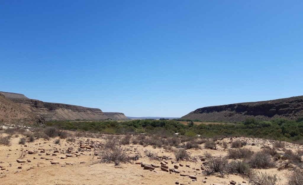
This includes the(KH1) site in South Africa's Doring River catchment, a rare and significant open-air location where 6747 artefacts have been discovered. This includes a cluster of over 180 stone tools associated with the Still Bay cultural group, dating back approximately 70,000 to 75,000 years.
"This cluster of stone tools have been found eroding out of ancient layers of soil, giving us a rare chance to study how early humans lived and used the land across a wide area," says Mr Hatswell.
"However, the site also exemplifies the paradox of open-air archaeology; we can see these artifacts because the areas have been damaged by erosion, while the parts that are better preserved don't always show anything on the surface."
To address this challenge, the research team employed two geophysical methods - electrical resistivity tomography (ERT) and magnetometry - to map the subsurface of KH1.
These non-invasive techniques allowed the team to identify the specific rock characteristics and potential archaeological features, without the need for extensive excavation.
The study found the ERT was able to identify the stratigraphy - the order and layers of sediment within - including that the layers containing stone tools likely extended up to eight metres deep within the site.
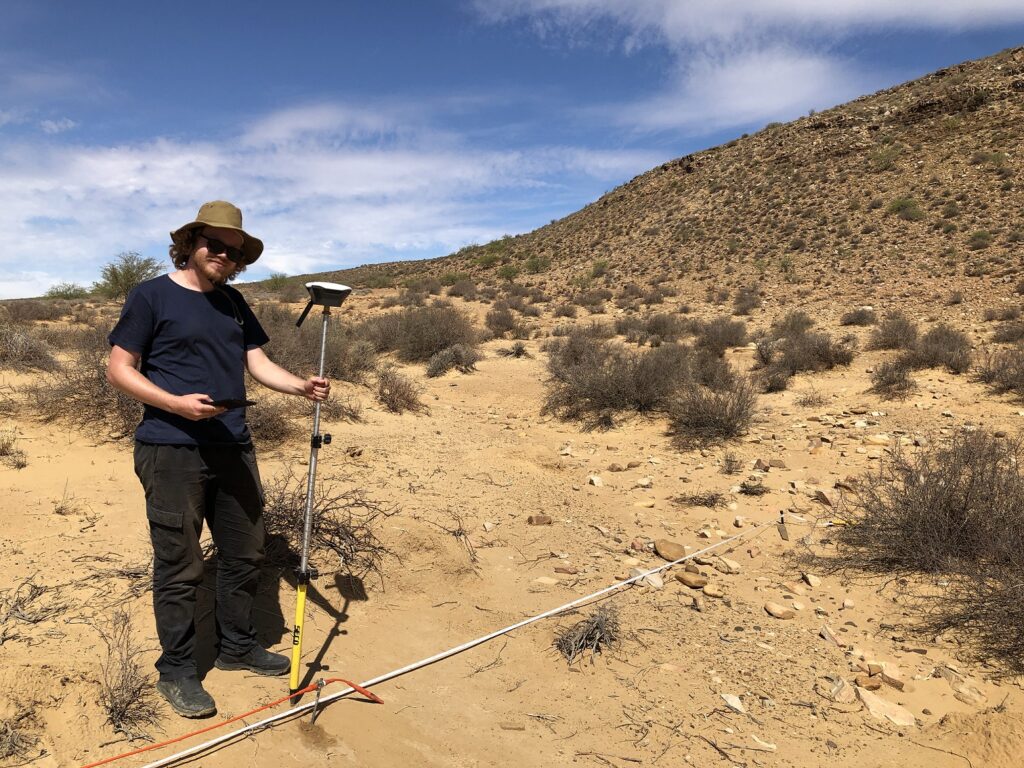
While the magnetometry survey was able to detect subtle magnetic anomalies that could indicate where hearth features may be located, which are features potentially created by past human burning and generally have archaeological material located near them.
"The combination of ERT and magnetometry provides a powerful toolkit for archaeologists working in open-air contexts," says senior co-author Professor Ian Moffat, a Flinders University Professor of Archaeology who has worked extensively with geological mapping technology.
"These methods not only reduce the time and cost associated with traditional excavation but also help us target areas with the highest potential for meaningful discoveries."
The authors say the study, published in the journal Geoarchaeology, demonstrates that geophysical methods can be effective components of archaeological investigations in arid open-air sites.
"This research underscores the importance of expanding archaeological research beyond rock shelters to include open-air sites, which can offer a more representative view of the past," says Mr Hatswell.
"By integrating geophysical techniques into our investigations, we can open up our areas of investigation and begin to correct the geographic, environmental, and behavioural biases that have shaped our understanding of the past."
The paper 'Understanding the Depositional History of the Archaeological Open‐Air Site, Klein Hoek 1, South Africa, Using Geophysical Geoarchaeology' by Oliver Hatswell, Ian Moffat, Christopher J. H. Ames, Matthew Shaw, Natasha Phillips, Jessica‐Louise McNeil, Brian G. Jones and Alex Mackay is published in the journal Geoarchaeology. DOI: 10.1002/gea.70015. Funding: Alex Mackay and Ian Moffat are recipients of Australian Research Council fellowships.


