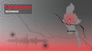
The March 28, 2025, Myanmar earthquake is giving scientists a rare look into how some of the world's most dangerous fault systems behave, including California's San Andreas Fault. Earthquakes are notoriously messy and complex, but this one struck along an unusually straight and geologically "mature" fault, creating near-ideal conditions for researchers to observe how the Earth releases energy during a major continental rupture.
An international team of researchers led by The University of New Mexico set out to understand how these mature faults break during massive seismic events, focusing on a long-debated phenomenon known as the "shallow slip deficit." In many earthquakes, the surface shifts far less than the rocks deep underground, leaving scientists to question whether the missing energy is absorbed by surrounding rock or simply unmeasured. By analyzing the 2025 Myanmar earthquake, the team aimed to determine how a simple, ancient fault system releases energy, and whether that energy reaches the surface.
The research titled, "Mature fault mechanics revealed by the highly efficient 2025 Mandalay earthquake" was published in Nature Communications and was led by UNM Assistant Professor Eric Lindsey, who worked together with collaborators from Taiwan and Myanmar.
Because Myanmar is experiencing armed conflict and there was additional infrastructure damage after the earthquake, researchers were unable to rapidly conduct fieldwork in the region. Instead, they relied on remote sensing from space to gather the data they needed.
"We used two primary satellite technologies: Optical Image Correlation (using Sentinel-2 satellites) to track how pixels in satellite photos moved between two images collected before and after the quake, and Interferometric Synthetic Aperture Radar (InSAR) using Sentinel-1 satellites, which measures the change in distance to the ground from the satellite between two consecutive passes. These tools allowed us to measure ground shifts with incredible precision without setting foot in the danger zone," explained Lindsey.
 represents an additional relative difference of 2.8 cm of displacement along the radar line of sight. North is to the right; the fault slipped right-laterally by 3-5 meters along a ~500 km rupture, one of the longest strike-slip earthquakes ever recorded Horizontal image scale is 350 km. Contains modified Copernicus Sentinel Data from the European Space Agency.")
InSAR works like a high-tech game of "spot the difference," using radar to track subtle changes in the Earth's surface from space. As the satellite orbits, it sends radar pulses toward the ground. Researchers then combine the reflected signals to create a high-resolution image of the area before the earthquake and another one afterward.
"By comparing the time it takes for the signal to bounce back to the satellite from each point on the ground, we can detect changes in the ground's elevation or position down to a fraction of an inch. It allows us to map exactly how the Earth warped over an area hundreds of miles wide, day or night, and through clouds," said Lindsey.
The Myanmar earthquake rupture stretched nearly 500 kilometers. To put that in perspective, imagine a crack in the Earth running from Albuquerque to Denver, with the two sides suddenly shifting past each other by 10 to 15 feet.
"Most earthquakes we study break much shorter fault segments—perhaps 30 to 60 miles long. It is incredibly rare and scientifically significant to see a rupture that is this long, continuous, and straight," Lindsey said.
The Myanmar earthquake occurred on the Sagaing Fault, a strike-slip fault, meaning the two sides slide past each other horizontally, almost like two cars sideswiping each other on a highway.
"This is just like the San Andreas fault in California," he said. "We also describe the Sagaing fault as 'mature,' which means it has been slipping in the same way for millions of years. Over that vast time, the rough edges and bends in the fault have been ground down. Because it is so smooth and straight, the earthquake rupture could travel very efficiently across a huge distance."
For years, scientists have observed that in many earthquakes, the amount of ground movement at the surface is much less than the movement deep underground. This is a mystery known as the "Shallow Slip Deficit."
"We found that in the 2025 Mandalay earthquake, this deficit was non-existent. The massive amount of slip that happened miles underground was transferred 100% to the surface," explained Lindsey.
The absence of shallow slip deficit in this event contrasts with a lot of recent data from other earthquakes where surface slip was missing on the fault and was likely taken up instead along many small fractures across a broad damage zone.
"This shows that on mature, smooth faults, the energy is highly focused and comes right to the surface," explained Lindsey. "This is significant because it means the ground shaking near the fault line might be more intense than our current hazard models predict for these types of faults."
Researchers also found that the earthquake was able to "link up" multiple sections of the fault into one massive 500-km chain reaction, ignoring boundaries that scientists previously thought might stop a rupture.
"We found that the fault followed a historical pattern: it slipped less in areas that had experienced earthquakes in the 20th century and slipped the most in areas that hadn't broken since the 1800s," he said. This is known as "slip predictability" and suggests we might be able to forecast how much slip is likely to occur on other fault segments that have not yet ruptured, improving our ability to plan and prepare for future earthquake hazards.
 Sentinel-2 optical image correlation, showing the North-South component of motion, (b) Sentinel-1 SAR image azimuth (Azi.) offsets along the descending satellite orbit direction, (c) SAR image range offsets from the same tracks, and (d) combined interferograms. Black arrows indicate the direction of positive ground motion in each image (red colors, or increasing phase).")
This study highlights the power of modern satellite observation. Even in the midst of a conflict zone where traditional field science was impossible, researchers were able to capture one of the most detailed pictures of earthquake mechanics in history.
"It's a testament to how global scientific collaboration and open data access (like the Copernicus Sentinel missions) can help us understand natural hazards that affect millions of people," he said. "The significance lies in safety. This earthquake showed us that mature faults can be much more efficient at transmitting energy to the surface than younger ones, which has direct implications for how we build infrastructure to withstand the 'Big One' in the United States."
Lindsey concludes by stating that New Mexico sits on a different fault system, the Rio Grande Rift, which is pulling apart inside of sliding sideways.
"The remote sensing techniques we refined in this paper are the exact same methods we can use to monitor safety issues close to home," he explained.
By using InSAR to track ground sinking due to aquifer depletion around New Mexico and monitoring slow ground movements associated with the rift and deep magma body inflation beneath Socorro, researchers can provide information that helps the state better allocate resources and prepare for potential future seismic hazards.
"Understanding the physics of 'mature' faults helps us understand the general mechanics of the earth's crust, which improves earthquake hazard models globally," Lindsey concluded.
*Caption for photo at the top: View of the Ava Bridge near Sagaing, Myanmar, which collapsed during the March 2025 magnitude 7.7 earthquake. The bridge was built in 1934 and was the only bridge across the Irrawaddy river for more than 60 years after its construction. Photo by study coauthor Wang Yu.


