
Roads, bridges and culverts rarely make the news until they suffer damage. When the 2022 floods tore through the Tweed's hinterland, the damage was on a scale the region had never seen: 3,476 damaged sites, $257 million in estimated damage, and areas cut off in ways that went well beyond inconvenience.
The damage extended across the entire Shire, from Bilambil to Kunghur, Burringbar to Chillingham, affecting roads and locations serving businesses, farms, properties and the people who depend on them to get in and out. For hinterland areas, the loss of key access corridors meant farmers couldn't move stock, visitors stopped coming and emergency services had to coordinate carefully with ground crews just to reach residents in critical need. During the most challenging periods on Byrrill Creek Road, that coordination included supporting a home birth and assisting with an attended death, managing dignified access through restricted and damaged routes. For the people who live beyond these roads, access is everything.
The 2022 flood was compounded by 2 further natural disasters: flooding in 2024 and Cyclone Alfred in 2025, resulting in a combined damage bill to the Tweed's road network approaching $350 million. The recovery program is the largest road infrastructure undertaking this region has seen.
"The scale of what this team has delivered across 3 flood events is extraordinary – it is the equivalent of adding almost 4 times our annual construction program to the work we're already doing. We're not just repairing damage. We're rebuilding to a higher standard wherever possible so that when the next event comes, these assets perform better and recover faster. The roads program alone represents one of the most complex engineering undertakings this region has seen, and the work continues."
Tim Mackney, Director Engineering, Tweed Shire Council
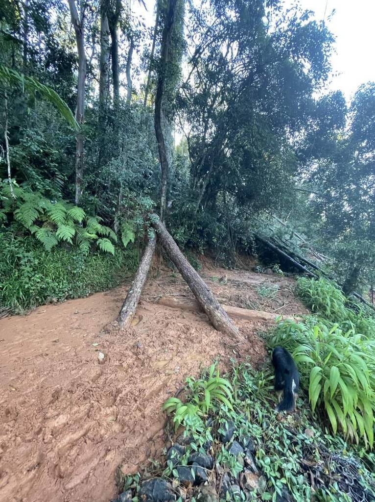
Byrrill Creek Road: bridge and major slip
As an example of the program's current works, 2 significant projects have taken shape on Byrrill Creek Road, in a part of the catchment that experiences extreme changes in flood depths and velocities and carried massive amounts of debris during the 2022 event. A bridge restoration and a major landslip stabilisation project together reflect the depth and complexity of the Tweed's ongoing infrastructure recovery.
The bridge works involve reinstating the road with new concrete pavement and restoring the rock scour protection around the bridge structure. This is not a simple resurfacing. It addresses the road foundations that determine whether the structure will hold in the next flood event.
"Byrrill Creek is a high energy flash flood catchment, which rises fast and water flows very quickly. These flows concentrate beneath the bridge and can erode the riverbanks and bed supporting the bridge. We needed to bring in major rock scour protection to absorb that energy and prevent the scouring that would undermine the structure, especially when it is being hit by loads of debris from the river. The road surface and approaches are the final stages, but only once we have got the foundations right."
Danny Rose, Manager Roads and Stormwater, Tweed Shire Council
Further along the same road, a major landslip stabilisation project has just been completed, one of the most technically demanding in the entire program. Soil nailing was installed across the upslope area and steel mesh anchored across the face of the slip, with works finished in July 2026.
"This slip moved a significant volume of material and what you're left with is an unstable face that will keep moving if you don't anchor it properly. The soil nailing goes back 6 metres into solid ground. It's essentially stitching the hillside back together from the inside out. We've done a lot of slip work across the program but this one is among the most technically demanding we've tackled."
Kurt Heidecker, Project Director Flood Restoration, Tweed Shire Council
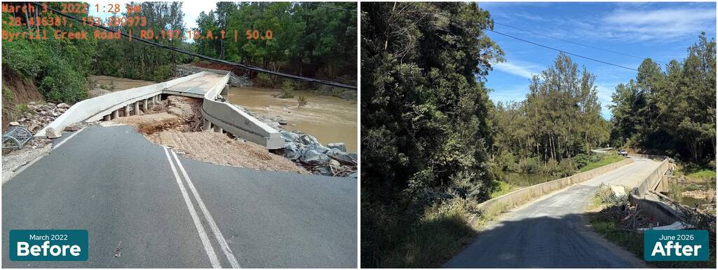
Byrrill Creek bridge, before and after restoration.
When roads close, emergency services feel it first
For the emergency services, a compromised road network presents real challenges. Initially the 2022 floods meant that combat agency crews could not safely navigate damaged hinterland routes to reach people in crisis. At the peak of the event, Murwillumbah was accessible only by boat. Residents requiring dialysis had to be transported to hospital by water. Landslips made it impossible to reach communities to the west by road, and helicopters, unreliable in severe weather and dependent on suitable landing sites, could not fill the gap. It took a massive, coordinated effort of emergency services working with Council's maintenance and construction crews to access isolated communities and keep people safe.
"When a major event hits, the road network and community resilience are both being tested at the same time. We can have the best crews in the world but if we can't get to people, preparation is everything. Communities that have done the work beforehand, that know each other, that have a plan, they can hold until we get there."
Grant "Jack" Frost, Unit Commander, Tweed Coast SES
What resilient communities look like
Natascha Wernick has lived through what Jack describes. As the founder and team leader of the Byrrill Creek Community Resilience Team, she helped lead her community's response to the 2022 floods, one of the most devastating events in the region's recent history. But Byrrill Creek didn't cope by chance. Natascha had founded the resilience team in 2020 following the bushfires, modelled on the Australian Red Cross Community-led Resilience Team framework, with neighbourhood coordinators acting as the link between residents and emergency services. The community held annual Get Ready Days, maintained a fact-checked emergency information group and had spent years building the kind of social bonds that meant, when the event came, people already knew who needed help and who could give it. In 2023, Natascha co-authored a peer-reviewed paper in the Australian Journal of Emergency Management on how Byrrill Creek and Uki self-organised during the disaster, drawing on structures built long before the water rose.
"Byrrill Creek has been flooded in many times. We know how to look after ourselves and each other, that's been built over decades. But 2022 was different. The scale was beyond anything anyone had experienced and it exposed how much everything depends on the roads. When Murwillumbah was only accessible by boat, you understood very quickly that infrastructure and community resilience aren't separate things."
Natascha Wernick, Team Leader, Byrrill Creek Community Resilience Team
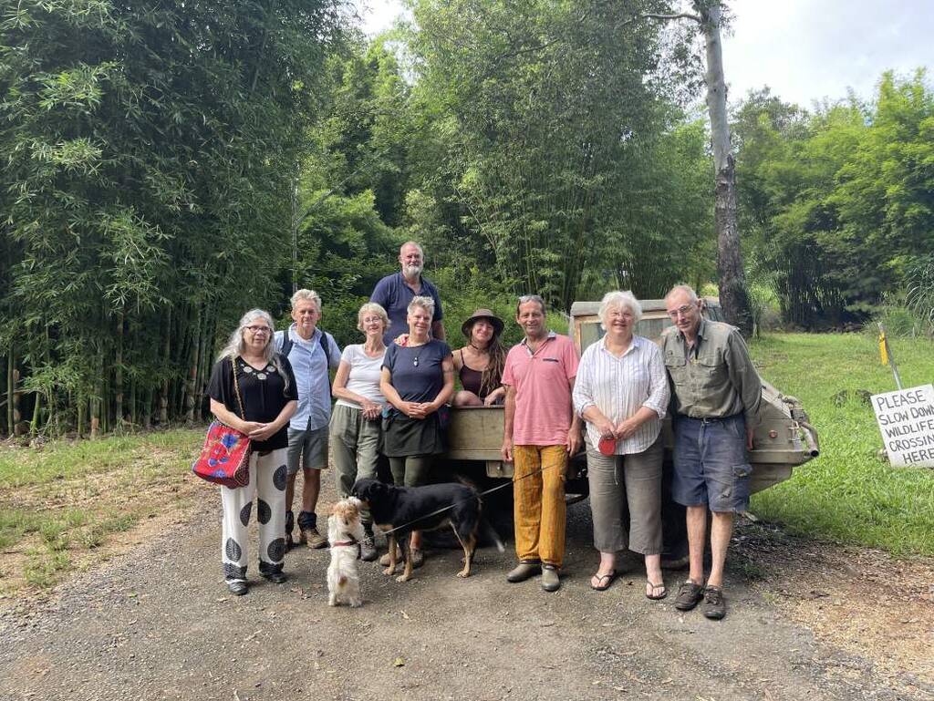
Members of the Byrrill Creek Community Resilience Team, founded by Natascha Wernick in 2020.
The scale of the program
Byrrill Creek Road is one site among thousands. Across 3 flood events, 3,989 road sites have been completed and 386 roads, bridges and culverts restored. Work continues at Dulguigan Road, Tyalgum Road, Doon Doon Road and Rowlands Creek Road, where a causeway is being replaced with a permanent bridge. Construction also began in June 2026 at Blacks Drain in South Murwillumbah, where a major betterment project will strengthen the old highway embankment, which has washed away repeatedly, including in 2017 and 2022.
Among the program's most significant completed achievements is the Kyogle Road restoration between Byangum and Uki. On that project alone 7 major slip sites were rebuilt, 22,000 tonnes of rock were moved, 3,445 gabion baskets installed, and the fully restored road was reopened in January 2025. For the broader hinterland, that reopening marked a turning point in the region's recovery.
All flood restoration works are funded through the Disaster Recovery Funding Arrangements, jointly paid for by the Australian and NSW Governments, and must be approved by the NSW Reconstruction Authority before works can begin.
Working with the environment
A number of improved waterway outcomes have been implemented following approvals from NSW Fisheries. On the Kyogle Road project and other restoration sites, Council's engineering and environment teams worked together to include natural features, hardwood timber piles and revegetation in road repair works to protect adjacent riverbanks from further erosion and improve habitat outcomes. Without that intervention, the road repairs themselves could have caused additional environmental damage downstream. It is one of many examples across the program where recovery work has been designed to consider the long-term health of the landscape alongside the immediate infrastructure need.
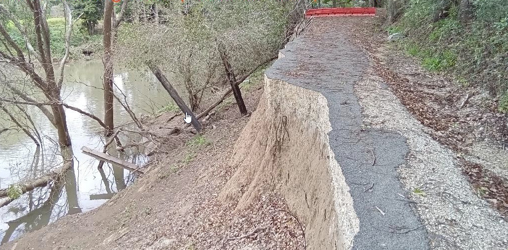
Flood Damage to Mount Warning Bridge Road.
KEY FACTS
2022 flood road damage: $257 million estimated, 3,476 sites, 84 still underway
2024 flood road damage: $16.2 million, 331 sites, 24 still underway
Cyclone Alfred 2025: $78 million estimated, 1,181 sites, 189 still underway
Combined damage bill: Approximately $350 million across three flood events
Completed to date: 3,989 roads, and 386 bridges and culverts complete
Kyogle Road: Seven slip sites rebuilt between Byangum and Uki, 22,000 tonnes of rock, 3,445 gabion baskets, reopened January 2025. Numerous other repairs along the length of Kyogle Road.
Funding: DRFA, jointly paid for by Australian and NSW Governments, approved by NSW Reconstruction Authority
ABOUT THE FACING THE RIVER SERIES
This release is part of Tweed Shire Council's seven-week flood resilience media series, Facing the River, running 19 June to 28 July 2026. Each chapter tells a different dimension of the Tweed's recovery story, across civic space, sport and wellbeing, community hubs, infrastructure, neighbourhood liveability, the natural environment and the relocation of flood-affected businesses to higher ground. Full series information at tweed.nsw.gov.au
Week 1 — Civic Heart: 19 June, 10 am
Week 2 — Sport and Wellbeing: 25 June, 10 am
Week 3 — Community Hubs: 2 July, 9:30 am
Week 4 — Infrastructure and Connectivity: 9 July, 10:30 am
Week 5 — Neighbourhood Liveability: 17 July, 10 am
Week 6 — Working with Nature: 23 July, 10 am
Week 7 — Trading Turbulent Waters for Solid Ground: 28 July, 10 am
Downloads
Caption: Kyogle Road - 2022 flood damage, rock embankment, reopened January 2025
Photo 2: Byrrill Creek Landslip
Caption: The major landslip on Byrrill Creek Road following the 2022 floods which left residents isolated for 14 days.
Caption: Byrrill Creek bridge, before and after restoration.
Photo 4: Members of the Byrrill Creek Community Resilience Team
Caption: Members of the Byrrill Creek Community Resilience Team, founded by Natascha Wernick in 2020.
Caption: Flood Damage to Mount Warning Bridge Road.
Connection to Council's Community Strategic Plan:


