Chinese Academy of Sciences
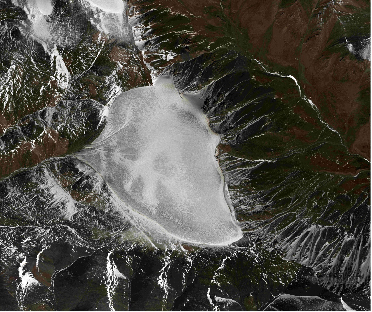
Using an aeronautic remote sensing system, Chinese scientists have obtained effective mountain glacier data during an ongoing airborne-ground science experiment on detecting the condition of Bayi Glacier in Haibei Tibetan Autonomous Prefecture, northwest China's Qinghai Province, according to the Aerospace Information Research Institute (AIR), Chinese Academy of Sciences (CAS).
It is the first time worldwide that a combined P-band, L-band, and VHF-band radar glacier detection experiment was conducted based on an airborne platform.
The experiment was jointly conducted by the Institute of Tibetan Plateau Research, the Aerospace Information Research Institute, the Northwest Institute of Eco-Environment and Resources, and the Innovation Academy for Precision Measurement Science and Technology, all of which are affiliated with CAS, and Wuhan University.
It started on March 20 and is scheduled to end in mid-May. By far, a total of 11 flights have been conducted by the aerial remote sensing system, including seven flights for P/L-band tomographic and interferometric imaging and four flights for VHF-band fluoroscopic imaging, and 4.6 TB of valid data have been acquired.
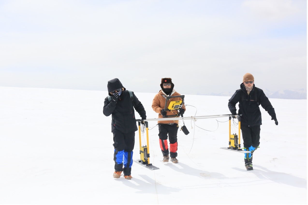
The researchers conducted simultaneous optical and LiDAR observations of the ice surface, as well as onboard instrument calibration of the ice surface, ground-penetrating radar glacier thickness measurement, and ultra-long-range 3D laser point cloud imaging.
Preliminary data analysis showed that the 3D reconstruction results of P-band and L-band synthetic aperture radar (SAR) images could reflect the changing trend of glacier surface elevation, which is basically consistent with the results of airborne 3D LiDAR and ground survey.
The VHF data provided a clear glacier profile, which could clearly reflect the interface line of atmosphere, ice surface, and bedrock, as well as the artificially placed electrical anomalies located at 80-m depth of the ice core borehole. The depth of the profile interpretation was basically consistent with the ground-sounding results.
The preliminary results showed that the experiment had validated the comprehensive observation technique of glacier characteristics, obtained valid data, and verified the feasibility of the P/L/VHF bands joint experiment.
In the future, the data obtained from the experiment will be further opened and shared in the National Tibetan Plateau Science Data Center to promote further development of remote sensing inversion methods for glacier thickness and internal structure.
Prof. WU Yirong, director-general of AIR, noted that the VHF band airborne radar onboard is China's first domestic aerial glacier detection payload independently developed by AIR. "It is also the first time a domestic remote sensing aircraft has flown above 4,500 meters in the mountain region."
This experiment showcased the capability of using aerial remote sensing to monitor glacier thickness and estimate ice reserve, marking the development of the next-generation cryosphere remote sensing technology.
The aeronautic remote sensing system, hosted by AIR, was officially put into operation in July 2021. Featuring the most comprehensive aerial remote sensing platform and scientific experiment platform in China, it has undertaken various scientific research tasks such as large-scale aviation remote sensing comprehensive scientific experiments, new remote sensing payload calibration, and disaster and environmental monitoring, and obtained a large number of valuable scientific data.
/Public Release. This material from the originating organization/author(s) might be of the point-in-time nature, and edited for clarity, style and length. Mirage.News does not take institutional positions or sides, and all views, positions, and conclusions expressed herein are solely those of the author(s).View in full here.


