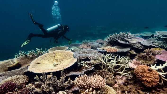
AIMS scientists monitor Australia's tropical marine ecosystems up close and personal in the water but also from a distance via satellite and from computer screens. They provide the public, managers, industry and other scientists with real time and historical data on ocean health by monitoring in water temperatures, ocean currents and waves, water chemistry, and meteorological conditions.
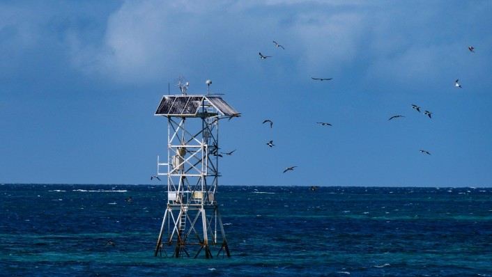
To achieve this, AIMS and partners have established an interlinked network of weather stations , moorings , buoys and other sensor-loaded devices to collect data, and assembled a team of oceanographers to coordinate efforts, and analyse and interpret the information.
It's a complex task, made more difficult by the remote locations of some of the weather stations, moorings and buoys, and the marine life all around it.
"The instruments we use operate in difficult environments and can get damaged - a tenacious barnacle can ruin months of data," said AIMS Oceanography and Shelf Processes Team Lead Simon Spagnol, who oversees a network of buoys and moorings as part of AIMS' work with IMOS (Integrated Marine Observing System) .
"You might put down a wire as thick as your thumb but when you pull it out it might have quadrupled in diameter due to barnacles and other sea creatures becoming attached. This can mess with sensors and prevent you from collecting important data.
"There are some easy fixes, like applying zinc cream or copper tape to prevent encrustations. It is important to be in problem solving mode to ensure you can collect the best data for as long as possible from these instruments."
Extreme weather
Other impediments to data collection include severe weather events, such as cyclones which have been known to wipe out infrastructure and sensors for long periods. Examples include Cyclone Yasi toppling the station at Myrmidon Reef in February 2011, Cyclone Kirrily damaging Myrmidon again in 2024, and Cyclone Debbie damaging equipment at the Hardy Reef weather station in March 2017.
And of course, these kinds of events tend to drive traffic to the AIMS website as people monitor conditions in real time.
AIMS Marine Observation Coordinator Dr Bozena Wojtasiewicz said: "People want to know what is happening and the weather stations provide a live feed of in-water temperatures, wind, air temperature, humidity, rainfall and light, as well as a webcam in some cases.
"We get about 500,000 hits to our weather station web pages every year. When a weather station goes down, we are contacted very quickly. At Ningaloo for example, we know tourism operators are looking at the read outs there daily at certain times of year because they are onto us whenever any element goes down.
"It is good to know these instruments and sensors are supporting marine safety and tourism as well as providing scientific data so we can understand these environments better."
Dr Wojtasiewicz also coordinates the distribution and collection of approximately 300 temperature loggers helping gather data on sea temperatures on Australia's reefs. These are positioned on reef slopes and flats by AIMS researchers across multiple teams and by collaborators. They are exchanged annually and more frequently if there is a coral bleaching event.
"These loggers help us to understand the water temperature variability on reefs.
Underway systems backing up satellites
"Even our research vessels have underway systems on them with the ability to measure temperature, salinity, chlorophyll fluorescence, and turbidity.
"In the summer, when there is often higher cloud cover, we cannot access the sea surface temperature data assisted by satellites. So, the underway systems provide some data where there might not be any.
"Our research vessels also transfer through areas where we have scant observations. The data can be used by modellers to help improve model accuracy, especially in the northern Australia area, because it is so remote.
"The RV Solander regularly travels to the North West Shelf, passes through Northern Territory waters and the Torres Strait. These areas don't have many observations, even though we know they have some really interesting oceanographic features and processes. That's why we're keen to learn more about them, and why it's such an important region to collect data."
AIMS physical oceanographer Dr Jessica Benthuysen , an expert in marine heatwaves, said it was vital to capture ocean temperature information as comprehensively as possible.
"Ocean temperature is one of the fundamental properties of the marine environment. If waters become too hot for too long, it can have consequences for species survival," she said.
"Fishes have the potential to escape to cooler waters, but for corals, there is no escape from marine heatwaves. Heat stress causes corals to bleach and die. That is why we need to understand what is changing about marine heatwaves and what is driving these changes.
"Warming temperatures also have consequences on water quality and chemistry. Warming temperatures at the surface can lead to increased stratification, which can result in algal blooms."
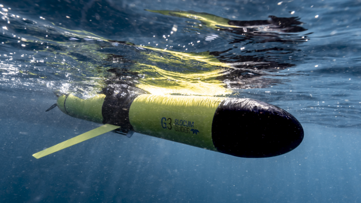
Dr Benthuysen uses products from the Bureau of Meteorology and NOAA (National Oceanic and Atmospheric Administration) alongside data from the weather stations and IMOS and AIMS moorings to monitor marine conditions and temperatures throughout the summer. She is also part of a collaborative effort across universities and government agencies to monitor conditions at key times and locations using IMOS Event Based Sampling's ocean gliders - autonomous and sensor packed devices that look like a bright yellow rocket.
"Using all these products helps us to incorporate weather conditions, currents and winds to feed into models to help us make predictions and untangle the main causes of marine heatwaves that are causing coral bleaching events. We are trying to understand when and where the maximum temperatures will occur on the reefs, and how deep they will go.
"As our predictions improve in their accuracy, it will help management agencies around Australia make more informed decisions on how they can protect and restore marine environments affected by marine heatwaves."


