The menacing band of thunderstorms that stretched across the Tennessee Valley was quickly heading south. From a makeshift operations center inside a Des Moines, Iowa, hotel, University of Miami atmospheric sciences doctoral student Cam Pine tracked the severe weather system on his laptop, alerting a team of scientists aboard a high-flying jet of its location.
With the update in hand, the pilot changed course, flying the plane not away from the storms but directly toward them. It wasn't a navigation error, but a course adjustment made in the name of science.
"We approached the bands from the north and were able to get pretty close to them—within 20 nautical miles, in fact, which was exactly the plan we wanted to execute," said atmospheric scientist David Nolan.
A professor at the University of Miami Rosenstiel School of Marine, Atmospheric, and Earth Science, Nolan is one of two principal investigators of a National Science Foundation (NSF)-funded project that, for the first time ever over the United States, studied and documented the complete lifecycle of convective gravity waves—from their creation by thunderstorms to their growth and upward movement through the stratosphere to their eventual dissipation. To accomplish their task, they flew within what some might describe as a hair's breadth of violent storms. "Close, but still far enough away that we don't experience a bumpy ride," Nolan said.
But just what are convective gravity waves, and why is it important to study them?
To start with, just think of a stone being dropped into a still pond. Just as ripples or waves spread outward in the pond when the water is disturbed, waves also form in the atmosphere when air is disturbed.
In the case of some gravity waves, the trigger mechanism is not a stone, but hills and mountains that force air upward into a layer of stable air. "Gravity pulls the air back down, and it starts to oscillate, creating a ripple effect," Nolan explained.
Thunderstorms also spawn gravity waves. But whether they are generated by terrain or violent weather systems, gravity waves can be a significant cause of turbulence experienced on airplanes, even the biggest ones. In June 1996, a gravity wave generated by wind from a distant thunderstorm shook Air Force One as it flew 33,000 feet over the Texas Panhandle, throwing passengers around and injuring a Secret Service agent. President Bill Clinton, seated in the front of the custom-built 747 when the turbulence hit, quickly fastened his seatbelt and escaped injury.
Disruptive effect
"Gravity waves can reach altitudes as high as 300,000 feet. They disrupt and redistribute vast amounts of energy and momentum from the lower to the upper stratosphere, affecting global circulation patterns and influencing weather and climate," Nolan said. "If we try to run models without accounting for them, then we get a very poor representation of our climate and weather."
Extensive data on convective gravity waves, especially those produced by thunderstorms, is sparse and not well represented in current weather and climate models. The Convective Gravity Waves in the Stratosphere, or CGWaveS, study will help correct that.
During the monthlong deployment out of Des Moines, Iowa, Nolan and scientists from Global Atmospheric Technologies and Sciences, Inc. (GATS) and Embry-Riddle Aeronautical University, along with staff from the NSF's National Center for Atmospheric Research (NCAR), flew on almost daily flights aboard a Gulfstream V aircraft, soaring close to severe weather systems and using two types of a laser-equipped instrument called a LiDAR (Light Detection and Ranging) to measure temperature variations and wind speeds of gravity waves spawned by storms.
Some of the flights lasted as long as eight hours and reached altitudes of 47,000 feet, Nolan said. Because sunlight and clouds hamper the LiDAR's ability to capture accurate measurements, the flights took off at night and never ventured into storms.
Researchers also used a set of airglow cameras to detect faint atmospheric emissions about 50 miles above Earth, providing a wide-angle view of gravity wave structures across a wide swath. "Combined, these instruments reveal the structure and movement of gravity waves in unprecedented detail," read one of the preflight reports issued by NCAR. "Meanwhile, atmospheric sensors aboard the aircraft are measuring gravity waves along with real-time turbulence and composition data at flight level, helping researchers understand how breaking waves mix air between the troposphere and stratosphere."
NASA satellite imagery, weather radar, high-resolution weather models, and advanced computer simulations will aid researchers in interpreting what they observed and measured in the sky.
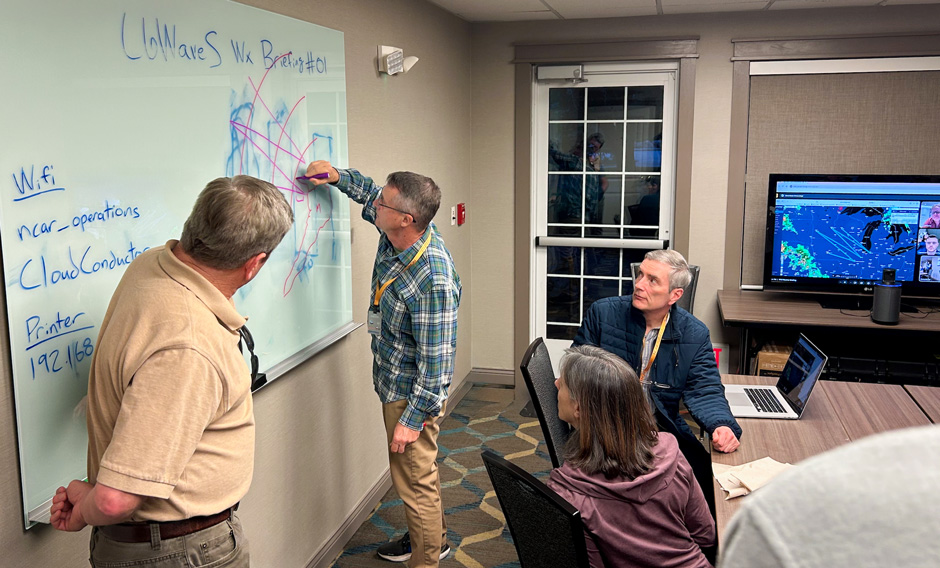
Pine, the Rosenstiel School doctoral student, acted as a meteorologist during the deployment, monitoring weather in the region in real time, which allowed Nolan to create intricate flight patterns for each mission and to adjust those patterns on the fly when necessary.
It was a role Pine said he was "extremely comfortable with and prepared for." Through the National Weather Service's Pathways Program for students, he has interned during the past three summers at the agency's Miami and Phoenix field offices. "This deployment helped to bolster my knowledge on storm systems, which originated when I was 6 years old growing up in Fort Lauderdale and Hurricane Wilma struck the area," Pine said.
Rosenstiel School assistant scientist Yi Dai, who earned his Ph.D. from the school in the dynamics of tropical cyclones, also played a critical role in the project, operating the airglow camera that detects atmospheric emissions.
"For me, this project takes me back to my childhood," Dai said. "I was born and raised in a city in China that wasn't located on the coast but was still impacted by hurricanes. And that's what sparked my interest in this type of research. What I'm excited about for this campaign is that instead of sitting behind a desk and conducting storm simulations, I was able to monitor the very phenomena I'm interested in."
Ideal location
The scientists couldn't have been in a better location for the study. "We were located at the big source of the severe storm season," said Nolan, referring to the multitude of thunderstorms that occur in the Midwest region during this time of the year.
A 2014 experiment that measured the dynamics of gravity waves over New Zealand is the genesis of the NSF-funded CGWaveS, which struggled to get off the ground when it was awarded four years ago. The COVID-19 pandemic and technical problems with the Gulfstream V aircraft delayed the mission until this year.
"There have been a lot of evolutions over the course of the last couple of years, and that delay in the field program enabled us to dramatically improve the LiDAR lasers," said atmospheric scientist and CGWaveS principle investigator David Fritts, the founder of GATS, Inc. who led that earlier campaign in New Zealand. "Whereas, initially, we would have had only a single laser viewing vertically, we had two different lasers viewing both vertically and forward, and that gave us a dramatically expanded measurement capability."
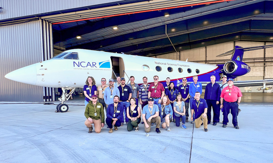
All told, some 40 scientists, researchers, technicians, engineers, and others participated in CGWaveS, with NCAR's Earth Observing Laboratory handling the mission's logistics and providing the HIAPER (High-performance Instrumented Airborne Platform for Environmental Research) Gulfstream V jet on which scientists flew.
"We worked closely with the scientists to bring this campaign to life," said NCAR project manager Pei-Sang Tsai. "From pilots and aircraft mechanics to aeronautical engineers, instrument technicians, and scientists, our staff at NCAR is extensive. So it's been rewarding to bring all the parts together to help the researchers learn more about one of the atmosphere's most mysterious forces."


