The Law of the Sea recently played a major role in a long-running territorial dispute that led the United Kingdom to agree to return sovereignty of the Chagos Islands to Mauritius, paving the way for island residents exiled in the 1970s to return home.
The court case also explored the application of maritime boundaries to submerged reefs, which could prove significant as sea levels rise, says Dr Constantinos Yiallourides, a Macquarie University legal scholar and expert in maritime law.
The ripple effect: A new court ruling which looked at the application of maritime boundaries could have consequences for archipelagic states.
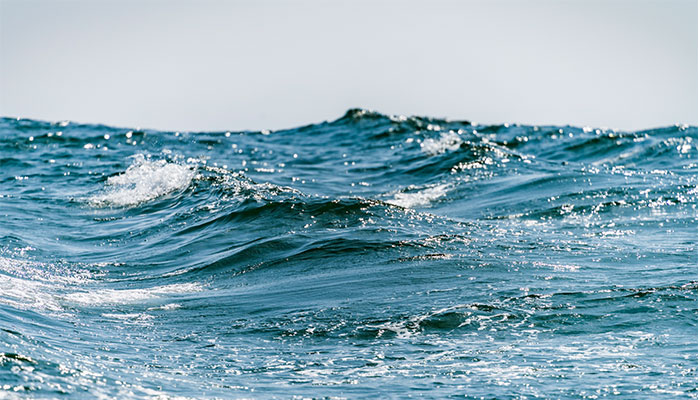
The oceans occupy more than two-thirds of the Earth's surface, with most of that area known as the 'high seas' – the international waters extending beyond the national boundaries and laws of any one country, and subject to the law of the sea.
International laws established over many centuries regulate transport, fishing, mining and military access and use of our oceans, and are embodied in the UN Convention on the Law of the Sea, adopted in 1982 and now ratified by 167 countries.
The UK's retreat follows a dispute heard in the International Tribunal for the Law of the Sea, based in Hamburg, after years of legal tussles in international courts over the remote Indian Ocean archipelago.
Rising concern over coastal countries
International maritime boundaries now surrounding coastal countries involve onion-rings of rights that expand closer to shore, with fishing and mining rights extending 200 miles offshore, and scientific and military rights limited to 12 nautical miles from the coast.
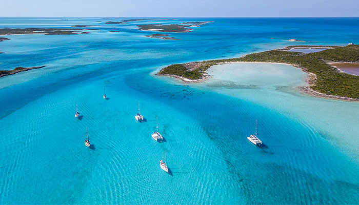
Big blue: The Bahamas was one of five original countries designated as an archipelagic state.
Archipelagos are a special case, defined by boundaries that extend beyond the outermost 'drying reefs' where land remains permanently above water at high tide.
This means that by establishing that Chagos Islands form an integral part of Mauritian territory, Mauritius has now expanded its ocean rights hugely, Yiallourides says. But defining these boundary lines has been contentious.
International wrangling
Following a UN decision in the International Court of Justice in the Hague that Mauritius had ownership of the Chagos Islands (which the UK contested), Mauritius asked its oceanic neighbour, Republic of Maldives to define its maritime boundaries with Chagos.
Disagreement over who owned the vast fishing grounds of some 100,000 square kilometres that lay between the two nations, led Mauritius to take the Maldives to the International Tribunal for the Law of the Sea for a resolution.
"The Maldives became entangled in 'law-fare' over Mauritius and the UK's claims to the Chagos Islands. The Maldives argued that certain points Mauritius claimed as its boundary were based on tiny island reefs that disappear at high tide. However, Mauritius argues that these smaller features form part and parcel of the archipelago and can't be ignored," says Yiallourides.
To completely ignore certain territorial features of the archipelago on the basis that these are submerged under sea level could send a distress signal to other small low-lying island nations affected by sea-level rise.
"Mauritius says it is entitled to locate base points on its outmost drying reefs, to be used in drawing its boundary with the Maldives. But the Maldives counters that territories below water at high tide don't form part of the land territory of a State in a legal sense, so cannot be included in maritime delimitation."
While the UK has now finally agreed to transfer the colonised Chagos Islands back to Mauritius – the boundary demarcation dispute with Maldives continues.
Public hearings in this case were completed on October 24, and the Special Chamber of the International Tribunal for the Law of the Sea is now deliberating on the case.
Rules determining boundaries of archipelagos were adopted at the 1982 Law of the Sea Convention in Montego Bay in Jamaica, and now form part of a binding international legal instrument.
Archipelagic states are those countries made up entirely of islands – and the Law of the Sea treats these differently to other coastal states, with all islands, reefs and waters contained within the baselines drawn around the outer islands of a state treated as the internal waters of that state – even if they are hundreds of kilometres apart.
The famous five
The five original countries designated as archipelagic states were the Bahamas, Fiji, Indonesia, Papua New Guinea and the Philippines, and 22 countries now claim archipelagic status.

Specialist: Dr Constantinos Yiallourides, pictured, is a Macquarie University legal scholar and expert in maritime law.
Yiallourides says this is the first time that an international court or tribunal has been tasked with delimiting the maritime boundary between two archipelagic states – both of them small, developing island nations confronted with the effects of climate change and sea-level rise.
"To completely ignore certain territorial features of the archipelago on the basis that these are submerged under sea level could send a distress signal to other small low-lying island nations affected by sea-level rise. This boundary ruling could have far-reaching implications in international law."
Dr Constantinos Yiallourides is a lecturer and internatational law scholar with a particular focus on the Law of the Sea, Environmental & Natural Resources law at Macquarie Law School.