
When a vessel goes missing, wind and current forecasts can narrow the search. Maritime experts from 11 countries examined how weather information reaches rescue teams and ships.
When severe weather threatens people at sea, an accurate forecast is only the first step to getting useful information to the people who need to act on it. Information must travel from observing and forecasting systems to maritime authorities, rescue coordinators and ultimately to people navigating at sea. Every link in this chain matters. A delay, a communication gap or information that cannot be translated into action can reduce the value of the forecast.
Across the Americas, meteorological, oceanographic and maritime services are working to strengthen these connections. A World Meteorological Organization (WMO) regional learning initiative held from April to August 2026 brought together experts from 11 countries to examine how each part of the maritime safety chain works in practice.
When information leads to decisions
Search-and-rescue operations show how weather and ocean information guide decisions in an emergency. When a vessel or person is reported missing at sea, responders need to determine where winds and currents may have carried them and where to concentrate search efforts.
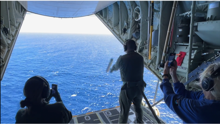
Examples discussed during the regional initiative showed how this works in practice. The United States Coast Guard uses environmental data from ocean and meteorological numerical models in its Search and Rescue Optimal Planning System (SAROPS). Combined with information on currents, winds and drift, these data help responders estimate possible trajectories and plan search areas more effectively.
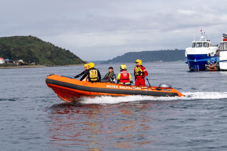
In Chile, real cases shared by the Maritime Authority showed how meteorological and oceanographic information feeds directly into operational decisions during maritime search-and-rescue operations and aquatic environmental emergencies. Drift modelling tools, including open-source OpenDrift framework can help track how people, objects or pollutants move at sea.
Similar tools can be used to manage marine pollution incidents, such as oil spills or other hazardous releases, by estimating where pollutants may spread. In Argentina, satellite imagery, ocean currents and meteorological data are combined to track marine pollution and guide emergency response.
Reaching people at sea
Forecasts and warnings are only useful if they reach the people who need them in time to act. Across the region, maritime services use radio, satellite and digital technologies to distribute Maritime Safety Information to vessels at sea.
Experiences from Brazil, Chile and Peru show how different communication systems can complement one another to transmit forecasts and warnings to vessels. These include NAVTEX, an international radio service that automatically transmits navigational and weather warnings to ships, as well as high-frequency and very-high-frequency radio and satellite services.
The National Hurricane Center in the United States provides information on hurricanes, strong winds and dangerous seas, helping maritime users avoid hazardous areas and adjust their routes.
Effective communication also depends on knowing who receives the information and how they use it. In Colombia, the General Maritime Directorate (DIMAR) highlighted the need to better characterize maritime communities, their vulnerabilities and how they access warnings. Information must not only reach users, but also be clear, accessible and relevant to the decisions they need to make.
Building the maritime safety chain together
The nine-session initiative was organized by the Expert Team on Marine Meteorology and Oceanography of the WMO Regional Association III . Initially developed for South America and opened to Spanish-speaking countries across the Americas, it brought together more than 80 participants from 11 countries, including meteorological and hydrological services, maritime and hydrographic authorities, search-and-rescue specialists and ocean experts.
The exchange highlighted the foundations of effective maritime services: sustained ocean and atmospheric observations, cooperation between institutions, trained personnel and regular service evaluation. Participants also considered emerging Electronic Navigational Chart standards and the International Maritime Organization's Member State Audit Scheme , as well as the fundamental role of ocean observations in supporting forecasts, warnings and emergency response.
The central lesson was simple: maritime safety depends on a connected chain. Observations must become reliable forecasts; forecasts must become timely warnings; warnings must reach the people who need them; and those people and institutions must be able to act on them.


