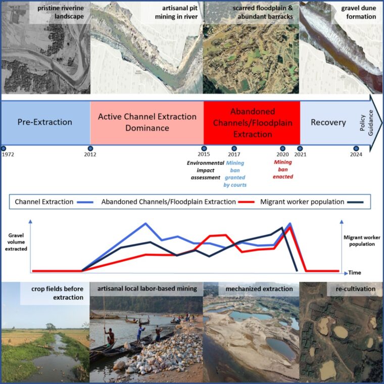
A new study using multidecade satellite imagery and face-to-face human interviews tracked the environmental and societal impacts of gravel mining in the Lubha River, Northeast Bangladesh. The researchers found that the river had recovered its natural shape within just four years after gravel mining stopped. However, the local economy did not bounce back nearly as quickly.
The study, published in the journal Cell Reports Sustainability, documents both environmental and societal outcomes and offers recommendations for the extraction of natural resources while minimizing their burden on the land and the people who live there.
University of Illinois Urbana-Champaign professor Jim Best, who's research involves using satellite imagery to study the mutual relationships between rivers and people, collaborated with U. of I. graduate student Sadiul Chyon and Shah Atiqul Haq from Shahjalal University, Bangladesh, to highlight that decades of research have shown that mining too much sediment too quickly changes the river shape and ecology, and causes highly accelerated rates of downstream erosion.
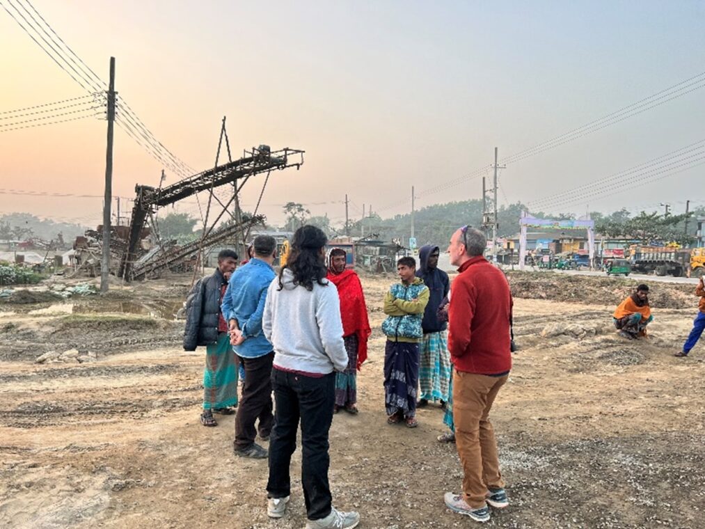
The new methodology uses historical and contemporaneous satellite imagery to monitor landscape changes and estimate the number of migrant workers involved in gravel mining. This, combined with interviews with the locals and an environmental pressure group, helped develop a design for a fairer, more sustainable model for river sediment extraction in the Lubha River.
"Rivers are mined for sand and gravel to support construction projects in regions of economic growth, and the profits and jobs they provide can be a major economic and societal driver for a region," Best said. "It is a worldwide practice but is particularly common in developing countries experiencing rapid growth."
Before coming to the U. of I., Sadiul worked as an engineer in Bangladesh, designing embankments to shore up erosion in densely populated areas downstream of these types of mining operations.
"Resource extraction, which is necessary for economic development, has huge implications for the physical landscape and for the people living there," he said. "I got to see firsthand how years of intensive sand and gravel extraction led to river degradation, loss of farmland and often yielded an economic dependence on mining."
Then, in 2021, the Bangladesh government enacted a ban that halted gravel extraction in the Lubha River.
"The ban forced a compromise between need and destruction," Sadiul said. "When enacted, local incomes and livelihoods were destroyed. The people had no other source of income, and many resorted to illegal activities, such as sugar smuggling. I spoke with students who said they had to quit school to find jobs to support their families because of the abrupt nature of the ban and lack of communication between locals and policymakers."
The study found that 95% of locals reported unemployment after the ban, 88% pointed to economic decline, and 73% petitioned to reopen mining operations.
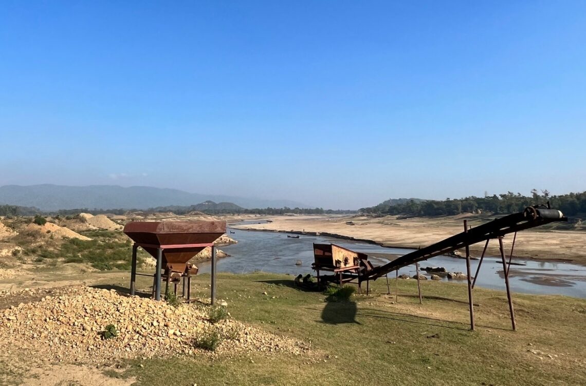
Access to historical and contemporaneous satellite imagery allowed the team to observe the progress of gravel extraction at high resolution in both time and space. In the past, researchers have treated river extraction as a bulk process, viewing the river as a single channel, and have not examined the river's recovery after mining operations have ceased.
"But rivers don't work like that," Best said. "They contain many channels, some active, some inactive. What we're able to determine is how much material was being removed from individual channels versus how much would have been coming into the system via natural processes."
In this case, like so many others, the team found that too much sediment was being removed too quickly. In addition, the study documented that operators accelerated extraction in anticipation of the mining ban, resulting in an unintended negative consequence of the regulation.
The new approach allowed the team to develop a series of evidence-based recommendations to improve the river mining process and minimize environmental and human impacts, which can also be applied to other rivers in rapidly developing regions. These recommendations include where and how to mine, how much to mine, how to strengthen monitoring using remote sensing, better governance through community engagement and suggestions for managing the long-term transition.
The U. of I College of Liberal Arts and Sciences and the Jack and Richard Threet Chair in Sedimentary Geology funded this research.
Best is affiliated with earth science and environmental change, geography and geographic information science, mechanical science and engineering, civil and environmental engineering and the Center for Latin American and Caribbean Studies at Illinois.


