
Riley Culberg spends much of his research time looking below the surface of glaciers, using radar to extract information hidden within layers of snow and ice. Beginning next year, that expertise will contribute to a large NASA effort to understand how rapidly changing glaciers are responding to a warming climate - and what those changes could mean for future sea-level rise.
Culberg, assistant professor of earth and atmospheric sciences in the Cornell Duffield College of Engineering, is a member of the science team for Snow4Flow, a new NASA Earth Venture Suborbital mission led by the University of Arizona. The five-year project brings together researchers from 12 U.S. universities and NASA to study glaciers in Alaska, the Canadian Arctic Archipelago, Svalbard and southeastern Greenland.
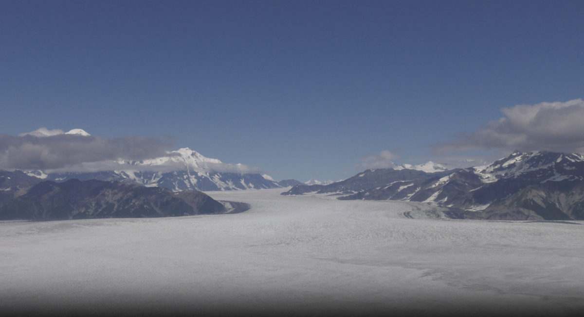
Alaskan glaciers photographed during the 2018 Operation IceBridge Alaska campaign.
Beginning in spring 2027, researchers will use aircraft equipped with ice-penetrating radar and other instruments to survey major glaciers across the four regions. Field teams will also make measurements directly on selected glaciers. The campaign will continue through 2029, followed by two years devoted largely to analyzing the resulting data.
"The overarching goal of this project is to better understand how rapidly changing glaciers in mountainous regions are contributing to sea level rise," Culberg said. Many of the glaciers targeted by Snow4Flow are changing quickly but remain poorly surveyed, leaving scientists without some of the basic information needed to model their futures.
Snow4Flow is designed to fill two particularly important knowledge gaps: how much ice glaciers contain and how much new snow they receive. NASA estimates that meltwater from glaciers, as distinct from the much larger Greenland and Antarctic ice sheets, currently accounts for more than 20% of sea-level rise. Yet projecting their future behavior requires better measurements of their present condition.
The mission will use a Basler aircraft carrying a laser altimeter and multiple radar systems to measure ice thickness, the topography beneath glaciers and snow accumulation. Those observations will ultimately be combined with satellite data and computer models to improve projections of glacier change through the end of the century.
Culberg's group will concentrate on the "snow" half of Snow4Flow.
A high-frequency radar aboard the aircraft will provide cross-sectional images of roughly the upper 10 to 15 meters of a glacier. To Culberg, those images should resemble a layer cake, with radar reflections marking boundaries associated with successive years of snowfall.
"Each of those layers is basically telling us the depth of the snow that got dropped this last winter," Culberg said. "Each layer corresponds to roughly one year's worth of snow."
His team will develop methods to identify those layers efficiently and convert their thickness into estimates of snow mass. That requires knowing not just how deep the snow is, but its density - something influenced by temperature, wind, snowfall history and the way snow compacts over the winter.
Ground teams will help provide that missing information by drilling snow cores, digging snow pits and making other measurements while aircraft surveys are underway. In some locations, small drones carrying radar will add another scale of observation between measurements made on the surface and those collected by the aircraft.
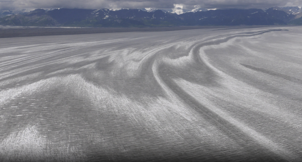
Striations on top of an ice sheet in Alaska captured during Operation IceBridge Alaska.
Gili Kurtser Gilead, a doctoral student who joined Culberg's group this fall, is already analyzing historical radar observations and developing a processing pipeline that can eventually be applied to the new Snow4Flow data.
"I'm developing tools to identify snow layers in radar images and estimate snow accumulation," Gilead said, "and as a first-year doctoral student, I'm excited to contribute to research that combines algorithm development with real-world measurements of how glaciers are changing."
Culberg is also collaborating with researchers at Georgia Tech and the University of Florida, including experts in geostatistics and machine learning. Their challenge will include turning measurements collected along individual aircraft flight lines into estimates covering entire glaciers, making the observations more useful for climate and glacier models.
The first flights are expected in late April 2027, with Culberg anticipating that processed data could reach his group that summer. Additional campaigns are planned for spring 2028 and 2029.
For Culberg, Snow4Flow represents a rare opportunity. Ice-penetrating radar has been his primary research tool since graduate school, but much of his work has relied on existing observations collected during NASA's Operation IceBridge, which ended in 2019. The United States has not undertaken a comparable large-scale airborne collection of glacier radar data since then.
"I was really excited to see this project come through because it's an important opportunity to get new data as we continue to see the climate changing," Culberg said.
Snow4Flow is especially well matched to Culberg's research because it explicitly prioritizes the near-surface portion of glaciers. Previous radar campaigns were often designed primarily to measure total ice thickness and the terrain beneath the ice; Culberg and others subsequently found ways to extract information about near-surface processes from data that had not necessarily been collected for that purpose.
"We have an exciting opportunity in this project to actually prioritize the near-surface as one of the reasons we're collecting," he said.
The project may also advance radar science itself. Mountain glaciers present difficult conditions for radar: signals can bounce off steep valley walls, crevasses can disrupt otherwise recognizable layers and snow accumulation can vary dramatically across short distances. Culberg expects those challenges to drive improvements in both radar observations and data-processing methods over the course of the mission.
Ultimately, though, the new measurements are intended to answer much larger questions.
Scientists devote considerable attention to Greenland and Antarctica because of the enormous quantities of ice they contain. But smaller mountain glaciers are changing particularly rapidly and can be difficult to measure and model because of their complex surroundings.
"I hope it will allow us to better understand how these peripheral, smaller glaciers are collectively contributing to global sea level rise," Culberg said. "That is ice that could have a bigger impact in the next few decades than Greenland or Antarctica."
Snow4Flow, he said, should provide some of the "grounding data" scientists need to better understand those changes - measurements that can then be incorporated into atmospheric and glacier models to sharpen projections of what comes next.


