
Key points
- CSIRO has a fleet of around 160 drones in use across Australia in different research areas.
- The drones have allowed scientists better access, greater scope, more efficient ways of working and the ability to scale up the data collected.
- Drones have also delivered a lot more environmental data.
CSIRO's chief remote pilot has never flown a plane.
Amanda Meys oversees almost 100 other remote pilots across Australia's national science agency.
The aircraft they fly are not planes or helicopters – but drones.
Around 160 of them – up from 25-30 in 2020.
And CSIRO is not alone.
According to Civil Aviation Safety Authority (CASA) figures there are close to 45,000 remote pilot license holders, not including recreational drone users. Up from 16,500 in 2020 and less than 3,300 in 2016.
In a short space of time, drones have changed the way we see our world – and in many cases, the way we do environmental research and collect data.
Coming out of winter, we're entering drone season once again.
RPAS, UAV or drone
Whether they're called remotely piloted aircraft systems (R-PAS), uncrewed aerial vehicles (UAVs) or just drones, through the 2020s they've proliferated as they've become cheaper and easier to use.
Though not yet autonomous, the gamechanger for researchers is what drones are now able to carry.
"The drones themselves haven't changed much, but the software and the technology and the camera systems have certainly advanced," says Ms Meys.
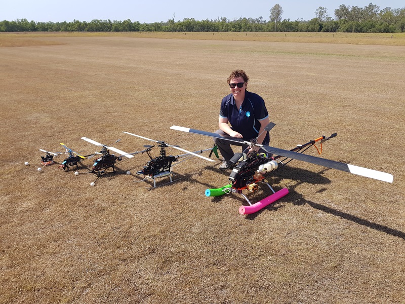
For CSIRO's chief remote pilot, that now means managing and maintaining the fleet, training CSIRO's certified remote pilots, overseeing compliance and approving work plans to ensure each flight is safe, legal and conforms with regulations.
"I was involved from day one around 2019. Even though I'd never flown a drone before I joined the project," recalls Ms Meys.
"I've also never been a pilot, but I'm an avionics technician by trade, which is conducting maintenance on aircraft, mainly dealing with electrical, radar and radio systems."
Today's fleet of 160 drones range from 2 kilograms to more than 100 kgs and can include night flying.
"Aviation has been a passion since I was small," she says.
"I look back and imagine that little kid would be very excited to be part of an industry that is growing and using drones in CSIRO for so many different things which makes it so interesting."
Counting koalas
Take koalas. They can be very hard to find.
From the ground, researchers rely on that "pair of headlights", the koala's eyes staring back at the flashlight from the dark. Without that, they can be invisible, says CSIRO field ecologist Eric Vanderduys.
His team uses acoustic recorders to pick up the bellowing sounds of males, up the east coast from Victoria to New South Wales and Queensland. But the acoustic recorders detect the presence of koalas, they don't help with numbers.
The team started using drones in 2022 and they've brought two advantages.
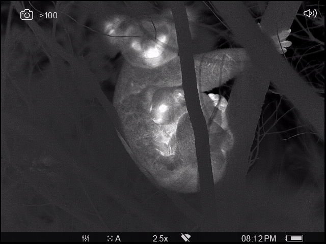
Firstly, they can go where humans can't, up above the canopy and, second, carrying thermal imaging equipment they can 'see' what humans can't.
"The idea is you have a thermal drone that detects difference in temperature under the range of conditions where it is overcast or it has rained and you're out early and you get real hot spots in the trees," says Vanderduys.
"It allows you to see not every single koala but a much greater percentage than you would see walking along the ground in the daytime."
There is a third advantage. Drones are programmed to cover their tasks in straight lines called transects, up and down like a lawn mower – which is repeatable.
"In 10-years' time we can repeat that from A to B, at the same height, same resolution, and compare numbers."
That is how scientists can help monitor and model population numbers for decisions around species protection.
Mapping biodiversity
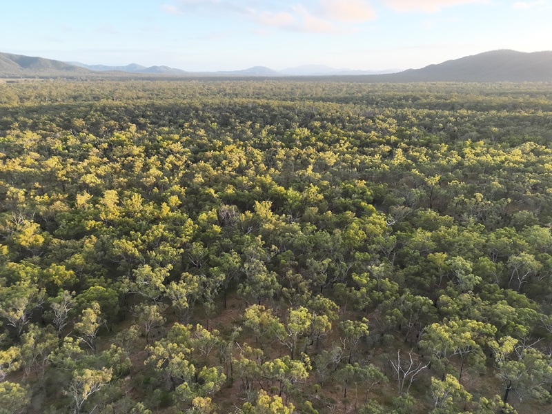
A challenge facing environmental scientists can be the sheer size of the area they are studying.
Where once he trudged on foot with heavy equipment or contracted expensive light planes, Senior Principal Research Scientist Dr Shaun Levick now uses LiDAR imaging from large drones over the vast and remote landscape across Australia.
Light Detection and Ranging (LiDAR) is a remote sensing technology that uses rapid laser pulses to measure distances and create precise, three-dimensional maps.
"I didn't jump straight into drones, because the quality of lightweight LiDAR sensors wasn't there in the beginning," says Dr Levick.
"But that changed around 2021 with the introduction of the Riegl VUX-120 sensor that really enabled similar quality of measurement that you could do on the ground to be collected from the air. What that meant is we could take our individual tree measurements and modelling, and where it used to take us about three hours to collect one hectare of data, we can now do 100 hectares in about 30 minutes. So, it's a massive increase in productivity."
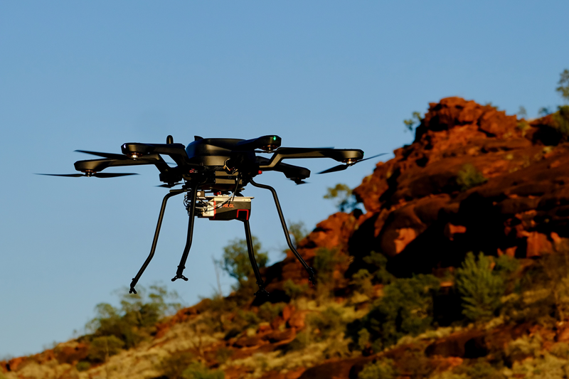
The LiDAR sensor maps the 3D structure of land and the vegetation to an incredibly high level of detail, with more than 1000 points per square metre, enabling measurement of individual tree height, crown diameter and even the stem diameter.
Dr Levick has done population-level estimates of rare tree species such as red cabbage palms in the unique Palm Valley in the Finke Gorge National Park as well as the Acacia Peuce, one of Australia's slowest growing tree species, in the Matt Clark Conservation Area.
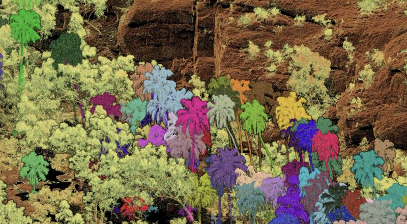
That degree of information not only allows him to map protected or unique species for conservation, it also enables him to estimate the biomass and standing carbon with applications in carbon accounting.
Collecting data of large areas, up to 1000 hectares in a fieldtrip, they also use the data to train satellite-based imagery which validates models built over much larger areas with satellites, such as on-ground calibration for NASA-ISRO's NISAR L-band SAR mission and the European Space Agency's BIOMASS P-band SAR mission.
Modelling the coast
Using drones along the coast, by contrast, is not an easy task.
Already, drones have a limited flight time but there is always the weather.
"When I say weather, we mean wind," says Ms Meys. "The wind is what precludes a lot of drone flights; the smaller the drone, the less wind it can handle, and you can't fly."
Coastal Research Scientist Dr Paul Branson is based in Western Australia and studies oceanography to understand coastal circulation and waves which is then used to model how coastal ecosystems change.
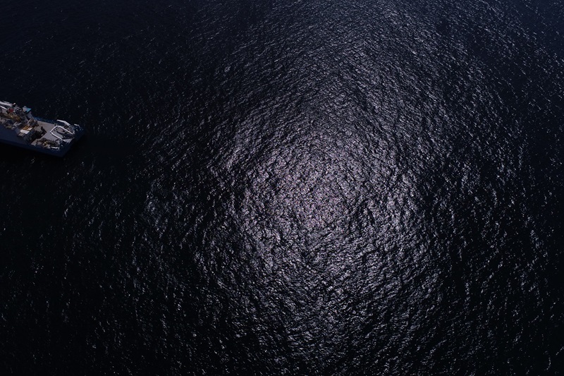
He needs wind because wind is a factor in the currents and wave motions he studies. Too much wind, and a drone is hard to control. About 10 knots is the sweet spot, he says; not during extreme conditions but under general conditions to understand how the system evolves so they can improve ocean models and understand longer-term changes in sediment movement and benthic or seafloor habitat.
"The ocean is never static, and our coastlines evolve on a wide range of time scales which makes planning decisions difficult," he says.
"We use drones in the study of the physical processes that operate in the water, the waves and current and bathymetry (or seafloor). We equip them with cameras that observe a variety of wave lengths of light and use them to observe the signatures of ocean waves and the seafloor. We're wanting to understand the waves and currents and how they move tracers (like sediment or plankton) through the ocean and coastal zone."
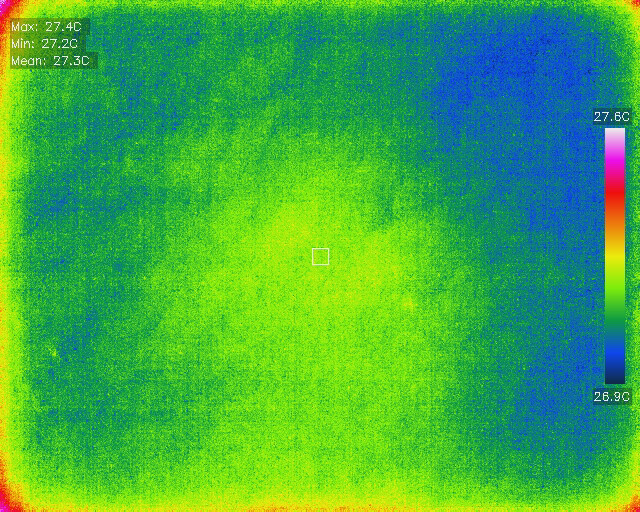
Drones can't provide the broad scale context of a satellite view, but navigation and positioning systems means drones can be deployed on demand at a site over several hours, across a tide or a day, and target processes a satellite can't.
For example, they can monitor the disturbance associated with dredging projects or harmful blooms and in other cases geomorphological features that evolve on decadal time scales that are now erosion hotspots.
Breeding cotton
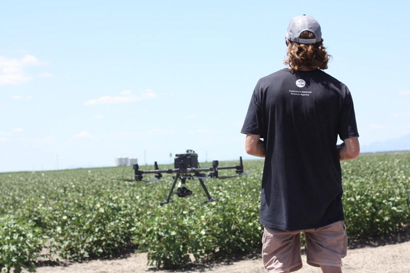
In agriculture, especially broad acre farming, drones are well established as the new workhorse.
In CSIRO cotton research they're being used in crop management, applying herbicides and pesticides, useful for spraying specific areas or when the field isn't accessible and helping with the workload.
As Ms Meys says, drones have an important role to play in some industries today in terms of health and safety.
"The growing season for cotton is in summer and they used to have to get fully dressed in chemical suits and hand spray crops. Now they can use drones to do that," she says.
But they're also being used as a new part of the kit in precision farming.
Research Scientist Dr Warren Conaty says his team initially contracted out drone services but quickly realised how many different data streams could be collected and has now built up a small team of pilots.
Loaded with multispectral cameras, drones catch a wider range of wavelengths that can characterise the environment and measure the performance of each individual line of cotton.
"In a breeding program, the traits you see or measure, what we call a phenotype, is a combination of the genotype (the DNA information), and the environment," says Dr Conaty.
"If you can capture the environment and how that interacts with the individual plant through these multispectral signatures, you can potentially improve the accuracy to which predictive algorithms can identify the superior breeding lines."
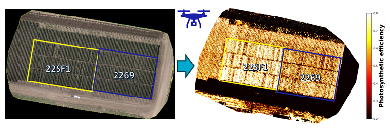
The team is also using hyperspectral imagery for the identification of disease pressure and sources of genetic resistance.
They're also using LiDAR cameras to measure the growth characteristics of the lines in the breeding program early in the season looking for establishment and vigour, and later in the season for growth and structure of the canopy.
"If you wanted to summarise it, the use of drones is about getting a finer-scale resolution on how the plant is growing in relation to its environment, so we can better identify breeding lines with the important characteristics required in commercial varieties."
Just scratching the surface
"When I first started there were only a couple of people," says Ms Meys.
"Now across CSIRO we use drones for so many applications and that's probably the best thing about them. They are useful in terms of so many different scenarios. We have just scratched the surface."


