
Falling river levels in the Brazilian Amazon during periods of severe and extreme drought can alter the way of life of the communities that depend on them, from food and income generation to mobility and access to essential services.
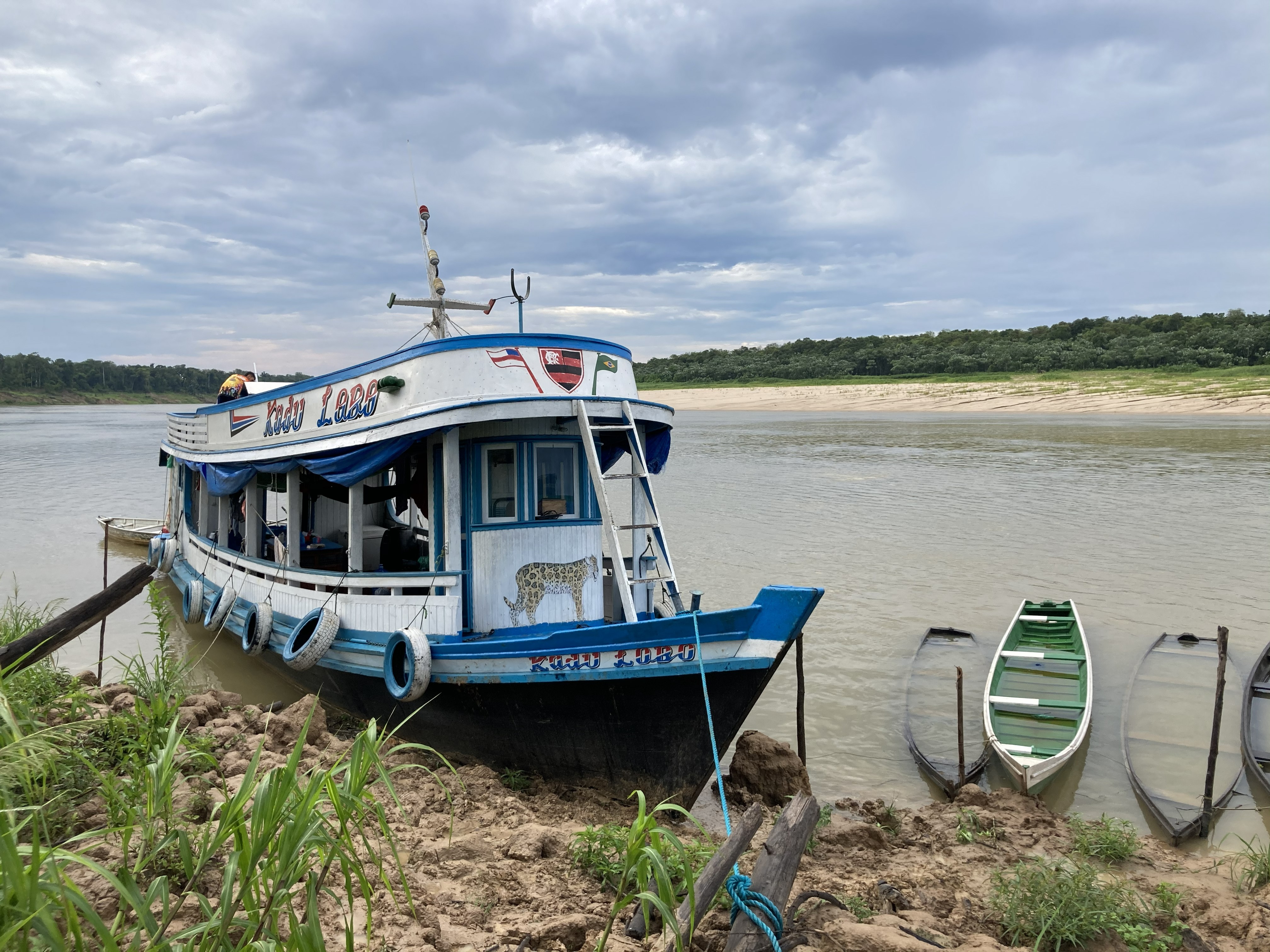
Given this major concern, a new international report produced by ICTA-UAB, in collaboration with IOM (the UN Migration Agency), the National Centre for Monitoring and Early Warning of Natural Disasters (Cemaden), Humboldt-Universität zu Berlin (IRI THESys, HU-Berlin), and the Universidade Federal de Minas Gerais, with support from the Brazilian Research Network on Global Climate Change (Rede Clima), makes it possible to identify the localities where falling river levels during El Niño months can increase the risk of immobility.
The "Drought and Immobility Risk in the Amazon Basin" report inaugurates a series of monthly editions that will be published throughout the coming Amazonian dry season. Each edition aims to track how hydrological conditions evolve and their possible impacts on the mobility of Amazonian communities, as well as provide information to support planning and decision-making by public managers and professionals working directly with vulnerable populations.
Amazonas State concentrates localities prone to immobility
The concept of involuntary immobility, used in preparing the report, refers to situations in which people or communities cannot leave their place of origin or residence in the face of extreme weather events or other types of disaster. Of the municipalities analyzed, São Gabriel da Cachoeira, in the state of Amazonas, Brazil, concentrates the highest number of localities prone to becoming isolated: 343, of which 318 are indigenous. It is followed by Lábrea, with 72 localities; Manicoré, with 68; Fonte Boa, with 66; and Atalaia do Norte, with 64. The analysis also identifies areas of concern in the states of Acre, Rondônia, and Pará.
The report goes beyond analyzing the intensity of droughts and identifies the places where a prolonged drop in river levels would generate mobility problems for populations. To this end, localities are considered prone to immobility when they are less than five kilometers from rivers and floodable areas, more than five kilometers from roads, and in areas where river levels are forecast to remain below historical patterns for prolonged periods. The analysis is based on data from 90 fluviometric stations.
As researchers Letícia Santos de Lima and Wilson Fernandes explain, "the method developed, which is still being refined, makes it possible to identify the localities most dependent on river and wetland navigation due to their geographic isolation, as well as those where water levels are expected to remain below normal for an extended period of time during the month analysed. Over the coming months we will work to refine these results, and we hope they can support decisions on assistance to communities."
Drought can affect mobility, agriculture, and access to services
The study also crosses data on the location of communities prone to isolation with drought alerts for family farming issued by Cemaden. The combination makes it possible to identify areas where the effects of drought can simultaneously hit agricultural production and mobility, suggesting a greater risk to food security.
"The Alerta-Secas platform estimates the potential impacts of drought on family farming, integrating drought intensity, local vulnerability, and the forecast of worsening conditions. The tool allows identifying municipalities at risk of losses in short-season rainfed crops, supporting early action to reduce productive, social, and economic impacts," explains Ana Paula Cunha, institutional relations coordinator and drought researcher at Cemaden.
The scenario gains relevance in light of the weather conditions forecast for the coming months. According to the El Niño Panel 2026-2027, there is a 95% probability of a very strong El Niño event occurring in the October-November-December quarter. The phenomenon could rank among the most intense recorded since 1950.
The latest data from Cemaden also point to the fact that special attention should be paid to Brazil's North Region. On October 7, levels of main rivers were at conditions near or below the climatological average in the region, with a growing number of stations showing levels far below average in the northern part of that area. For November, the forecast indicates a predominance of flows below or far below average across much of the North Region. Cemaden's monitoring shows that drought affects indigenous areas. In September, 170 of the 275 units monitored experienced drought, equivalent to 61.8%.
"When rivers fall, the impacts for many Amazonian communities can extend to various dimensions of life, including access to essential services. By identifying in advance where there is a risk of conditions worsening, we want to contribute to the planning and implementation of solutions tailored to the needs of the affected people," explains Débora Castiglione, National Officer for Environment, Climate Change, and Disaster Risk Reduction at IOM.
"The launch of the Drought and Immobility Risk in the Amazon Basin bulletin seeks to expand monitoring capacity and support institutional responses to the climate crisis in the region. The initiative gives visibility to vulnerable populations in the Amazon, especially indigenous communities affected by isolation and involuntary immobility caused by extreme droughts. By bringing together expertise in disaster anticipation and impacts on family farming, the bulletin strengthens climate governance and provides input for preventive and humanitarian protection policies, reaffirming the commitment of science and human rights to the future of the Amazon," notes Érica Menero, from Rede Clima.
Access the full bulletin here: link
Reference article: Lima, L.S.; Fernandes, W.S.; Cunha, A.P.; Costa, L.; Cuartas, L.A.; Castiglione, D. (2026). Seca e Risco de Imobilidade na Amazônia. OIM, Brasília.


