From 1 July 2026, the Bureau of Meteorology will be responsible for riverine flood forecasts and warnings in Greater Melbourne.
Until now, Melbourne Water has prepared these forecasts and warnings, with the bureau publishing the warnings on their behalf.
The bureau now has the rainfall and river data, models and tools needed to take on this role.
With this information and our experience, we can provide timely and reliable flood warnings for Greater Melbourne, consistent with our services across the rest of Australia.
We will also continue to give advance briefings to the Victoria State Emergency Service (VICSES) to support the community to prepare for and respond to flood events.
VICSES will continue to issue more localised community flood warnings and calls to action on the VicEmergency website, app and social media channels, as well as publishing the bureau's warnings.
Areas covered
We will deliver flood forecasting and warning services across Greater Melbourne, including:
- Werribee River catchment
- Maribyrnong River catchment
- Yarra River catchment
- Dandenong Creek catchment
- Bunyip River catchment.

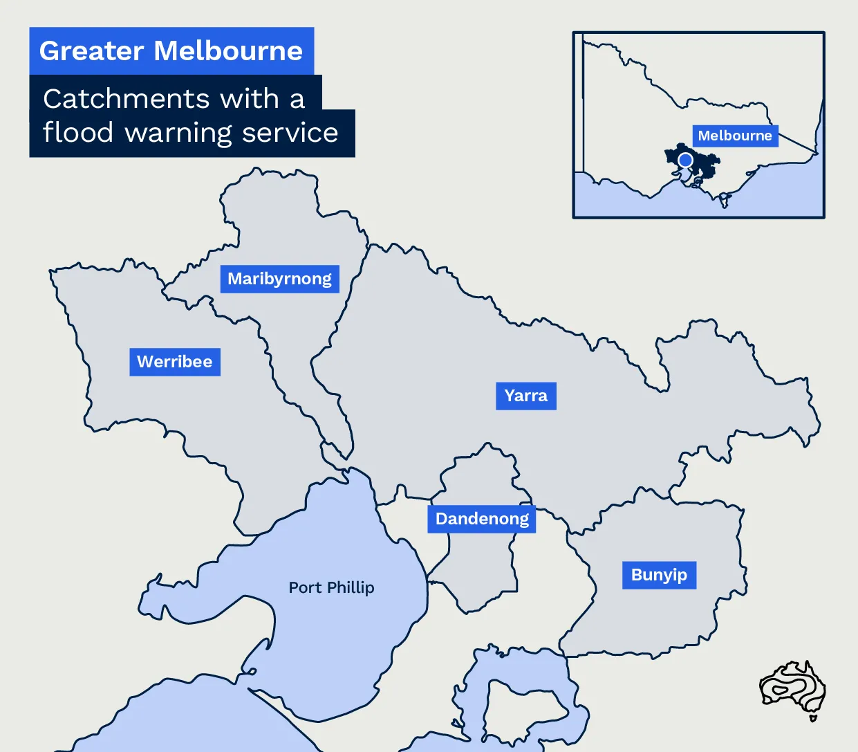
Map showing catchments in Greater Melbourne where the bureau will provide flood forecasting services from 1 July 2026
This adds 27 more flood forecasting locations in Victoria, increasing the bureau's statewide total to 98.
Yarra catchment warnings
We will issue separate flood warnings for the upper and lower Yarra so each community gets information most relevant to them.
Flood risk varies between the upper and lower Yarra due to differences in the landscape, land use, river features and amounts of rainfall. The lower Yarra usually receives less rain on average.
Flash flooding
Heavy or intense rainfall can cause flash flooding anywhere, often with little or no warning.
When rainfall may lead to flash flooding, we issue severe weather warnings or severe thunderstorm warnings.
Where possible community flash flood warnings may also be issued through VicEmergency.
Stay informed
We provide as much notice as possible before flooding is expected.
Stay up to date with the latest forecasts and warnings:
- bom.gov.au or the BOM Weather app
- the app can provide alerts within 5 km of a warning area - you can choose up to 3 locations.
For warnings and advice on what to do:
- visit the VicEmergency website, app and social media
- set up watch zones for up to 20 locations.
You can also view real-time rainfall and river conditions for Greater Melbourne to see what is happening as conditions change.
Be flood ready
Planning ahead reduces the impact of floods and helps recovery.
To prepare:
- learn about the flood risks in your area
- make a plan for what you will do.
Having a plan helps you think clearly and make better decisions during an emergency.
Find out how to prepare - visit the VICSES website.


