An international research expedition involving Cornell has uncovered new details as to why a 2011 earthquake northeast of Japan behaved so unusually as it lifted the seafloor and produced a tsunami that devastated coastal communities along with the Fukushima Daiichi nuclear power plant.
Some of the first published data from the expedition was detailed Dec. 18 in the journal Science and finds that at the Japan Trench - the deep ocean boundary where one tectonic plate dives beneath another - the fault zone narrows into a thin, clay-rich layer hidden just beneath the seafloor. That weak layer enabled the 2011 "megathrust" earthquake to rupture all the way to the trench, producing 50 to 70 meters of shallow slip in which large portions of the seafloor were displaced.
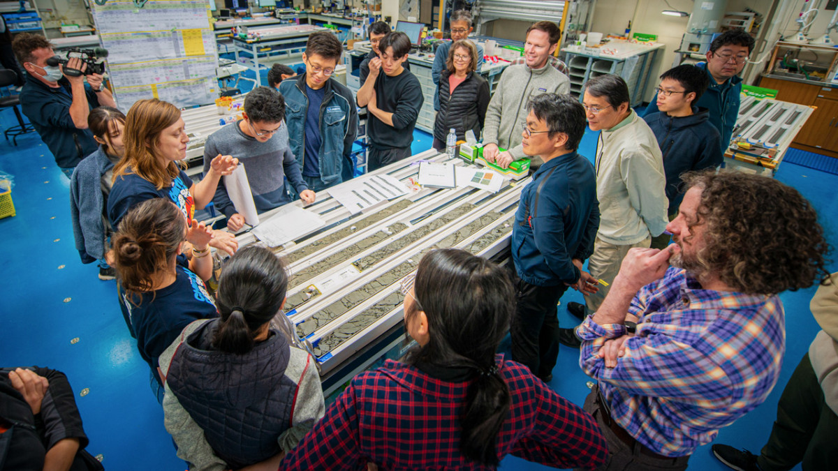
Patrick Fulton, right, associate professor of earth and atmospheric sciences at Cornell Engineering, and scientists aboard the drilling ship Chikyu observe core samples retrieved from the Japan Trench.
"This work helps explain why the 2011 earthquake behaved so differently from what many of our models predicted," said study co-author Patrick Fulton, associate professor and Croll Sesquicentennial Fellow in the Department of Earth and Atmospheric Sciences at Cornell Engineering. "By seeing exactly how the fault zone is constructed, we can better understand where slip is likely to concentrate and how much tsunami potential a given subduction zone might have."
In most subduction zone earthquakes, rupture starts deep on the fault and the amount of slip decreases as the rupture travels upward towards the sea floor. But in 2011, the slip grew larger as the rupture neared the surface, a surprising result that geoscientists like Fulton have been trying to explain for more than a decade.
Fulton served as co-chief scientist for International Ocean Discovery Program Expedition 405, known as JTRACK, which in 2024 collected the study data by deploying a deep-sea research vessel to drill through the fault and into sediment on the Pacific Plate. The expedition achieved a total drill-pipe length of 7,906 meters beneath the sea surface, recognized by Guinness World Records as the deepest scientific ocean drilling ever conducted.
The record highlights both the technical capabilities of the ship and the close collaboration between the Japan Agency for Marine-Earth Science and Technology, industry partners and the international science team, said Fulton, who spent nearly two months on the vessel.
The JTRACK expedition builds upon results from an earlier expedition to the region one year after the earthquake, which first identified the weak nature of the shallow plate boundary fault. Fulton, who was involved with the earlier Japan Trench Fast Drilling Project, said the JTRACK results provide a much more complete picture of how the shallow fault zone and incoming sediments are organized.
The sediment samples recovered from the drilling operation revealed a 30-meter-thick layer of pelagic clay, a very soft and slippery material formed from microscopic particles that slowly settled to the sea floor over millions of years. With stronger layers surrounding it, the clay acted like a natural "tear line" that concentrated the rupture along that surface.
"At the Japan Trench, the geologic layering basically predetermines where the fault will form," Fulton said. "It becomes an extremely focused, extremely weak surface, which makes it easier for ruptures to propagate all the way to the sea floor."
Because the pelagic clay layer extends for hundreds of miles along the Japan Trench, Fulton said the region may be more prone to shallow-slip earthquakes than previously recognized.
"Ultimately, our goal is to translate this kind of detailed fault zone knowledge into better assessments of earthquake and tsunami hazards for coastal communities around the world," Fulton said.
Coinciding with publication of the study is the release of a 30-minute documentary about the expedition. The film follows Fulton and dozens of scientists through 105 days at sea as they plan, drill, recover cores samples and install long-term observatories that reach into the fault zone.
More data from the expedition is set to become publicly available through the International Ocean Discovery Program.
Syl Kacapyr is associate director of marketing and communications for Cornell Engineering.


