Only satellites were watching when the world's fourth-largest proglacial lake suddenly drained in 2020. Hokkaido University researchers now uncovered the event and analysed the cause-the collapse of a sediment bump at the outlet of the lake.
(Google Earth)
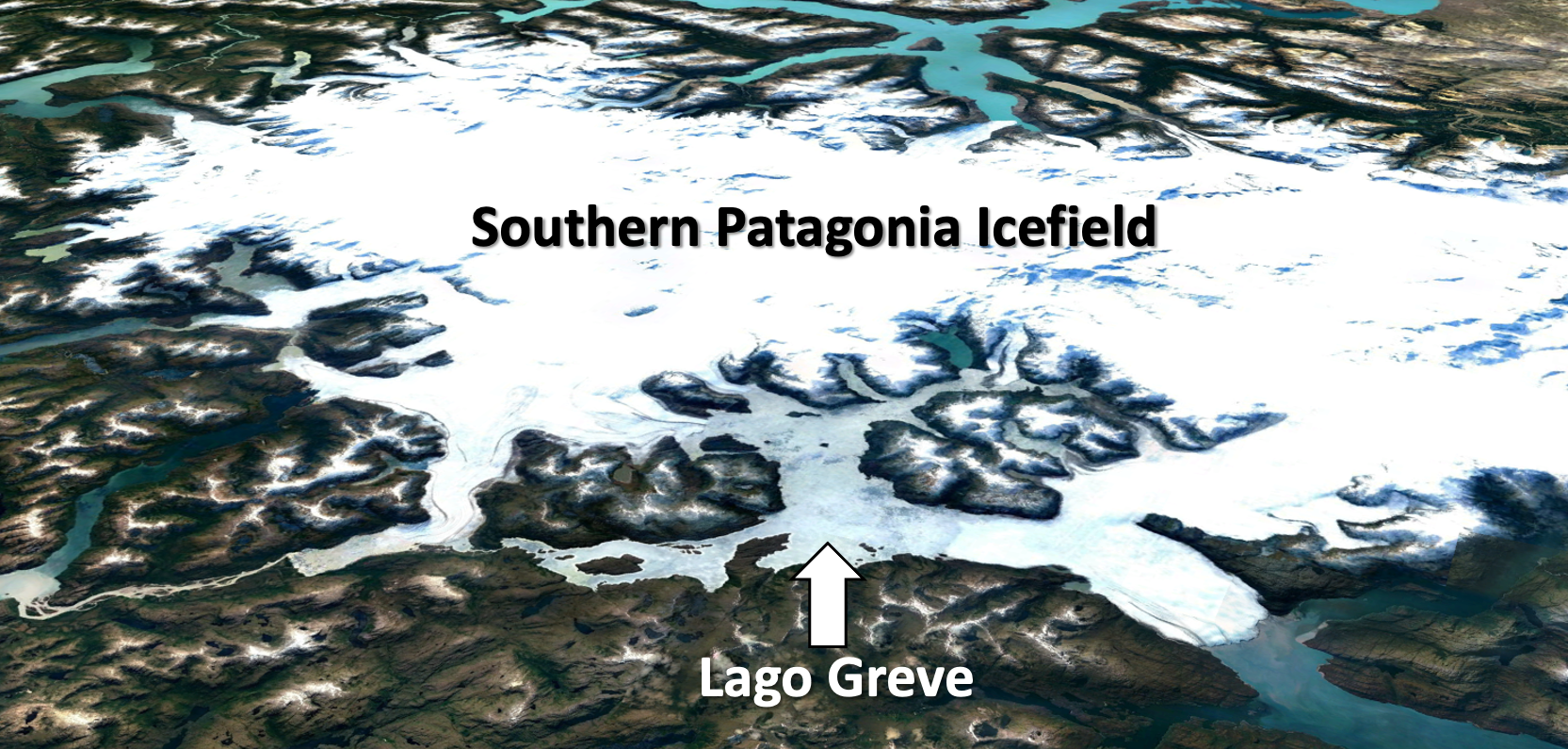
Proglacial lakes form when meltwater from retreating glaciers is trapped by ice or by a moraine left behind by the same or another glacier. A warming climate contributes to the recent global increase in the number and volume of these lakes, and they also themselves contribute to glaciers melting even faster. However, these lakes can drain very quickly when the dams that contain them fail for one of various reasons. Such a catastrophic event not only poses a direct safety risk for humans, but also influences ecosystems downstream due to the sudden influx of a large amount of freshwater. It is therefore important to monitor proglacial lakes and study their interactions with their surroundings. Unfortunately, this is difficult due to their often remote location.
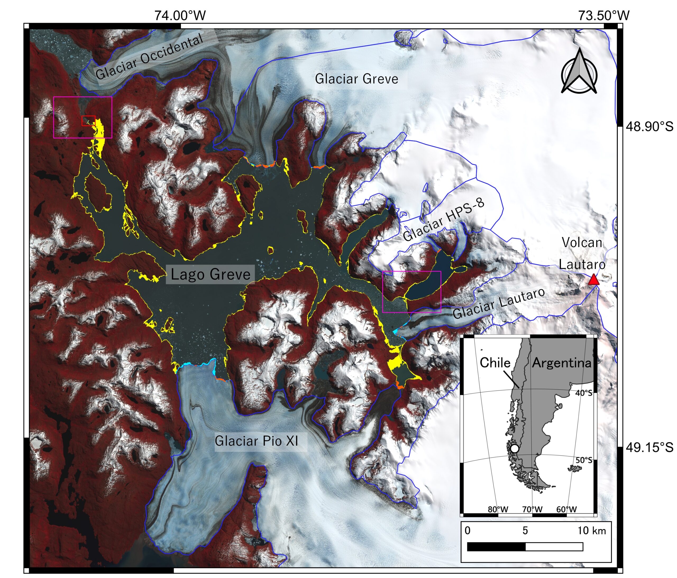
Satellite image of Lago Greve (Greve Lake), Chile and surrounding landmarks. The area which turned from lake to land surface from 8 April to 1st November 2020 are highlighted in yellow. Areas highlighted in orange and cyan indicate advance and retreat of glacier calving fronts during the same period. The red box (top right) indicates the location of the lake outlet (Shuntaro Hata, Shin Sugiyama, Kosuke Heki. Communications Earth & Environment. August 26, 2022).
Hokkaido University glacier scientist Shin Sugiyama and doctoral student Shuntaro Hata were studying glacier fluctuations in Chilean Patagonia using satellite images, when they noticed that the proglacial lake Lago Greve had shrunk significantly in the short time between April and July of 2020. In their publication of these findings in the journal Communications Earth & Environment, they add further analysis of the available data confirming that the lake's water level dropped by 18 meters, which translates to a loss of 3.7 cubic kilometers (or, giga-tonnes) of water-the largest such event observed by a satellite to date. This huge loss of water even measurably changed the gravity field of Earth, as recorded by GRACE satellites, even though quantitative data from these satellites is inconsistent with the actual amount of water drained. Finally, careful analysis of the satellite imagery and topographic data from before and after the event enabled them to deduce that the cause of the release probably was the collapse of a sediment bump close to the outlet of the lake.
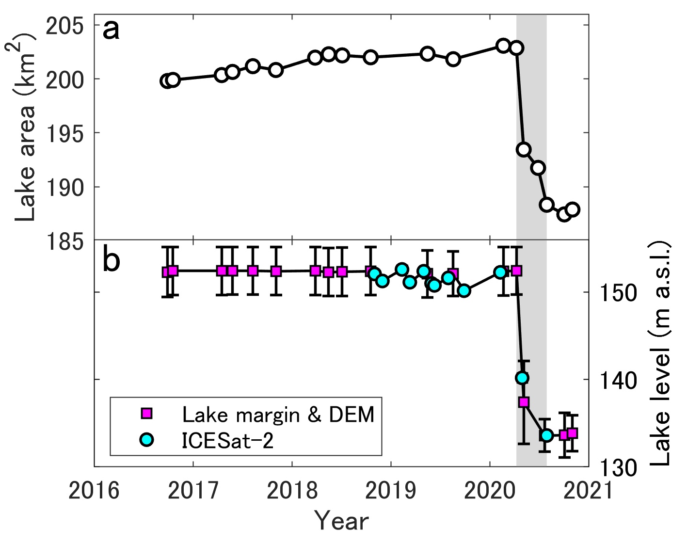
The lake area (top) and lake level (bottom) dropped precipitously within the span of 4 months in 2020 (Shuntaro Hata, Shin Sugiyama, Kosuke Heki. Communications Earth & Environment. August 26, 2022).
This study opens up many interesting aspects. For one, it points the way for future research on glacial dynamics. Sugiyama explains: "These results provide detailed information on large-scale glacial lake outburst floods, which occur very rarely, and are important for understanding disasters caused by glacial lake failures." It also highlights the possibility and the current limitations of using GRACE satellite data for observing such events. The researchers suggest: "The importance of GRACE measurements in studying such events would be increased if the calculation of the gravity field readings is adapted for localized events." And finally, the study provides concrete data that can be used to better understand the dynamics of the interactions between glaciers and the lakes they form, as "the observed changes in the water level of glacial lakes can be used to predict changes in the glacier inflow into the lakes."
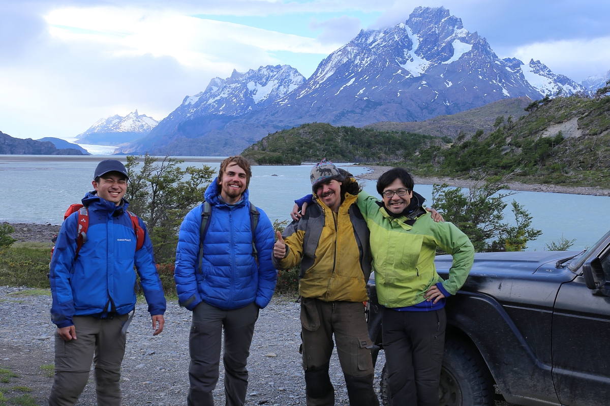
Shuntaro Hata (left) and Shin Sugiyama (right), authors of the study, with Matthias Scheiter (center left) and Rodrigo Traub (center right; Photo: Shin Sugiyama).
Original article:
Shuntaro Hata, Shin Sugiyama, Kosuke Heki. Abrupt drainage of Lago Greve, a large proglacial lake in Chilean Patagonia, observed by satellite in 2020. Communications Earth & Environment. August 26, 2022.
DOI: 10.1038/s43247-022-00531-5
Funding:
This work was supported by Grant-in-Aid for Scientific Research (20H00186) from the Japan Society for the Promotion of Science (JSPS), the Japan Science and Technology Agency's (JST) Challenging Research Program for Next-Generation Researchers (JPMJSP2119), and the International Fellowship Initiative (2022VEA0014) of the Chinese Academy of Sciences.


