It wasn't just data from maps, machines and rainfall readings that led CSIRO scientists to build Australia's most comprehensive and accurate flood model for the Richmond River catchment.
Information from local residents who know their environment, have lived through devastating floods and observed the impact, is what helped the team ensure all data driving the hydrodynamic model was as localised, precise and as accurate as possible.
Building the model
The catchment is large - more than 7000 km² - and covers complex and varied terrain.
Dr Jai Vaze, the hydrologist leading CSIRO's flood mitigation work for the National Emergency Management Agency's Northern Rivers Resilience Initiative , described it as "intricate".
The first phase of CSIRO's work was a rapid review and assessment in the six months following the 2022 floods. This phase identified and prioritised existing project proposals and analysed the most effective intervention options for allocation of the Federal Government's $150 million funding.
The team also characterised the catchment and climate conditions which led to the floods.

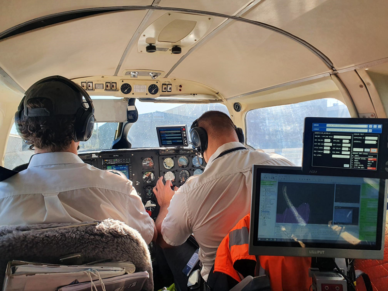
The second phase of work was much more involved using planes to gather Light Detection and Ranging (LiDAR) data to inform spatial analysis for the entire Northern Rivers region and boats to collect river bathymetry.
The design of the hydrodynamic model is based on detailed spatial representation of the catchment's biophysical characteristics such as soils (infiltration rates, soil storage capacity, etc.) and landscapes (roughness, flow paths, flow direction, structures, vegetation, etc.).
This high-quality data built the foundations of a detailed hydrodynamic model for the Richmond River catchment - the first time a catchment model of this scale and complexity has been built for the region.
Months on the ground
Jai has become a familiar face in the Northern Rivers region since the 2022 floods hit with devastating impact to local communities, and spent months at a time from Casino to Lismore to Ballina and many places in between.
He said the key to building the groundbreaking flood model released in June has been the proactive local communities and councils who have not only experienced the floods but taken observations and gathered information not always captured by existing measures and processes by government.
Locals have taken Jai and his team to their properties and spent days showing them areas hit by the floods. He's learned from what they know of the local terrain and infrastructure and what they saw.
Refining the model
Given the large area covered by the modelling domain and the very complex sections of steep and flat terrain, it was not possible to represent all small streams and channels.
Jai said every attempt has been made to make sure that all important streams, levees, flow control structures such as bridges, culverts and pipes across the entire catchment were represented in the model.
That included all levee details from the local councils and all data from the recent survey of the major levees undertaken after the 2022 floods.
But for all the data collected through instrumentation and from council and government mapping and monitoring, human observation was also needed to get it right, said Jai.
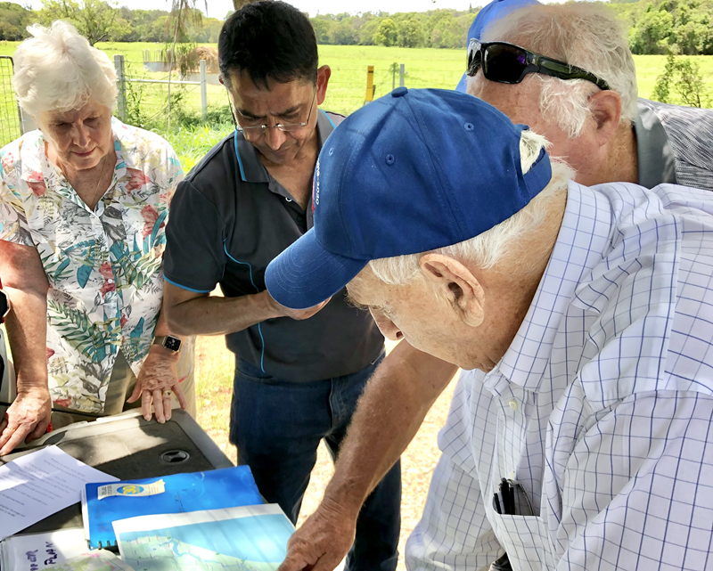
One resident took Jai to inspect a culvert near their property which had long been blocked. A single culvert. But that one culvert meant he could make sure it was also blocked in the model which would also affect the flow of water in the model.
"Data will give you a picture," said Jai.
"But to understand the catchment, that local knowledge which is there where people have seen floods for the last 70-80 years, is critical when you build a model."
Beth Trevan from the Lismore Citizens Flood Review Group told the ABC that Jai was "totally committed to the region and solving the problem".
"He has given his life to it for the past three years, seven days a week — he never stops working on it," she said.
"What is being developed is international best practice; it's not only going to be a template for Australia; it's going to be a template internationally.
"The level of detail is beyond comprehension; there's millions of items of data within it, that's its absolute strength."
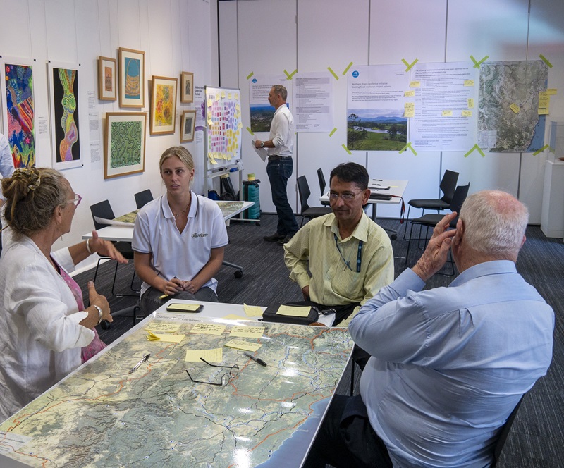
Validating the model
For a model to be reliable, it also needs to be validated.
Two residents who were also emergency volunteers spent days taking Jai to different locations where they had witnessed the height of the flood in residential areas and taken photos showing the level of the waters against particular buildings.
"That tells me that if my model shows it is higher in those locations, there is something wrong with the model," Jai said.
"Although we don't have exact measurements, when I run the model, I was checking against what they had seen.
"That on-ground knowledge is critical to building a reliable model. The detail from multiple locations and data sets helped me put together or build a better model and also helped me to validate it across the entire catchment to make sure the model was doing the right thing for the right reasons."
Next steps
The aim of the flood model is to enable the community and government to develop recommendations to inform planning resilience and readiness activities to reduce the effects of future flooding disasters in the region.
This is the first time comprehensive high-quality landform and river floor mapping data for the Northern Rivers region has been captured and made available to the community.
- View transcript
- Copy embed code


